
Ca. 1700.
Holländsk skeppare och kartritare. Inga upplysningar hittade.
Gift med den föregĺendes styfdotter, fortifikationsofficer, f. 1682 pĺ Nykvarns bruk, Södermanland, blef 1699 furir och 1701 konduktör vid Fortifikationen, deltog med finska armén i kriget mot ryssarna och utmärkte sig särskildt under Lybeckers misslyckade ingermanländska tĺg 1708, vid öfvergĺngen af Neva. Han utnämndes s. ĺ. till löjtnant, blef vid Viborgs uppgifvande 1710 rysk krigsfĺnge och förd till Klinov, hvarifrĺn han 1711 med tillhjälp af kommendantens hustru lyckades fly. 1712 blef han kapten, 1714 försĺg han Kastelholm pĺ Ĺland med provisoriska befästningar, tjänstgjorde sedan vid Upplandsarmén under generallöjtnant Taube, pĺbörjade ombyggandet af Eda skans 1717 och deltog 1718 i Strömstads befästande och Fredrikstens belägring. Han adlades 1719 (han hette förut Schultz) pĺ samma gĺng som Jacob Nordencreutz och ledde 1720 befästningsarbeten vid Skenäs och pĺ Säterholmen utanför Norrköping och var därpĺ med om utförandet af förstärkningsarbeten vid Vaxholm och om Fredriksborgs uppbyggande. 1739 blef ...
1703-1759. Född i Memmingen, Bayern.
Mĺlare, gravör och konstruktionsritare. Anlände till St Petersburg 1741 tillsammans med gravören Johann Stenglein. Grimmel medverkade bl.a. i utgivningen av en 'Atlas Russicus' 1745 (Inte d'Isles atlas som kom samma ĺr med samma namn.), samt gav även ut ett arbete i fyra blad 'Ladoga-kanal' 1741-42.
En av Grimmels elever vid vetenskapsakademin var Mikhail Makhayev.
Matthaeus Seutter gjorde kopior pĺ vissa av Grimmels kartor sĺ tidigt som under 1740-talet, bland annat 'Ingria et Carelia' samt 'Teshenije Nevy reky...'.
Bland arbeten.
Finskoj zaliv ot Kronshtata do Sanktpeterburga... = Der Sinus Finnicus von Cronstad bis St.Petersbürg benebst den aug seinen Kusten befindlichen Lusthöfen [engraved map] / J. Grimmel del. [St. Petersburg, c.1742].
Karta Ingermanlandii i Karelii. [The Academy of Sciences in St Petersburg]; Grimel del. - [St. Petersburg, c.1742].
Ladozhkoj kanal. Canalis Ladogensis [engraved map] / J. Grimmel del. [St. Petersburg, c.1742].
Ladozhskoe Ozero i Finskii zaliv s prilezhashchimi mestami. Lacus Ladoga et sinus Finnicus. [The Academy of Sciences in St Petersburg]; J. Grimel del. [St. Petersburg, c.1742].
Magnus Ducatus Finlandiae. [The Academy of Sciences in St Petersburg]; Grimel del. - [St. Petersburg, c.1743].
Techenije Nevy reky iz Ladozhgago ozera k St.Peterburgu = Fluwius Newa... [engraved map] / J: Grimmel del. - [St. Petersburg, c.1741-42].
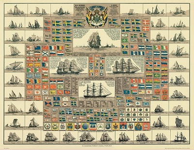
Amiral Häggs flaggkarta. - Stockholm 1888.
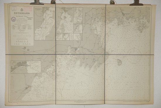
'Östersjön. Karlshamn - Ĺhus.' - Stockholm 1929.
Olaus Magnus text till den berömda kartan "Carta Marina".
Texten finns även pĺ katalanska, spanska och engelska.
Bureus karta över norden
Kartor och atlaser
Bilder och planschverk
Teckenförklaringar
Carta Marina et descriptIo
septemtrionalivm terrarvm ac mirAbilIvm rervm in eis contentarvum diligentissime
eleborata anno dni 1539
~
Marine
map description of the northern countries and their wonders, carefully executed
anno 1539.
Olaus
Magnus Gothus greets the honourable reader. To be able to understand easily this
map of the Scandinavian countries and the wonders that exist there (I published
this edition in honour of the revered Doge Pietro Lando and the senate of Venice
and for the general benefit of the Christian world), you must know that it is
divided into nine parts, indicated by the large letters A, B, C, etc, and
further that there are several smaller letters within the area of each big
letter, which indicate matters briefly referred to in the commentary.
A
comprises the island of Iceland, renowned for its unusual wonders; on this
island, close to the small letter A ~ There
are three mountains, their highest peaks glistening with eternal snow and their
bases flaming with eternal fire. B
~ Four springs of very different nature: the first one by means of its eternal
heat changes everything thrown into it into stone, while preserving the original
shape, the second one is intolerably cold, the third on produces “beer”, the
fourth one breathes forth destructive contagion. C
~ A fire consuming the water but not burning the wick. D
~ White ravens, falcons, magpies, bears, wolves and hares; yet there are also
totally black wolves. E ~ The ice
sounding like howling human voices and clearly indicating that human souls are
being tormented there. F
~ A piece of rock that seems to fly through a great cloud of vapour. G
~ A vast number of fish heaped up for sale in a pile as high as the houses under
the open sky. H
~ An
incredible amount of butter. I
~ The pasture is so lush that unless the cattle are kept from grazing, they are
destroyed through overfeeding. K ~ Sea monsters, huge as mountains, capsize the ships if they are not
frightened away by the sounds of trumpets or by throwing empty barrels into the
sea. L ~ Seamen who anchor on the backs of the monsters in belief that they are
islands often expose themselves to mortal danger. M ~
Merchant ships attacking each other with canons in their fight to be first in
harbour and do good trade. N
~ The arms of Norway and Iceland.
B
comprises first a part of Greenland, whose inhabitants, shown near letter A
~are pictured as very skilful sailors, using leather boats which are safe no
matter what danger might threaten; using these they attack and sink the ships of
the foreigners. B ~ Two
colossal sea monsters, one with dreadful teeth, the other with horrible horns
and burning gaze ~ the circumference of its eye is 16 to 20 feet. C ~ A whale
rising up and sinking a big ship. D
~ A worm 200 feet long wrapping itself around a big ship and destroying it. E
~ Rosmarus, a sea elephant, sleeps hanging from the cliff and is caught thus. F
~ Several horrendous whirlpools in the sea. G ~ The insatiable and gluttonous wolverine emptying its stomach by
squeezing itself between trees. H
~ A fisherman beating on the ice with a club so as to stun and catch the fish
under it. I ~
Reindeers are tamed flockwise and surpass the swiftest horses when they are put
before wagons. K ~ Demons, who have assumed bodily shape, are serving the people. L ~ A flock
of domesticated reindeers giving milk for household use. * A find of gold.
C
shows, at letter A
~ forest people who attack the sailors by night but are nowhere to be found
during the day. B ~ Pagan
worshippers adore as a divinity a piece of red cloth attached to the top of a
pole. C ~ Starchaterus, a Swedish fist-fighter, very famous in ancient time
throughout all Europe. D
~ A magnetic island, 30 miles from the Pole, beyond which the sailor’s guide,
the so-called compass, loses its power. E ~ A huge eagle wraps its eggs in the flayed skin of a hare; by means of
its life-giving warmth the chicks hatched. F
~ The great white lake (the White Sea), where are to be found fishes and birds
of an uncountable numbers of species. G ~ A marriage ceremony among the pagan worshippers performed with fire
struck from flints held over the heads of the bridal pair. H ~
Exchange of necessities without the use of money. I
~ Battle between two kings, one of whom fights with reindeers and foot-soldiers
on curved lengths of wood (that is, skis) and carrying bows. He defeats the
other who fights on horseback. K ~
Reindeers draw a wagon (sledge) across the snow and ice. L ~
Sealhunting on ice-floes and an incredible abundance of salmon and pike. M ~ Marten,
sable, ermine, different kinds of squirrels, everywhere an enormous number of
beavers. N ~ Moscovite merchants dragging their boats between the lakes to do
barter trade.
D
shows near the small A the
island and the diocese of the Faroe Island, its fish-eating inhabitants cut up
and divide among themselves the big sea animals thrown up by the storms. B ~ Here
heads of ravens are given as a tribute to the governor of the region as a sign
that they have killed the destructive bird which kills sheep and lambs. C ~ At the
approach to this island there is a high rock, which the sailors call the Monk
– an excellent protection against storms. D
~ The terrible sea-monster Ziphius devouring a seal. E ~ Another grisly monster,
namn unknown, lurking at its side (that is to say at the side of Ziphius). F
~ Here lies the island of Tyle. G ~ The
Hetlandic (Shetlandic) island and bishopric, a fertile country with the most
beautiful women. H ~ The Orcadic (Orkney) island and bishopric, 33 in number, which in
ancient times was called a kingdom. I
~ Ducks being hatched from the fruit of the trees. K ~ A sea monster similar to
a pig.
E
comprises at A
the name of the island of Scandia, from which in bygone days the most powerful
people have gone out into the whole world. B ~ The arms of the Kingdom of Sweden: three crowns. C ~ The
arms of the Kingdom of Norway: a lion armed with a broad-axe. D ~ Here
they try to measure the unfathomable depths of the sea. E ~ A
monster looking like a rhinoceros devours a lobster which is 12 feet long. F ~ Plates
are fastened as shields to the feet of the horses so that they will not sink
down into the snow. G
~ Domesticated reindeers give excellent milk. H ~ Lynxes devour wild cats. I
~ An attack by wolves against elks on the ice. K ~ Pyramids and enormous stones bearing the deeds of ancestors described
in Gothic letters. * is the sign for finds of iron. * Finds of copper. * Hoards
of excellent silver. L
~ A lake which never freezes. M ~ A sea
snake, 30 or 40 feet long.
F
Below small A:
its often happens that the sea freezes and is able to carry very heavy carriages
(sledges) and at the same time alongside their route leaves a navigable waterway
to the seafarers, who compete with the carriages in swiftness. B
~ Wild donkeys or elks pull the carriages swiftly over the snow. C
~ A fight between shepherds and snakes. D ~ Pheasants or woodcocks lie hidden under the snow without food for
several months at a stretch. E
~ Other birds, totally white snow birds, which never show themselves except
during sever winters. F ~ A black
river of immeasurable depth; it contains only black fishes, but these have a
delicious taste. G ~ Outbreak of an unendurable din, when something living is thrown into
the Viborgian cave or hollow. H
~ The den of beavers, partly on land, partly in the water; how they build it by
drawing together pieces of wood. I ~ The pelican, a bird big as a goose giving out a very strong call with
his water-filled throat. K
~ The otter is tamed to fish and to bring the fish to the cook. L
~ People are moving rapidly over the endless frozen sea with (skates made of)
bones under their feet. M ~ Vessels
for feasting, called Kĺsa. N
~ During the winter fighting takes place on the ice as during summer it does at
sea.
G
gives the whole key to the map as well as parts of the kingdoms of England,
Scotland and Holland.
H
contains at letter A
the old kingdom of Frisland, where there are excellent horses, and then the
kingdom of Denmark, broken up into its many island and among its warlike
inhabitants. B
~ The mighty and stately Vendic towns, the harbours of which are permanently lit
up so that the seamen can avoid running into any danger through carelessness. C
~ Public lodgings are sometime built on the frozen sea. D
~ Collecting amber on the Prussian coast. E ~ The town of Danzig, inhabited by
well-to-do and honest citizen. F ~ The
benevolence of the fishes called rockas in Gothic and raya in Italian: They
protect the swimming man and save him from being devoured By the sea monsters. G ~ The
kingdom of Gothia, the first fatherland of the Goths. H ~ The
island of Gotland, according to the etymology of its name, the island of the
Goths, where even today cases involving maritime law are settled. I ~ Fires
are lit on the coastal mountains in wartime. K
~ The royal city of Stockholm, well protected by the art of fortification, by
natural formations and water. L ~ Mighty
ships for sea battle, equipped on all sides with big canons, from which pieces
of iron are fired, enclosed in barrels.
I
first contains at the letter A ~ the
country of Livonia, which is under the rule of the German Order of the Blessed
Virgin. B ~ Kurland, on the coast of which there are repeated shipwrecks and scant
comfort is given to the victims. C
~ Samogethia, so called after the settlement there of the Goths. D
~ The Grand Duchy of Lithuania, under the King of Poland. E
~ shows an aurochs which easily lifts and tossen a man in full armour. F
~ Bears poking honey from the trees, are being beaten down by ironspiked clubs
which have been hung there. ~ Finally a table gives the names of a number of
peoples who according to the unanimous testimony of the ancient authors
originate from the island of Scandia.
Forbidden
for a period of ten years (the map is entitled “The Geographia or Description
of the Scandinavian Countries”). This prohibition also applies to his books
describing the Scandinavian countries. Anyone infringing these rules is
threatened with excommunication and fines of 200 golden ducats. ~ After the
description, it is noted that the map can be bought in the shop of Thomas de
Rubis at the Rialto bridge in Venice.
A map of
the countries of the north, remarkably modern for its time, was printed at
Venice in 1539. The viewer here meets for the first time a map of this region
which was correct in its main features. In size too the map was a work on a
grand scale, nine sheets printed from wood blocks, were assembled to form a map
1,25 meters high and 1,70 meters broad. The creator of this remarkable map was
Olaus Magnus (1490-1557). Certain stages in his life are unknown, but it is
known that he was born at Linköping. Received an education in the church, and
stayed at various seats of learning abroad. On his return to Sweden he was
active in the church at Uppsala and Linköping. In 1522 he was a priest in
Stockholm. Some years earlier Olaus Magnus had travelled in northern Sweden and
Norway as a collector of church dues. The money was to be used in the building
of St Peter’s in Rome, which began in 1506. The journey, which took a year
from may 1518 to summer 1519, taught him much about the nature and the people of
these tracts. He was to have great use of this knowledge in his later
undertakings. In 1524 Olaus Magnus was sent to Rome by the newly elected king,
Gustavus Vasa, for diplomatic negotiations with the papal curia. During his
absence, however, the Lutheran teachings gained an increasingly strong footing
in Sweden. He lived for about a decade in Danzig and it was there work on the
Carta Marina started. But it was not until he moved to Italy at the end of the
1530’s that it became possible to print the map. Olaus Magnus added to the
Carta Marina descriptions in latin (on the map), italian and german (printed
separately). The map can be regarded as an anticipation of his major work “Historia
de Gentibus Septemtrionalibus” (history of the northern peoples), printed at
Rome in 1555. This is the first description on a large scale of the countries
and peoples of the north. Its connection with the Carta Marina is obvious. It
can be said that his “history” constitutes a richly detailed commentary on
the map. Carta Marina was probably printed in a small edition, which explains
its rarity. For centuries it disappeared without trace. In 1888 a copy was found
at the Hof- and Staatsbibliothek in Munich. Seventy-five years was to pass
before another copy was found, the one which Uppsala University Library secured
from Switzerland. These two surviving copies of Olaus Magnus fantastic map of
1539 are priceless documents for the study of historical cartography and
cultural history in the north.
Source: Uppsala Universitetsbibliotek
