
Född 1700, dp 2/2, trol. i Malungs sn (Kopp.), där samtliga kyrkböcker för detta år brunnit, död 1755 23/2 i Stockholm (Klara).
Kopparstickare och kartograf. Konduktör vid Fortifikationen. Ingenjör. Son av komministern Petrus B. och Elisabet Persdotter. Ingenjör vid Lantmäterikontoret och föreståndare för dess tryckeri 1739
Bland arbeten.
A. GIESE, Prospect af Stockholms stad, jämte deviser, hörande till frögdebetygelsen vid K. Fredriks hemkomst från Hessen, 1731, kpst.
GRÖNWALL, De lacu Siljan, diss., resp. O. Silieström, Uppsala 1730: Siön Sillian, kpst.
Karta över Uppland. 1742.
Karta över Västmanland, 1742.
Vägvisare til och ifrån alla städer och namnkunnige orter uti Svea och Götha riken samt storfurstendömet Finland, Sthlm 1743.
Karta över Närke. 1745
Karta över Svea och Göta riken med Finland och Norrland, 1747.
Karta över Stockholm med dess malmar och förstäder, 1751.
Karta över Skåne, 1752.
Vägkartor över Sverige och Finland.
Hultmark, 1944.
Flourished 1822-29.
Engraver for Dèpôt de la Marine.
Bland arbeten.
Côtes de Brésil 1822.
du Pérou 1824.
Golfe du Mexique 1826.
Rade de Rio 1820.
Tooley.
Holländsk bok- och karthandlare i början av 1700-talet. 1721 ingick han kompanjonskap med Cornelius Mortier (se denne) och fortsatte under firmanamnet Cóvens et Mortier Pieter Mortiers (se denne) affär i Amsterdam. Firman gav ut flera stora atlaser, i de flesta fallen sammansatta med kartor utförda av flera kartritare under en relativt lång tid. Förutom ett par odaterade verk kan nämnas 'Nouvel Atlas' (ca. 1735) och 'Nieuve Atlas' (1730-39). 1761 kom 'Atlas nouveau' med kartor så långt bak i tiden som 1683. Firman fanns kvar till 1817.
Bland arbeten.
Nouvel Atlas (ca. 1735).
Nieuve Atlas (1730-39).
'Atlas nouveau (1761).
Kleerkooper. Phillips.

Vägvisare för XI Olympiaden i Berlin - 1936
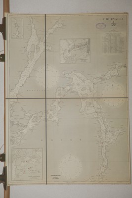
'Uddevalla.' - Stockholm 1891.
På kartorna är information om vattendjup, särskilda landmärken såsom kvarnar, fyrar, floder, vägar och även höjder och berg samt bebyggelse inritat.
Kartorna har parallelltext i de flesta fall på ryska samt engelska eller tyska.
Skalorna som anges är alltid dels i ryska verst men även i italienska mil, tyska mil eller engelska leagues. Samtliga djupangivelser är i famnar, vilka motsvarar 6 engelska fot.
Samtliga bilder från VÖBAM's faksimiler.
Förteckning över kartorna.
"Atlas of the Gulf of Finland containing the South Coast..." - L. Spafarieff 1817.
"Atlas of the Gulf of Finland containing the South Coast, with the Islands from cape Luserort to Cronstadt with Light houses & Towers necessary to be known for sailing by night. Compiled and published by the Director of the light houses Major General knight Leonty Spafarieff." S:t Petersburg (engraved & printed in the Naval printing office) 1817.
Spafariev was an important contributor to the improvement of navigation along the Russian coasts. The first lighthouses in Russia were built during tsar Peter the Great's drive for reform and modernization at the beginning of the 18th century. However, it was only until the Administration of Lighthouses was created in 1807 that the Russian lighthouse system followed an organized pattern, becoming effective and efficient. This office was established by the Russian Navy and it began under the leadership of Leontiy V. Spafaryev.
As a cartographer, perhaps his most outstanding work is the "Atlas of the Gulf of Finland", published in 1817. His name is spelt as "Spafarief" or "Spafarieff" in the United States.
The Spafaryev Islands in the Sea of Okhotsk and Spafarief Bay in the coast of Alaska were named after Leontiy V. Spafaryev.
I - "A chart of a part of the Gulf of Finland from Stoneskare to Cronstadt where the light
houses & towers are marked.
Depth in fathoms.
The doded line which is on the top of the Chart is marked by Z which signifies the shoals
of the northern shore."
Med följande fyrtorn avbildade i profil samt Hoglands profil.
"the Upper Hogland Light house the height 380 feet."
"the lower Hogland Light house the height 28 feet."
"the Light house of Narva the height 72 feet."
"the tower on the Island Rodsker the height 50 feet."
"the tower on the Island of Nerve the height 50 feet."
"Sommers Light house the height 85 feet."
"Seskar Light house the height 88 feet."
"Tolbouhin Light house the height 88 feet."
Graverad och okolorerad.
Vikt. Pappret veckat i mittvecket. Reva i mittvecket utanför kartans kant.
Nära skuren i högra kanten. Reparerad 'osynlig' reva ca 6 cm in från kartans högra kant.
Storlek: 93x59 cm.
VÖBAMs faksimil, handkolorerad på akvarellpapper. Storlek som originalet.
Kartan sträcker sig från en punkt å den estniska kusten norr om Rakvere i väst till Petrodvorets (Peterhof) i öst.
Palatset Peterhof är utmärkt på kartan.
I norr visas delar av den finska skärgården. Mitt i kartan ligger Narva.
Med totalt åtta fyrtorn avbildade i profil samt tre 'prickar'(?) Hoglands profil avbildad med dess två fyrtorn.
II - "Lavensar"
"Special Karte der Insel Lavensaar, wo die nordlichen ufer der Bucht,
die da selbst befindlich ist aufge nommen und die Tiefe derselben im
Jahre 1814 nach Faden ausge mefsenworden ist."
"Sommars"
"Special Karte der Insel Sommers, aufgenommen und ausgemefsen im Jahre
1807, mit Angabe der Tiefen nach Faden."
Graverad och okolorerad.
Storlek: 60x41 cm.
VÖBAMs faksimil, handkolorerad på akvarellpapper. Storlek som originalet.

Detalj av fyrarna.
Detalj av Tallinnbukten.
Finska viken - västra delen.
III - "A chart of a part of the Gulf of FInland from the Island of Dago to Stoneskar with the
Light Houses marked.
Depth in fathoms.
The dodded line drawn at the top of the chart is marked by the letter Z signifies the
limit of the skares at the northern skare."
Med följande fyrtorn avbildade i profil.
"the Monwick Light house the height 75 feet."
"the Kockskar Light house the height 99 feet."
"A turning light house proposed to be built on the Island of Nargin in the year 1814."
"the light house of Katerindal at Revel the height 135 feet."
"the Surop Light house the height 136 feet."
"Packerort Light house the height 146 feet."
"Odensholm Light h ouse the height 111 feet."
Graverad och okolorerad.
Vikt med smärre krakeleringar i pappret nära vecket. Lagad 'osynlig' reva ca 6 cm in från kartans högra kant.
Storlek: 93x58 cm.
VÖBAMs faksimil, handkolorerad på akvarellpapper. Storlek som originalet.
Hela den nordvästra estniska kusten med Dagös norra spets och ön Vormsi i väst
till en punkt å kusten norr om Rakvere i öst.
Även den finska kusten från Ålands hav till Helsingfors.
Sju fyrar i profil i kartans övre vänstra hörn.
IV - "A Chart of Revel roads. The entrance to the roads and Light houses of Catherindal, which Lights
the North passage.
The Depth of water in fathoms.
The dodded lines drawn from the light house of Catherindal opens to the shown compass points a
feeble Light but between the compass lines drawn from the said light house a strong light appears
which is the only mark for runing into the roads. The chord a b, shows the distance of the light
is to be seen at the height of 15 feet from the edge of water. The letyter N shows the turning
light of the Nargin light house."
"Die Untiesen zwischen Nargen und Wulf, sind im J. 1816 vom Steuermane Charitonofsky berichtiget
und von der bishirigen Angabe des Adm. Nagaef abweichend befunden worden."
Infälld karta över "Island Woolf" och även "Vien of the tower on the point of Wolf Island forthy feet above the horizon".
Graverad och okolorerad.
Vikt.
Storlek: 91x57 cm.
VÖBAMs faksimil, handkolorerad på akvarellpapper. Storlek som originalet.
Kartan sträcker sig från udden norr om Paldiski, Pakri neem i sydväst till udden Koljuots i ost.
Bebyggelsen och befästningarna i och runt om Tallinn noggrannt inritade.
V - "A chart of the Baltic Port with the entrance into it."
Graverad och okolorerad.
Storlek: 37x58 cm.
VÖBAMs faksimil, handkolorerad på akvarellpapper. Storlek som originalet.
Nuvarande Paldiski med bukten och udden samt ön "Little Roge". Bebyggelsen och befästningen
i Paldiski inritad. Noggranna och täta djupangivelser på redden mellan "Little Roge" och Paldiski.
VI - "A part of the Island Dago with the Gulf at the N. E. side of it, known under the
name of Deephaven, sounded 1814."
Graverad och okolorerad.
Storlek: 49,5x61x5 cm.
VÖBAMs faksimil, handkolorerad på akvarellpapper. Storlek som originalet.
Skuren innanför kartans högra kant. Dock ingen märkvärd kartförlust.
Bukten utanför dagens Kärdla, Hausma. Noggranna och täta djupangivelser på redden utanför "Deephaven".
VII - "A chart of the Riga Bay With the Monsound & western passage between Swafwer Ort
& Domes Ness with the Island & light houses thereunto belonging."
"Explication of the Charts of this Atlas.
1e The circles drawn round the light houses are to shew the distance at which the
lights are to be seen on those points on which they are distinguishable.
2e The compass drawn round the light houses shew the points of the compass per compass.
3e The tables on the chart shew
1e The height of each light house from the water mark. 2. The distance at which the light can
be distinguished in Italian miles at the height of 15 feet from the water edge. 3. The letters
on the circles round the light houses shew to which light house they belong to.
4e the depth of water is marked in fathoms, each fathom being 6 feet english."
Graverad och okolorerad.
Vikt. Smärre skada i mittveckets högra yttre del, limningen mellan bladen släppt.
Storlek: 61x94 cm.
VÖBAMs faksimil, handkolorerad på akvarellpapper. Storlek som originalet.
Kartan sträcker sig från Riga i syd upp till och med hela Estniska västkusten i norr. Öarna
Ösel och Dagö och den Kurländska västkusten i väst och till och med den Lettiska kusten i ost. Borgarna i Haapsalu och Kuressaare inritade på kartan.
VIII - "Chart For the entrance into the bay of Riga between Courland and the south point of Esel called Svalferort."
Med följande fyrar avbildade i profil.
"Round Light house the height 79 feet."
"Zirtih Light house the height 114 feet."
"Dagerort Light house the height 538 feet."
"Foulsand turning Light the height 110 feet."
Infälld karta.
"Bucht bey dem Vorgeburge Swalferort, aufgenommen im Jahre 1813."
Graverad och okolorerad.
Vikt.
Storlek: 58x73 cm.
VÖBAMs faksimil, handkolorerad på akvarellpapper. Storlek som originalet.
Kartan sträcker sig från och med Kuressaare och Ösels södra udde i norr till och med kurlands norra udde.
Sundet mellan Dagö, Muhu och fastlandet.
IX - "Carte der Passage Monsund nebst Anzeige des Umfangs und der Tiefe des Fahrwassens der
Richtung des Compasses, der Untiefes und des Raums zwischen den im Fahrwasser belegenen
Ufern Berichtiget im Jahre 1815."
Infälld karta.
"Eine kleine bucht an der westlichen seite der Insel Werder, die im Jahre 1814 aufgenomen
und deren Tiefe nach Tussmaass angegeben ist."
Graverad och okolorerad.
Vikt. Nära skuren i nederkant.
Storlek: 61x97 cm.
VÖBAMs faksimil, handkolorerad på akvarellpapper. Storlek som originalet.
Sundet mellan Dagö, Vormsi å ena sidan och Muhu och fastlandet å andra. Den infällda kartan visar bukten, hamnen, vid Virtsu med täta och noggranna djupangivelser.
X - "A Map of the Bay near Tolsbourgh on the river Kunda composed on the rechitied compass
sounded in the year 1813."
Infällda kartor.
"Particular Chart of the Entrance of Friedrichshamn within and without the Aspo Islands."
"Particular Chart of the Entrance of Wiburg."
"Particular Chart of the Entrances of Hango Road."
"Particular Chart of the Entrance of Lovisa Through Orenground."
Graverad och okolorerad.
Vikt. Skada i vikningen där limningen har släppt. Delvis nära skuren i vänstra kanten samt hela övre och nedre.
Storlek: 59x95 cm.
VÖBAMs faksimil, handkolorerad på akvarellpapper. Storlek som originalet.
Kartan visar bukten utanför floden och staden Kunda. Livländska ordens slott Toolse (Tolsburg) inritat.
Noggranna och täta djupangivelser i hela den östra delen av Kunda-bukten.
XI - "Chart of part of the Gulf of Bothnia." 1816.
Graverad och okolorerad.
Vikt. Pappret krackelerat i vikningen.
Storlek: 64x95 cm.
VÖBAMs faksimil, handkolorerad på akvarellpapper. Storlek som originalet.
Från Stockholm och Åbo skärgård i syd till och med Wasa i norr.
XII - "Chart of part of the Gulf of Bothnia." 1816.
Graverad och okolorerad.
Vikt. Kartans övre halva med äldre reparerad reva rakt över. Brunfläck vid vecket samt smärre krackeleringar.
Storlek: 62x76 cm.
VÖBAMs faksimil, handkolorerad på akvarellpapper. Storlek som originalet.
Norra delen av Bottenviken. Från Wasa upp till och med Torneå.
Kartans vänstra hörn har en utvikbar del med Nordmaling, Grundsunda, Degerfjärden bl.a.
