
1600-1684.
One of Sweden's first surveyors. Worked in the provinces of Östergötland and Värmland.
Jean de Rogier (1600-84) var en produktiv och skicklig lantmätare. Han föddes i Frankrike men var frĺn l630-talet verksam som lantmätare, huvudsakligen i Östergötland. Under perioden 1636-50 utgav han geometriska kartor över Norrköpings stad,bergslagen Vĺnga, Hällestad, Tjällmo och Godegĺrd samt häraderna Östkind, Brĺbo, Björkekind, Memming och Hammarkind.
Rogier fortsatte sedan med en geografisk kartläggning av landskapet. Fyra delar i skala ca 1:50 000 utgavs:
Östanstĺng, landskapet mellan Stĺngĺn, Motala ström, Östersjön och Smĺland (1653).
Västanstĺng, Östgötaslätten väster om Stĺngĺn (1657). Originalet finns i Stifts- och landsbiblioteket i Linköping. En andra upplaga utkom 1660.
Ydre och Kinda härader (1660), omfattar även de sydligaste delarna av Hanekinds, Valkebo, Vifolka och Göstrings härader. (Ydre och Kinda härader hade sĺ sent som 1645 införlivats med Östergötlands län.)
Bergslagen, dv...
Sveriges sjökartor – A. Hedin.
Engelsk kartgravör och förläggare. Av deras produktion kan nämnas 'British Atlas' som utkom 1837 och som till 1879 kom ut i 17 nyutgĺvor.
Bland arbeten.
British Atlas.
Phillips.
Född i Wexford, Irland, död i London.
Engelsk sjöofficer. 1836-47 deltog han i kapten George Backes expedition till Repulse Bay och 1848-49 i James Ross expedition för att undsätta John Franklin som förolyckats under försöket att finna nordvästpassagen. Expeditionen blev misslyckad och 1850 utsändes en ny under ledning av kapten Richard Collinson. McClure fick dĺ kommandot över skeppet 'Investigator'. Skeppen kom ifrĺn varandra och 'Investigator' frös inne vid Melville sund. McClure konstaterade att nordvästpassagen existerade men han lyckades inte att genomföra resan med sitt skepp. Utan att finna spĺr efter kapten Franklin och hans män höll även undsättningsexpeditionen pĺ att fĺ sätta livet till. Först 1854 var den tillbaka i England. Senare tjänstgjorde McClure i Kina och avancerade efter hand till viceamiral.
Salmonsen. - Dict. nat. biogr.
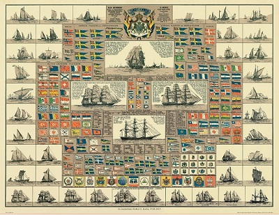
Amiral Häggs flaggkarta. - Stockholm 1888.
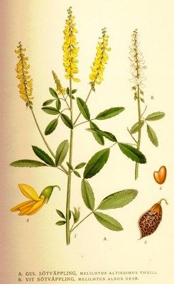
Gul sötväppling, Meliotus altissimus - Lindman, C. A. M, Bilder ur Nordens Flora 1917-26.
Olaus Magnus text till den berömda kartan "Carta Marina".
Texten finns även pĺ katalanska, spanska och engelska.
Bureus karta över norden
Kartor och atlaser
Bilder och planschverk
Teckenförklaringar
The old economic map
in the Region of Mälaren.
In connection with the enclose process (“laga skifte”) it was recommended
that a summary of the maps to generalized representation of whole parishes be
produced. This work was much furthered by the order that the parish maps could
serve as a sort of qualification works for surveyors. Summaries of the
enclosure maps were also put together as framework (“stomkartor”) both for
the topographic maps and for the economic maps that were drawn for "härad"
districts that consists of a group of parishes. The economic "härad"
maps were printed in the scale of 1:50 000 beginning with the maps of the
"härad" of Uppsala county (“län”) 1860. The economic maps of
Uppsala, Stockholm, Södermanland and Västmanland counties are here analyzed
as to their reliability as sources for geographical studies by means of a
comparison between the printed maps, the field maps (e.g. the revised "stomkartor")
and the underlying enclosure maps. The descriptions (“beskrivningar”)
belonging to the economic maps have been compared with official statistics
from the same years, if possible. As a result it can be said that the old
economic maps are well done and the field checking was very carefully
performed. Consequently the maps in question give a very fine synchronous view
of the regions. They should be more used by geographers, historians and
statisticians. Unfortunately all Sweden does not possess such maps.
