VÖBAM - Din källa till den äldre bild- och kartvärlden. - Tel: 08-102121 - Epost: info@vobam.se
Biografier.

NORRIS, JOHN Sir.

Omkring 1660-1749.
Engelsk amiral , deltog som fartygsbefälhavare i sjöstriderna på 1690-talet och under 1700-talets första år, blev 1708 viceamiral och låg 1709 utanför Helsingör med uppdrag att hindra fransk spannmålsinförsel från östersjöhamnarna. 1709 amiral, var han 1710-11 överbefälhavare för Medelhavsflottan. 1715, 1716 och 1718 var han befälhavare för de till Östersjön sända engelska flottor, som avsågo att öva press på Sverige. Efter Karl XII:s död sändes han ånyo till Östersjön för att mota de ryska planerna mot Sverige men lyckades ej förhindra ryssarnas härjningar på den svenska östkusten och intog i det hela en passiv hållning. 1734-44 var han överbefälhavare för engelska flottan.


Svensk Uppslagsbok.


Salmson, Axel Jacob.

(1807-1876)
Salmson, svensk-judisk konstnärsfamilj inflyttad från Prag på 1790-talet. Axel Jacob Salmson, litograf (1807-76), utgav bl.a. planschverken 'Trettioåriga krigets märkvärdigaste personer' (1844-56), ny upplaga 1861. 'Konung Gustaf III och hans samtida' (1846-47), och 'Rikssalen på Gripsholms slott' (1847-49). Salmson grundade 1854 en litografisk anstalt och gav 1859-61 ut 'Litografiskt allehanda', som fick stor betydelse för svensk illustrationskonst men tyvärr förorsakade Salmsons ekonomiska ruin. 1862 bosatte sig Salmson i USA

Axel Jakob (förut Sem Jakob) S., litograf, f. 1807, d. 1876 i Amsterdam, staten New York, blef liksom brodern elev vid konstakademien, men utbildade sig på egen hand för sitt blifvande fack. Bland de planschverk, som han utgaf, äro porträttsamlingarna Svenska konungar och deras tidehvarf (1830-43; förkortad uppl. 1855-60) samt Trettioåriga krigets märkvärdigaste personer (1844-56; ny uppl. 1861), båda efter egna teckningar. Dessa verk, som vunno mycken spridning, utmärkas för pr
...
Bland arbeten.
'Trettioåriga krigets märkvärdigaste personer' (1844-56), ny upplaga 1861.
'Konung Gustaf III och hans samtida' (1846-47),
'Rikssalen på Gripsholms slott' (1847-49)
Svenska konungar och deras tidehvarf (1830-43; förkortad uppl. 1855-60)
Lithografiskt Allehanda.


Nordisk Familjebok, Uggleupplagan. Svenskt biografiskt handlexikon.


FLEURIEU, CHARLES-PIERRE CLARET de.

1738-1810.
Greve, fransk sjöofficer. Född i Lyon, död i Paris. Som ung kom han in i marinen, blev kapten 1776 och samma år hamn- och arsenaldirektör. Under krigen 1778-83 visade han sig som en mycket duktig strateg. 1790-91 var han marin- och koloniminister. Vid revolutionen fängslades han men släpptes fri och hade senare olika offentliga ställningar både under republiken och kejsardömet. 1808 blev han greve. Han gav ut flera geografiska verk, varav kan nämnas 'Découvertes des Francais en 1768 et 1769 dans le sud-est de la Nouvelle-Guinée' (1790) och 'Voyage d'un autour du monde par Etienne Marchand' (1798). 1809 kom en stor atlas över skandinaviska farvatten. 'Neptune des mers du Nord, ou Atlas du Cattégat et de la Baltique'.

Bland arbeten.
Découvertes des Francais en 1768 et 1769 dans le sud-est de la Nouvelle-Guinée.
Voyage d'un autour du monde par Etienne Marchand.
Neptune des mers du Nord, ou Atlas du Cattégat et de la Baltique.


Nouv. biogr. gen.


Vägvisare för XI Olympiaden i Berlin - 1936
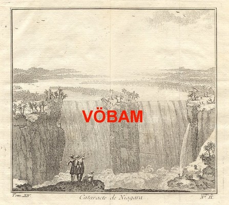


Tuvull, Eriophorum vaginatum - Lindman, C. A. M, Bilder ur Nordens Flora 1917-26.


Sök efter biografi:

Du sökte på: 10285

Klicka på valfri bokstav för att återgå till hela listan.  

A  B  C  D  E  F  G  H  I  J  K  L  M  N  O  P  Q  R  S  T  U  V  W  X  Y  Z  Å  Ä  Ö

NICOLAUS GERMANUS.

Often called 'Donis' from a misapprehension of the title 'Donnus' or 'Donus' an abbreviated form of 'Dominus.
A fifteenth-century cartographer, place of birth, and date of birth and death unknown. The first allusion to him of authentic date is an injunction of Duke Borso d'Este (15 March, 1466) to his referendary and privy counselor, Ludovico Casella, at Ferrara, to have the 'Cosmographia of Don Nicolò' thoroughly examined and then to determine a recompense for it. The duke, on the thirtieth of the same month, called upon his treasurers for 100 florins in gold 'to remit as a mark of his appreciation to Donnus Nicolaus Germanus for his excellent book entitled 'Cosmographia''. On 8 April, 1466, the duke again drew thirty golden florins to present to the Rev. Nicolaus, who 'in addition to that excellent Cosmography' (ultra illud excellens Cosmographie opus) had dedicated to the duke a calendar made to cover many years to come ('librum tacuini multorum annorum'). The 'Cosmographia' as preserved in the Bibliotheca Estensis at Modena comprises a Latin translation of the Geography of Ptolemy with maps. The version of the geographical text is substantially the same as that dedicated in 1410 to Pope Alexander V by Jacopo Angelo, a Florentine. In the execution of the maps, however, Nicolaus, instead of adhering to the flat projection of Ptolemy, chose what is known as the 'Donis-projection', because first worked out by him, in which the parallels of latitude are equi- distant, but the meridians are made to converge towards the pole. He likewise introduced new modes in delineating the outlines of countries and oceans, mountains and lakes, as well as in the choice of cartographic proportions. He reduced the awkward size to one which was convenient for use; the obscure and often unattractive mode of presentation he replaced by one both tasteful and easily intelligible; he endeavored to revise obsolete maps in accordance with later information and to supplement them with new maps. While his first recension embraced only the twenty-seven maps of Ptolemy (one map of the world, ten special maps of Europe, four of Africa, twelve of Asia), the second comprised thirty (including in addition modern maps of Spain, Italy, and the Northern countries: Sweden, Norway, and Greenland). The last-named enlarged recension he dedicated as priest to Pope Paul II (1464-71). He dedicated to the same pontiff his third recension, containing thirty-two maps, adding modern maps of France and the Holy Land. The works of the German cartographer were of great value in diffusing the knowledges of Ptolemy's Geography. The first recension, probably the very copy in the Lenox Library (New York), is the basis of the Roman editions of Ptolemy bearing the dates 1478, 1490, and 1507; on the third, certainly the copy preserved in Wolfegg Castle, are based the Ulm editions of 1482 and 1486. By combining the Roman and Ulm editions Waldseemüller produced the maps of Ptolemy in the Strasburg edition of 1513, which was frequently copied. The modern map of the Northern countries, made by Claudius Clavus, which Nicolaus embodied in his second recension of Ptolemy, was perhaps the source of the Zeni map which had such far-reaching influence, and likewise of the maritime charts of the Canerio and Cantino type. The revised map of the Northern countries in the third recension of Nicolaus, which placed Greenland north of the Scandinavian Peninsula, was a powerful factor in cartography for a century, especially as Waldseemuller gave the preference to this representation in his world and wall map of 1507, 'the baptismal certificate of America'. Because of these and other services to geography and cartography, as for example, by the revision of Buondelmonte's 'Insularium', it would be desirable to have it established whether Nicolaus was really, as I conjecture, a Benedictine father of the Badia at Florence.
(FISCHER, Nicolaus Germanus in Entdeckungen der Normannen in Amerika (Freiburg, 1902), 75-90, 113 sqq. (Eng. tr., London, 1903), 72-86, 108 sqq.)

Tillbaka till början.