
1717-1791. Född 31 oktober 1717. Död 25 oktober 1791.
Inskrevs vid Uppsala Universitet 1729. Han hamnade 1734 i Lantmäteriets tjänst där han 1747 utnämndes till förste lantmätare. Han var Lantmäteriets främste och flitigaste kartograf. Upprättade flera provinskartor och kartor över Vättern och Vänern. Han invaldes i KVA 1769.
Även författare till kartografiska skrifter och beskrivningar. Dessa läckra smĺ skifter i liten 8:o är sällsynta och eftersökta.
Bland arbeten.
Beskrifning Til Chartan öfver Sjön Wenern.
Beskrifning Til Chartan öfver de til Segelfarten tienlige Siöar och Strömmar imellan Götheborg och Norrköping.
Matematiska institutionen, Uppsala universitet.
1740-1817. Född och död i Paris.
Fransk geograf. Verkade som lärare i geografi och gav bl.a. ut 'Apercu historique et géographique des Quatre Parties du Monde' (1790), 'Des usage de la Sphčre, des globes céleste et terrestre' (1790) och 'Description géographique et historique des peuples les plus renommés de l'Europe ancienne (1809). Under 1790-talet ansvarade han för olika nyutgĺvor av Robert de Vaugondys atlas och gav även ut 'Nouvel Atlas portatif de la Géographie ancienne' (1809) samt 'Atlas élémentaire' som kom i flera utgĺvor.
Bland arbeten.
Apercu historique et géographique des Quatre Parties du Monde.
Des usage de la Sphčre, des globes céleste et terrestre.
Description géographique et historique des peuples les plus renommés de l'Europe ancienne.
Nouvel Atlas portatif de la Géographie ancienne.
Atlas élémentaire.
Nouv. biogr. gen. - Phillips.
1785-1869. Född i Hurum, död i Drammen.
Norsk ämbetsman. Tog juridisk examen 1807, blev sockenskrivare i Nordre Jarlsberg 1810, byfogde och byskrivare i Drammen 1826, länsman i Buskerud 1831-57. Stortingsman under en rad ĺr och medlem av flera offentliga kommissioner, däribland 'Hovedmatrikuleringskommisjonen' 1823-38. Han författade en rad ekonomiska och statistiska skrifter. Av dessa kan nämnas 'Das Königreich Norwegen statistisch beschrieben' frĺn 1843. Medlem av Vetenskapssällskapet i Trondheim.
Bland arbeten.
Das Königreich Norwegen statistisch beschrieben.
K. St. O.O. Halvorsen.
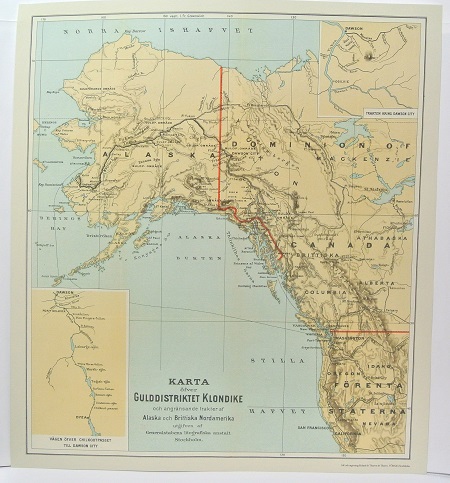
Gulddistriktet Klondike - ca 1897.
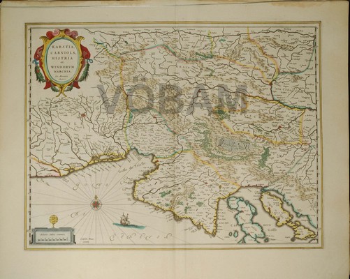
Carniola, Friuli, Istrien. - Blaeu 1643/44.
