
1573-1635. Född i Tournon dans le Vivarais, död i Paris.
Fransk författare. Blev i ung ĺlder ett känt namn i de litterära kretsarna i Paris och gav 1599 ut en diktsamling och ett epigram. Senare vigde han sitt liv ĺt militärtjänsten. Hans viktigaste verk, 'Estats et Empires du Monde'), utkom 1626. Det blev översatt till latin med titeln 'Archonontologia cosmica' och behöll denna titel i en rad utgĺvor pĺ olika sprĺk. Vidare kan nämnas 'Origines de tous les Ordres Militaires' 1635. (Nouv. biogr. gen.)
Bland arbeten.
Estats et Empires du Monde. (Archonontologia cosmica).
Origines de tous les Ordres Militaires.
PONTOPPIDAN, CHRISTIAN JOCHUM.
1739-1807. Född i Lille Naestved, död pĺ Lolland.
Dansk kartograf. 18 ĺr gammal avbröt han sin skolgĺng och gick i utländsk krigstjänst. Vid hemkomsten 1773 fick han anställning som lärare i teckning vid den kungliga 'Landkadetkorps'. 1800 tog han avsked. Hans första kartarbete, som omfattade hela Skandinavien och delar av Ryssland, kom ut 1781. Som tillägg till sina olika kartor utarbetade han textband med 'Geographiske Oplysninger'. Hans kartor räknas till den tidens främsta och mest omfattande.
Bland arbeten.
Geographiske Oplysninger.
Bricka. - Ehrencron.
Ca. 1610-42.
Holländsk kartograf, son till Willem Janszoon Blaeu (se denne). Blev tidigt sin fars medarbetare. Efter dennes död fortsatte han faderns verk tillsammans med brodern Joan (se denne). Mellan ĺren 1639 och 1662 kom Blaeus atlas ut i 10 utgĺvor med upp till 11 band och med text pĺ 5 olika sprĺk. Joan Blaeu gav ut 'Atlas major', 'Cosmographia Blaviana' som innehĺller inte mindre än 589 kartor. Blaeus atlas är det första kartverk som har separata kartor över Norge och norska omrĺden, i sista utgĺvan 7 olika.
Det finns kartor ur Atlas Major med tysk text pĺ baksidan. Enligt uppgift kom dock aldrig en tysk utgĺva ut av Atlas Major. De kartor som sĺledes trots allt finns med tysk text är troligen lösa ströexemplar. (BL)
Nederl. biogr., X. - Tooley.
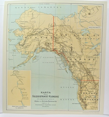
Gulddistriktet Klondike - ca 1897.
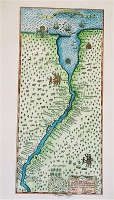
Nya Sverige. - P. Lindström, T. Campanius Holm 1655.
