
Keere, Pieter van den [Kaerius, Petrus]
1571-c. 1646.
Pieter van den Keere was one of a number of refugees who fled from religious persecution in the Low Countries between the years 1570 and 1 590. He moved to London in 1584 with his sister who married Jodocus Hondius, also a refugee there, and through Hondius he undoubtedly learned his skills as an engraver and cartographer. In the course of a long working life he engraved a large number of individual maps for prominent cartographers of the day but he also produced an Atlas of the Netherlands (1617-22) and county maps of the British Isles which have become known as Miniature Speeds, a misnomer which calls for some explanation.
In about 1599 he engraved plates for 44 maps of the English and Welsh counties, the regions of Scotland and the Irish provinces. The English maps were based on Saxton, the Scottish on Ortelius and the Irish on the famous map by Boazio. These maps were not published at once in book form but there is evidence which suggests a date of issue (in Amsterdam) between 1605 and 1610 although at...
Son till MORTIER, PIETER. 1721 ingick han kompanjonskap med Johannes Covens (se denne), och förde sin fars verksamhet vidare under firmanamnet Cóvens et Mortier. Deras kartproduktion, nämnt under Cóvens, var förvisso den viktigaste delen av verksamheten, men bokproduktionen verkar ocksĺ ha varit ganska omfattande. Under viss tid samarbetade de med brodern Pierre Mortier (död 1754) som hade sin egen verksamhet, bl.a. om utgivningen av ett stort illustrerat bibelverk.
Kleerkooper.
Gravör. Upptagen pĺ kopparstick till Denis Diderot's 'Encyclopédie ou dictionnaire raisonné des sciences', band LXXXIV och LXXXV. 1751-1780.
Bland arbeten.
Encyclopédie ou dictionnaire raisonné des sciences
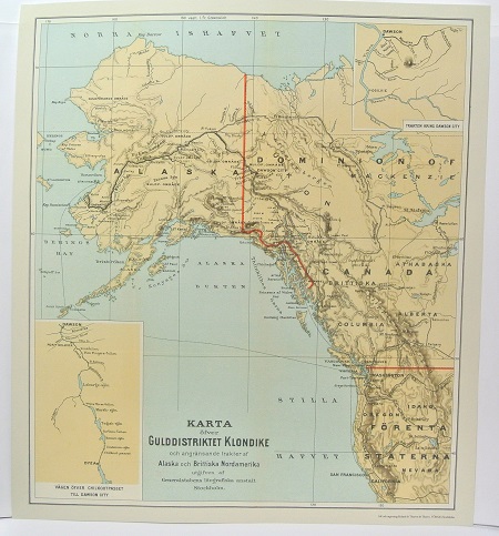
Gulddistriktet Klondike - ca 1897.
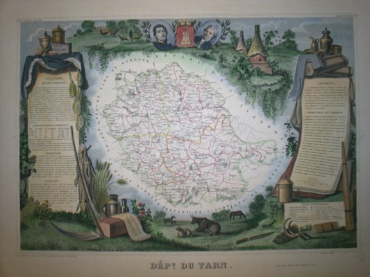
'Dép.t du Tarn.' - Paris ca 1850.
