VÖBAM - Din källa till den äldre bild- och kartvärlden. - Tel: 08-102121 - Epost: info@vobam.se

Biografier.
Se MAGNUS, OLAUS.
1851-1914.
Norsk ingenjör. 1874 fick han anställning som ingenjör vid 'Vassdragsvesenet' där han sedan verkade. Han deltog mycket i mätningsarbeten över hela Norge och utförde ett grundläggande undersökningsarbete vid förberedelserna av Bandakkanalen. Förutom Norgekartor gav han även ut specialkartor över Bandak-Nordsjökanalen samt över sträckan Christiania-Bergen.
T U. 1914. - U.B.
Gjorde de tolv kartorna till 'Atlas du Monde Ancien' vilken gavs ut i Weimar ĺr 1800 av C. Ph. Funke.
Bland arbeten.
Atlas du Monde Ancien.
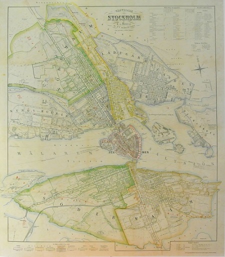
Stockholm - Mentzer ca 1860.
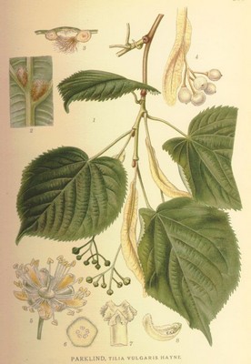
Lind, Tilia vilgaris - Lindman, C. A. M, Bilder ur Nordens Flora 1917-26.
VÖBAM - Din källa till den äldre bild- och kartvärlden. - Tel: 08-102121 - Epost: info@vobam.se
