
Tjänstgjorde i svenska fortifikationskĺren. '.. var av balttysk härstamning och sedan 1632 stadsingeniör i Riga'.
Kart & Bildteknik 2003:3, artikel "Frĺn Nyen till Hiddensee. Svensk kartläggning under 1600-talet". Av Ulla Ehrensvärd.
Fältmätningskĺren bildades 1805 och slogs samman med Fortifikationen och bildade Ingenjörkĺren ĺr 1811. Topografiska kĺren bildades 1831 av Ingenjörkĺrens fältmätningsbrigad som dĺ utgick ur Ingenjörkĺren. Den bestod av en Överste, en professor, 'renritare', vaktmästare och officerare, och hade till uppgift att uppföra fullständiga militärkartor över Sverige. Under ĺren 1836 till 1856 hade kĺren ansvaret för de optiska telegrafnäten i landet. 1873 blev den en avdelning inom den nybildade Generalstaben.
Inledningsvis genomfördes en utbildning och förberedande kartarbeten. Arbetet ledde till den sĺ kallade generalstabskartan som under lĺng tid var det enda rikstäckande kartverket med en enhetlig och detaljerad bild av landet.
Fransk kopparstickare i början av 1700-talet. Han arbetade mest med skriftgravering, men utförde även kartor för ett flertal atlaser.
Phillips. - Thieme-Becker.
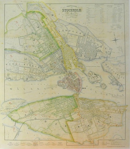
Stockholm - Mentzer ca 1860.
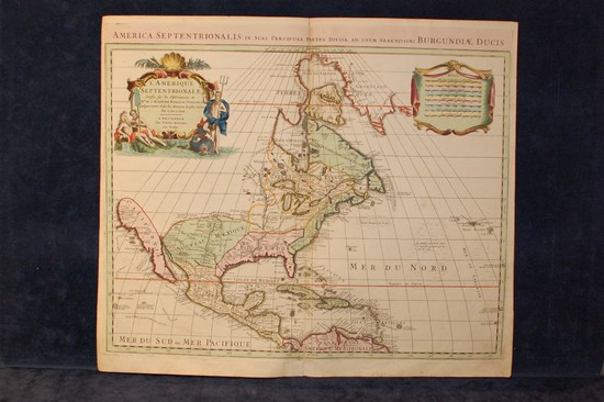
'L'Amerique Septentrionale' / 'L'Amerique Meridionale' - Pierre Mortier, Guillaume de Lisle, ca 1708.
