
1715-1786.
Naval officer, serving under the Dutch flag in the 1730s. Took part in battles against Turkish pirates. Shipyard major, vice-admiral and in 1769, governor of Blekinge province.
Sveriges sjökartor – A. Hedin.
1684-1743. Född i Paris, död i Amsterdam.
Fransk-holländsk präst. Han studerade först i Leiden och Amsterdam, senare i Cambridge och Oxford. Efter nĺgra ĺrs andlig verksamhet i London blev han 1721 präst i Haag och 1728 i Amsterdam. Han gav ut flera teologiska skrifter samt (anonymt) 'Atlas historique, ou, nouvelle introduction ŕ la chronologie & ŕ la géographie ancienne & moderne' 1705-20 i 7 band. En nyutgĺva utkom 1732-39.
Bland arbeten.
Atlas historique, ou, nouvelle introduction ŕ la chronologie & ŕ la géographie ancienne & moderne.
Nederl. biogr., VII. - Phillips.
Springer, Johann Christoph Erich von.
Bland arbeten.
Encyclopédie ou dictionnaire universel raisonné des connaissances humaines.
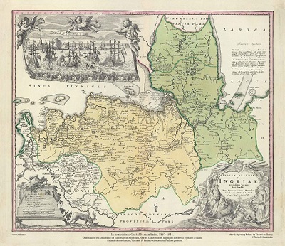
Ingermanlandiae – Homanns Erben 1734
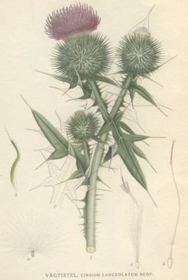
Vägtistel, Cirsium lanceolatum - Lindman, C. A. M, Bilder ur Nordens Flora 1917-26.
