
1561-1623. Född i Ličge, död i Frankfurt a. M.
Tysk kopparstickare. Bror till BRY, JOH. ISRAEL. Han var en talangfull kopparstickare, som förutom en rad enkla blad (däribland ett porträtt av Mercator), även utförde illustrationer till resebeskrivningar, samt anatomiska och andra vetenskapliga verk.
Thieme-Becker.
1588-1664.
In 1612, married one of cartographer Jodocus Hondius's daughters and began working as a publisher in Amsterdam. From 1616 until his death, Janssonius published numerous maps of various parts of Europe. From the 1630s, he worked in partnership with his brother-in-law Henricus Hondius.
Sveriges sjökartor – A. Hedin.
(1552-1629)
One of the most famous of English mapmakers, the historian John Speed decided in 1611 to publish a volume of maps to accompany his History of Great Britain. The maps were instantly popular, running to seven editions by 1676. Sudbury and Humble contracted Jodocus Hondius to engrave the plates in Amsterdam. From 1605 to 1610 Speed sent the information to Hondius, allowing Hondius to compose these famous maps.
Sotheby's
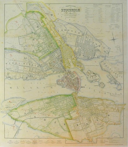
Stockholm - Mentzer ca 1860.
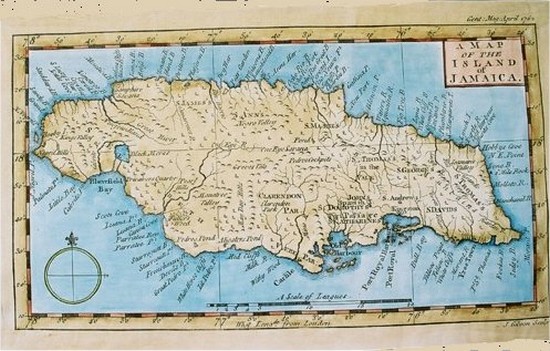
'A Map of the Island of Jamaica'
