
Ingeniör vid Lantmäteri-Contoret. (1846).
År 1853 utsatt som utgivare av 'Karta öfver Färentuna Härad eller det fordom så kallade Svartsjö län...'. Kartan sannolikt den första i vårt land utgivna häradskartan.
Bland arbeten.
Karta öfver Färentuna Härad eller det fordom så kallade Svartsjö län...
Född 1700, dp 2/2, trol. i Malungs sn (Kopp.), där samtliga kyrkböcker för detta år brunnit, död 1755 23/2 i Stockholm (Klara).
Kopparstickare och kartograf. Konduktör vid Fortifikationen. Ingenjör. Son av komministern Petrus B. och Elisabet Persdotter. Ingenjör vid Lantmäterikontoret och föreståndare för dess tryckeri 1739
Bland arbeten.
A. GIESE, Prospect af Stockholms stad, jämte deviser, hörande till frögdebetygelsen vid K. Fredriks hemkomst från Hessen, 1731, kpst.
GRÖNWALL, De lacu Siljan, diss., resp. O. Silieström, Uppsala 1730: Siön Sillian, kpst.
Karta över Uppland. 1742.
Karta över Västmanland, 1742.
Vägvisare til och ifrån alla städer och namnkunnige orter uti Svea och Götha riken samt storfurstendömet Finland, Sthlm 1743.
Karta över Närke. 1745
Karta över Svea och Göta riken med Finland och Norrland, 1747.
Karta över Stockholm med dess malmar och förstäder, 1751.
Karta över Skåne, 1752.
Vägkartor över Sverige och Finland.
Hultmark, 1944.
fl 1680-96.
Not much is known of Vooght's personal life beyond his own description of himself as a 'surveyor and teacher of mathematics and the art of navigation' on which he was a prolific writer. He is noted as the author of charts in Johannes van Keulen's Zee-Fakkel; indeed, on some editions only his name appears and in consequence the Zee-Fakkel is often catalogued under his name.
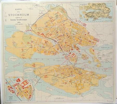
Karta öfver Stockholm. - 1904.
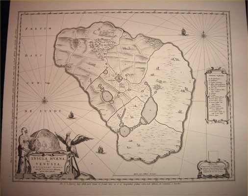
Komplett svit av J. Blaeus sju bilder/kartor från Ven. - Johannes Blaeu 1662.
