Född 1773 10/10 i Kumla sn (Västm.), död 1857 10/9 i Stockholm (Klara).
Kopparstickare. Son av nämndemannen Anders Christoffersson och Anna Samuelsdotter Kumlin. Inskrevs i Konstakademiens principskola i mars 1793, kallade sig då Samuel Kumblijn. Gravör vid Vetenskapsakademien 1805-29 och därefter stilgjutare i Rikets ständers bank. Graverade 1810-20 i samarbete med sonen Carl Christoffer en ny upplaga av D. K. Ehrenstrahls Certamen Equestre, se G. C. Eimmart.
Bland arbeten.
S. G. HERMELIN, Special kartor och ritningar till beskrifning öfver Sverige, Sthlm 1806: 2 kartor.
Karta öfver Elfsborgs höfdingdöme 1808.
Generalkarta över Göta kanal föreslagen till sammanbindande av Vänern och Vättern med Östersjön 1810.
N. G. WERMING, Kartor öfver svenska städer, u. o. [1806-19]: 4 blad, bl. a. Plan och läge af Oscars stad uti Wärmeland, 1811, och Special [karta] med belägenheten af Piteå, 1814.
D. K. Ehrenstrahls Certamen Equestre.
Hultmark, 1944.
Död 1794.
Engelsk matematiker och astronom. Född i Crediton, Devonshire, död i London. Innan han fyllde 20 år bedrev han privatundervisning i skrivning, räkning och navigation i sin födelsestad. 1751 slog han sig ner i London och även där försörjde han sig på att undervisa, dels i skolor, dels privat. 1757 skapade han en ny slags jordglob 'in plano', bestående av 4 stereografiska kartor. Till dessa gav han även ut en bruksanvisning. Han utvecklade ett rikt författarskap som spände över många fält, speciellt astronomi, matematik och navigation. Av hans böcker kan nämnas 'A new and general Introduction to practical Astronomy, with its Application to Geography... Topograhpy, etc.' (1775). 1774 gav han ut en 'New Atlas of the mundane System' med 62 vackert graverade kartor. Denna atlas kom senare i flera nyutgåvor.
Bland arbeten.
A new and general Introduction to practical Astronomy, with its Application to Geography... Topograhpy, etc.
New Atlas of the mundane System.
Dict. nat. biogr.
Född 1705, död 1778.
Son till löjtnant Ingevall Vallberg och Margareta Helena Blyberg, samt svåger med företrädaren Embring. Examen 1727. E. ord. 1728 på Öland, och 1729 i Östergötl. Ord. 1742. Kom.-lantmätare. 1760 genom byte med sonen. Kom.-lantmätare i Savolax 1778 genom byte med J. G. Leffler. Afsked med öfverinspektors titel s. å. Ågde Klosterorlunda i Hofs s:n. Gift 1730 med Maria Göthe, f. 1707, d. 1770.
Ekstrand - Svenska landtmätare.
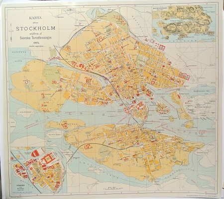
Karta öfver Stockholm. - 1904.
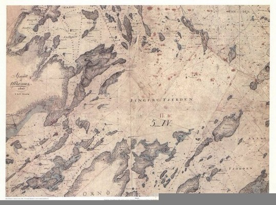
Dalarö - U. Thersner 1805.
HOGENBERG, FRANZ (Frans / Franciscus).
Biografiska uppgifter:Född mellan ca. 1535 och 1540 i Mecheln (Malines) i Belgien och död 1590 i Köln enl. uppgift.
Målare, graverare, etsare och förläggare. Son till kopparstickaren och målaren Nikolaus Hogenberg vilken var född i München och av tysk börd. Hogenberg gick i lära hos sin styvfar, kartografen Hendrik Terbruggen i Mecheln, och fick därigenom kontakt med kartografin. Hogenberg flyttade sedan till Antwerpen där han utförde arbeten i samarbete med bl.a. Hieronymous Cock. Hogenberg utförde i Antwerpen även kopparplåtarna till flertalet av Ortelius kartor, första utgåvan, som utkom 1570. Det är möjligt att Hogenberg även besökte både Poiters, 1560, och England, 1568. Efter religiösa oroligheter i Nederländerna 1570 så flyttade Hogenberg till Köln där han sammanträffade med Georg Braun vilken han kände sedan tiden i Antwerpen. De påbörjade då arbetet på 'Civitates Orbis Terrarum'. I ett brev från Braun till Ortelius daterat 31 oktober 1571 så insinuerar Braun att 'Civitates Orbis Terrarum' var Hogenbergs idé då han kallar den 'Mäster Frans' bok om städer'. Majoriteten av gravyerna i 'Civitates Orbis Terrarum' är gjorda av Hogenberg. Nästan alla original till de spanska och italienska städerna är även de av Hogenbergs hand samt flertalet av de andra originalen är omarbetade av Hogenberg. Arbetets första del utkom 1572 och slutfördes först 1618, nästan tre decennier efter Hogenbergs död.
Hogenberg, Franciscus (1538-1590) was born in Malines, Belgium as the son of engraver Nikolaus Hogenberg, who worked with Jacob van Deventer. He travelled to France with Ortelius and engraved most if not all plates of the first edition of Ortelius’ 'Theatrum'. He also worked in Antwerp with Hieronymus Cock, and also for some time in England. In 1570 he moved to Cologne, Germany, due to political and religious unrest in the Low Countries. There he met again the theologian Georg Braun (1541-1622), who had been a teacher in Antwerp from 1566 to 1568. Together with Braun, he published 'Civitatis Orbis Terrarum' a counterpart to Ortelius’ atlas containing city plans and views, which was finished with volume 6 in 1617. He also made numerous 'Gesichtsblätter', a travel atlas for the Christian world (1580) and an atlas of the Low Countries.
(Cartographica Neerlandica - www.orteliusmaps.com)
Franz Hogenberg. (b Mechelen, c. 1540; d Cologne, c. 1590). Painter, engraver, etcher and publisher, son of (1) Nicolas Hogenberg. He was probably a pupil of the cartographer H. Terbruggen in Mechelen but later worked in Antwerp, producing such engravings as the Allegory with Fortune (1561; Hollstein, no. 39), the Battle between Lent and Carnival (etching, 1558; published by Hieronymous Cock, H 40), the Fools’ Dance (H 41), and a portrait of Mary I, Queen of England (1554; H 54). It was probably in Antwerp that he executed several maps for the Theatrum orbis terrarum of Abraham Ortelius, which was published in 1570 (H 131). It is also possible that he travelled to Poitiers in 1560, as his name and that date appear on an engraving by Joris Hoefnagel of the ‘Celtic Stone’ at Poitiers. A visit to England is suggested by the 1568 engraved portrait of William Cecil, Lord Burghley (1568; H 43). Also from the period are the portraits of Robert Dudley, Earl of Leicester (H 45) and Elizabeth, Queen of England (H 46); all three portraits were published in the ‘Bishop’s Bible’ of Matthew Parker (1568). Hogenberg also engraved two Views of the Royal Exchange in London (H 58, 59).
Hogenberg. [Hogenbergh; Hohenberg; Hoogenberg] Netherlandish family of artists, active in northern Europe. (1) Nicolas Hogenberg worked in Mechelen for most of his career, producing prints with religious and historical subjects. His son Remigius Hogenberg (b Mechelen, c. 1536; d ?England, c. 1588) worked as an engraver. In 1570 Remigius executed a View of Münster (Hollstein, no. 20), which suggests a visit to that city, but by 1573 he was in the service of the Archbishop of Canterbury, Matthew Parker, whose portrait he engraved in the same year (H 16). He worked on the Genealogy of English and French Kings (1574; H 19) for Parker and produced a number of maps of English counties for Christopher Saxton’s Atlas of England and Wales (1579). The existence of several portraits of Huguenot nobles (e.g. Charles, Duc de Lorraine, H 6) indicates a possible visit to France. (2) Franz Hogenberg, also Nicolas’s son, worked mainly in England and Germany and is noted for his Civitates orbis terrarum, an atlas containing maps of Europe. Franz Hogenberg’s two sons, Johann [Hans] Hogenberg (b ?Munich, c. 1550; fl 1594–1614) and Abraham Hogenberg ( fl 1608–after 1653), were both engravers. Johann worked in Mechelen and Cologne, mainly as a portrait engraver, but he produced a few religious subjects and a series of 12 plates depicting birds and animals (H 43–54). Abraham Hogenberg assisted his father with the plates for Abraham Ortelius’s Theatrum orbis terrarum (Antwerp, 1570) and designed and engraved frontispieces for booksellers, possibly also working in Cologne.
(The Grove Dictionary of Art. © Copyright 2000 Macmillan Publishers Limited.)
Bland arbeten:
Civitates Orbis Terrarum.
(VÖBAM.)


