
1722-74.
Tysk astronom och fysiker. Född i Fürth, död i Ilowla, Ryssland. Redan som mycket ung blev han anställd som kartritare hos de Homannska arvingarna, senare även upptagen i firman. 1754 blev han professor i matematik i Göttingen, och 1767 blev han kallad till St. Petersburg som medlem av vetenskapsakademin där. Av Katharina II fick han i uppdrag att leda mätningen av Volgadistriktet, ett led i den första fullständiga kartläggningen av det ryska riket. Under arbetet blev han mördad av ryska kosacker. Av hans författarskap, som främst bestod av fysiska och astronomiska avhandlingar, kan nämnas 'Beschreibung der Nürnberger Erd- und Himmelsgloben' (1749).
Bland arbeten.
Beschreibung der Nürnberger Erd- und Himmelsgloben.
Allg. d. Biogr.
Caspar Henne(n)berg(er) (sometimes also 'Kaspar'.
1529 – 29 February 1600.
Was a German Lutheran pastor, historian and cartographer.
Hennenberger was born in a Franconian place given as Erlich (Erlichhausen?) and started to study Lutheran divinity at the University of Königsberg in 1550. In 1554 he began to work at the congregation of Georgenau and in Domnau. Probably in 1561 he moved to Mühlhausen, where he worked as a Lutheran Pastor for the next 29 years.
With the patronage of Duke Albert of Prussia Hennenberger published the first detailed map of Prussia in 1576, the book 'Kurze und wahrhaftige Beschreibung des Landes zu Preussen' (short and truthful description of the land Prussia) in 1584 and 'Erklärung der preußischen größeren Landtafeln oder Mappen' (explanation of the larger Prussian maps) in 1594.
In 1590 Hennenberger became the Pastor of the Large Hospital at Königsberg-Löbenicht, where he died in 1600. He was buried in the Hospital's Church.
Bland arbeten.
Kurze und wahrhaftige Beschreibung des Landes zu Preussen.
Erklärung der preußischen größeren Landtafeln oder Mappen.
Ca. 1664-1721.
Holländsk bokhandlare, son till Hendrick Doncker (se denne).
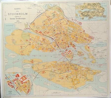
Karta öfver Stockholm. - 1904.
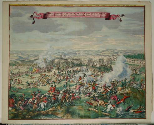
Poltava. - Bataljbild.
