
VÖBAM - Din källa till den äldre bild- och kartvärlden. - Tel: 08-102121 - Epost: info@vobam.se
Biografier.

Wytfliet, Cornelis.

fl. 1597.
Little is known of Wytfliet except that he was a native of Brabant, but there is no doubt about the importance of his only atlas, which was the first one printed to deal exclusively with America. Although its title indicated it to be a 'supplement to Ptolemy', Part 1 covered the history of the discovery of America and its geography and natural history and Part II consisted entirely of contemporary maps of America and a world map based on Mercator.


LAZIUS, [LAZIO, LATZEN], WOLFGANG.


(1514-65). Hungarian cartographer, Prof. Medicine Vienna, and Secretary to Thomas Bakocz, Archbishop of Esztergom. Oldest known map of Hungary known as Lazar's map (78.3x54.8 cm.) published by Tanstetter in 1528 includes Slovakia. His maps of Austria, Hungary and Bavaria weer used by Mercator, Ortelius &c.,

Bland arbeten.
Austria 1545, 1556 (4 sh.),
Hungary 1556 (10 sh.),
Bavaria 1545,
Greece 1558 (4 sh.),
Peloponese 1558,
Tyrol 1561,
Atlas of Austrian Provinces 1561.


Tooley


VALLBERG, KARL JAKOB.

Född 1705, död 1778.
Son till löjtnant Ingevall Vallberg och Margareta Helena Blyberg, samt svåger med företrädaren Embring. Examen 1727. E. ord. 1728 på Öland, och 1729 i Östergötl. Ord. 1742. Kom.-lantmätare. 1760 genom byte med sonen. Kom.-lantmätare i Savolax 1778 genom byte med J. G. Leffler. Afsked med öfverinspektors titel s. å. Ågde Klosterorlunda i Hofs s:n. Gift 1730 med Maria Göthe, f. 1707, d. 1770.


Ekstrand - Svenska landtmätare.
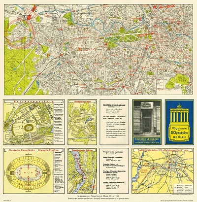


Vägvisare för XI Olympiaden i Berlin - 1936
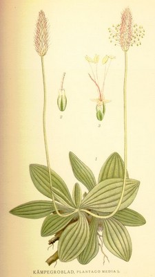


Kämpegroblad, Plantago media - Lindman, C. A. M, Bilder ur Nordens Flora 1917-26.


Sök efter biografi:

Du sökte på: 10533

Klicka på valfri bokstav för att återgå till hela listan.  

A  B  C  D  E  F  G  H  I  J  K  L  M  N  O  P  Q  R  S  T  U  V  W  X  Y  Z  Å  Ä  Ö

Zuda Rokashi [priest Hotan].

The first Buddhist world map printed in Japan and the prototype for all subsequent Buddhist world maps printed in Japan until the late nineteenth century. The author, Hotan (1654-1728) was a scholar-priest and founder of the Kegonji Temple in Kyoto. The earliest known example in Japan is the Gotenjiku Zu (Map of the Five Indies) by the priest Jukai dating from 1364 and now preserved in Horyuji Temple in Nara. However Hotan’s map was revolutionary in being the first printed Oriental map to introduce detailed Western cartographic information into this traditional Buddhist cosmological view and attempt to merge the two together into a comprehensible form. Europe is depicted as a series of islands in the upper left of the image whilst South America is likewise another island in the lower right of the image. Africa is omitted completely. China and Japan are clearly defined in the upper right of the map. The popularity of the map is evidenced by the fact that although the map is dated 1710, it was reissued unchanged in numerous editions through to about 1815 and spawned innumerable copies and derivatives over the next 150 years. A rare and important cartographic work.
Bland arbeten:
Nantanbushu Bankoku Shoka No Zu [Map of the Universe as a result] [Kyoto: Uhei Bundaiken, Hoei 7 (1710)]
(Sotheby's. Murogo & Unno, “The Buddhist World Map in Japan” in /M Xvi (1962); H. Cortazzi, “Island of gold, p.38 pl.48; Harley & Woodward, “The History of Cartography, 2.2, pp. 428ff and Fig. 11.59; Nanba, “Old Maps of Japan, p. 179 pl.8; K. Yamashita, “Japanese Maps of the Edo Period, pp. 32-33 ill.1.)

Tillbaka till början.