VÖBAM - Din källa till den äldre bild- och kartvärlden. - Tel: 08-102121 - Epost: info@vobam.se
Biografier.

Fricx, Eugene Henri.

fl. 1706 - ca 1740.
Bookseller and printer in Brussels whose major work was a very large-scale map of Belgium and Luxembourg, much copied by other publishers. 


GERINGIUS, ERIK.

Född 1707 19/12 i Bettna sn (Söd.), död 1747 12/1 i Stockholm (Jakob).
Brukspredikant och komminister. Kopparstickare. Son av kyrkoherden Anders G. Och Catharina Bergander. Elev av Johan van den Aveelen o. 1724. Student vid Uppsala universitet 1725, brukspredikant vid Vällinge i Salems sn (Sthlm) 1737, komminister i Jakobs och Johannes församlingar i Stockholm 1740. Kusinen C. E. Bergquist har graverat ett porträtt av sin lärare Geringius med följande omskrift:
»Den oss i koppar har så mänga bilder visat
Blir här i koppar sjelf af eftervärlden prisat
Som prest och konstnär har han tjent sitt fosterland
Var nitisk i sitt kall och konstrik i sin hand.»
Bland arbeten.
O. CELSIUS d. ä., De insula Melita, diss., resp. A. Geringius, Uppsala 1725: karta över Malta.
Antependium i Riddarholmskyrkan, 1726, kpst., avsett för J. Possieths tillämnade beskrivning över Riddarholmskyrkan.
P. TILLAEUS, Karta över Stockholm, efter P. Wallrave, 1733, utförd i samarbete med C. E. Bergquist, jämte porträtt av Fredrik I, efter M. Mijtens, kpst.
Karta över Mälaren, 1739.
Karta över Södermanland, 1743.
M. A. SAHLSTEDT, Stora Tuna i Dahlom och Bergom minnesdöme, Sthlm 1743: karta över Stora Tuna.


Hultmark, 1944.


Dupuy de Bordes, Henri-Sébastien


Bland arbeten.
Encyclopédie ou dictionnaire universel raisonné des connaissances humaines.


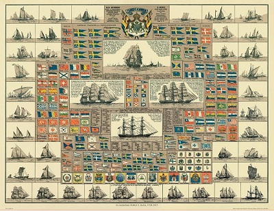
Amiral Häggs flaggkarta. - Stockholm 1888.


Gelder - Bataljbild från Preussiska bombardemanget 1703.


Sök efter biografi:

Du sökte på: 10016

Klicka på valfri bokstav för att återgå till hela listan.  

A  B  C  D  E  F  G  H  I  J  K  L  M  N  O  P  Q  R  S  T  U  V  W  X  Y  Z  Å  Ä  Ö

ARROWSMITH, AARON.

Biografiska uppgifter:1750-1823.
He was an English geographer (mapmaker) and member of the Arrowsmith family of geographers. He moved to Soho Square, London from Winston, County Durham when about twenty years of age, and was employed by John Gary, the engraver and led for some years the office of hydrographer to the king. In January 1790 he made himself famous by his large chart of the world on Mercator projection. Four years later he published another large map of the world on the globular projection, with a companion volume of explanation. The maps of North America (1796) and Scotland (1807) are the most celebrated of his many later productions. He left two sons, Aaron and Samuel, the elder of whom was the compiler of the Eton Comparative Atlas, of a Biblical atlas, and of various manuals of geography.
The business was thus carried on in company with John Arrowsmith (1790-1873), nephew of the elder Aaron. In 1821, they published a more complete North American map from a combination of a maps obtained from the Hudson Bay Company and Aaron's previous one. In 1834 John published his London Atlas, the best set of maps then in existence. He followed up the atlas with a long series of elaborate and carefully executed maps, those of Australia, America, Africa and India being especially valuable. In 1863 he received the gold medal of the Royal Geographical Society, of which body he was one of the founders.
His maps were very numerous, and the neatness and finished style of their execution gained for them a very extensive reputation, which, however, on closer examination, they have not permanently sustained. Arrowsmith was a most industrious collector of materials, but he was not equally judicious in using them ; and though, in various respects, useful and meritorious, his maps contain many great and important errors.
Mount Arrowsmith, situated east of Port Alberni on Vancouver Island, British Columbia, is named for Aaron Arrowsmith and his nephew John Arrowsmith.
Bland arbeten:
First map of North America, 1790
A Map Exhibiting All the New Discoveries in the Interior Parts of North America, January 1, 1795 (Other editions 1801, 1802, 1804 and 1816 featuring roads)
Chart of the South Pacific, 1798
A New Map of Africa, 1802
Map of Countries Round the North Pole, 1818
Ogden map (North America), 1821 (2nd edition : 1834)

Tillbaka till början.