
MERCATOR, GERARD (Gerard de Cremere el. Kremer).
5/3 1512- 2/12 1594. Född i Rupelmonde i Flandern, död i Duisburg.
Belgisk-tysk geograf. Från 1530 studerade han vid universitetet i Leuven under astronomen och kartografen Gemma-Frisius (se denne), och var dennes assistent under arbetet med hans jordglob. Hans första självständiga arbete, en Palestinakarta från 1537, finns det idag bara en känd kopia av. Lika sällsynta är flera av hans andra tidigaste arbeten. År 1541 konstruerade han en jordglob över jordklotet och en himmelsglob, båda på uppdrag av kejsare Karl V. År 1552 slog han sig ned i Duisburg där han sedan fortsatte sin verksamhet. 1569 gav han ut en liten bok om kronologi och samma år kom hans framstående världskarta. 1578 gav han ut Ptolemaeus geografi, kompletterad med sina egna kartor. Detta verk kom i 7 nyutgåvor, den senaste 1794. Mercator är ansedd som den mest betydelsefulla geografen sedan Ptolemaeus. Hans främsta verk, 'Atlas, sive cosmographicae meditationes de fabrica mundi' utkom första gången 1585 och slutfördes 1595, en kort tid efter hans död. Detta arbete var epokavgörande och kom fram till 1642 ut...
Bland arbeten.
Atlas, sive cosmographicae meditationes de fabrica mundi.
(Averdunk. - Bagrow. - Nederl. biogr. X.)
1774 - 1857
Turner was a very acomplished and productive english engraver and draughtsman. He worked for the great London print publisher Boydell.
Hammarlund
1744-1820. Född och död i Stockholm.
Svensk kartograf och friherre. 1770 blev han bergsmästare och 1781 bergsråd. Han gjorde även en förtjänstfull insats som kartograf genom att ta upp en gammal plan om geografisk beskrivning och kartläggning av Sverige och Finland. Verket påbörjades 1795 och avslutades 1818 med totalt 33 kartor med titeln 'Geographiske chartor öfver Swerige i 4 afdelingar'. Det 'Hermelinska kartverket', som är den första svenska rikskartan i atlasform, fick stort erkännande. Arbetet med kartorna försatte honom i svåra ekonomiska omständigheter. Hermelin var medlem av en rad lärda sällskap både i Sverige och utomlands.
Bland arbeten.
Kartor i verket Geographiske chartor.
Finland.
1. Storfurstendömet Finland.
2. Nylands och Tavastehus samt Kymmene-gårds höfdingedömen.
3. Savolax och Karelens eller Kuopio höfdingedömen.
4. Uleåborgs höfdingedöme.
5. Wasa höfdingedöme.
6. Åbo och Björnebergs höfdingedöme med Åland.
Sverige.
1. Swerige med tillgränsande länder.
2. Carlstads höfdingedöme eller Wärmeland. (2 blad).
3. Elfsborgs höfdingedöme.
4. Göta rike eller Södra delen af Sverige.
5. Göteborgs och Bohusläns höfdingedöme.
6. Halmstads höfdingedöme eller Halland.
7. Helsingland och Gestrikland.
8. Herjeådalaen.
9. Jönköpings, Kronobergs och Blekings höfdingedömen.
10. Kalmar höfdingedöme med Öland.
11. Kopparbergs Säters, Näsgårds och Wester bergslags fögderier i St. Kopparbergs höfd.
12. Linköpings höfdingedöme eller Östergötland.
13. Nyköpings höfdingedöme.
14. Skaraborgs höfdingedöme.
15. Skåne eller Malmöhus och Christianstads höfdingedömen. (2 blad).
16. Stockholms höfdingedöme.
17. Stora Kopparbergs höfdingedöme eller Dalarne.
18. Svea rike och Norrland.
19. Upsala höfdingedöme.
20. Westerbotten och Lappmarken, eller Umeå höfdingedöme.
21. Westerås höfdingedöme.
22. Wisby höfdingedöme eller Gottland.
23. Ångermanland, Medelpad och Jämtland eller Wester Norrlands höfdingedöme.
24. Örebro höfdingedöme.
I atlasen ingår även 3 vyer / utsikter.
1. Utsigt af ett Wattenfall i Lappmarken.
2. Utsigt af en Belägenhet i Finland.
3. Utsigt af Stockholm.
Totalt 33 kopparstick.
(Lönborg, s. 193-209. - Sv. män och kv.
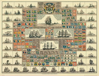
Amiral Häggs flaggkarta. - Stockholm 1888.
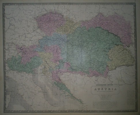
'Empire of Austria.' - Johnston ca 1860.
