
Död 1858.
Se under Robert Laurie.
1720-1804. Född och död i Gran.
Norsk ämbetsman och naturhistoriker. Började 1738 att studera och läste olika ämnen under ett antal år. 1750 blev han anställd av den stora bok- och kartsamlaren greve Joh. L. Holstein för att måla grevskapet Ledreborg vid Roskilde. 1752 utnämnd till generalkonduktör vid Akershus stift. Han hade titeln kansliråd, senare justitieråd. Medlem av 'Det kgl. Videnskabers Selskab' i Trondheim och 'Det kgl. danske Landhusholdningsselskab'. - Av hans författarskap, som framförallt omfattar naturhistoriska avhandlingar, kan nämnas 'Indbydelse til de Norske Karter', en uppfodring att sända honom kartor och dokument som stöd för ett påtänkt norskt kartverk (1766), samt 'Subscriptions Plan Till En Norsk Atlas eller Land-Beskrivelse over Kongeriget Norge' (1773). Detta verk blev emellertid aldrig utgivet. Sina samlingar, däribland en betydande kartsamling, och en stor del av sin förmögenhet testamenterade han till 'Videnskabsselskabet' i Trondheim.
Bland arbeten.
Subscriptions Plan Till En Norsk Atlas eller Land-Beskrivelse over Kongeriget Norge.
Indbydelse til de Norske Karter.
Ehrencron.
Död 1703.
Fransk geograf, son till Nicolas Sanson (se denne). Tillsammans med sin bror Adrien Sanson (se denne) fortsatte han sin fars arbete och utgav flera av hans verk på nytt. Av egna arbeten kan nämnas 'Introduction à la géographie' i 3 band (1681) och olika avhandlingar i tidskrifter. Bägge bröderna hade titeln 'Géographe du Roi'. Familjens samarbete med Pierre Mariette verkar ha upphört omkring 1670. Istället övertogs det av Hubert Jaillot (se denne).
Bland arbeten.
Introduction à la géographie.
Nouv. biogr. gen.
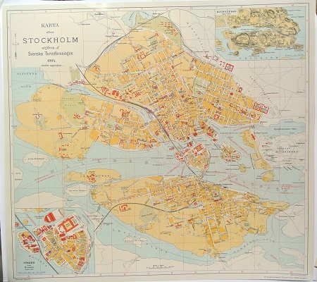
Karta öfver Stockholm. - 1904.
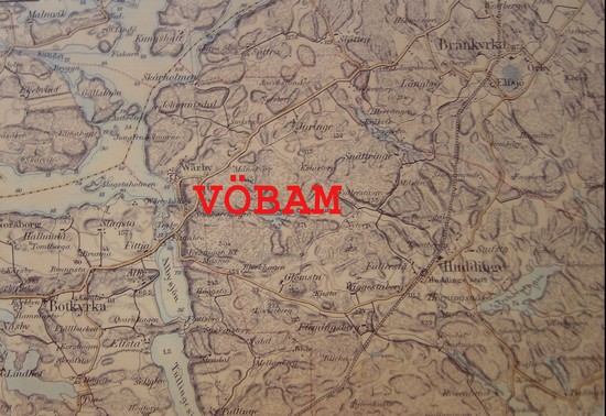
Huddinge - Topografiska Corpsen 1873.
