
Flemish cartographer.
Brabant (Sylvaducis) used by Blaeu 1634 and later.
Tooley.
Bland arbeten.
Encyclopédie ou dictionnaire universel raisonné des connaissances humaines.
1531-88. Född i Messina, död i Padua.
Italiensk matematiker. Han var under en tid lärare ĺt Prins Vincent av Mantua och blev senare professor i matematik i Padua. Efter uppdrag hos pĺven Gregor XIII och stadsrĺdet i Venedig, utförde han 'Tabulas Gregorianas' som förbättring av kalendern. Förutom sin skickliga kommentarutgĺva av Ptolomaeus gav han ut 'Tabulas geographicas' och 'Ephemerides coelestium motuum ab an. 1563 ad 1580'.
Bland arbeten.
Tabulas Gregorianas.
Tabulas geographicas.
Ephemerides coelestium motuum ab an. 1563 ad 1580.
Jöcher.
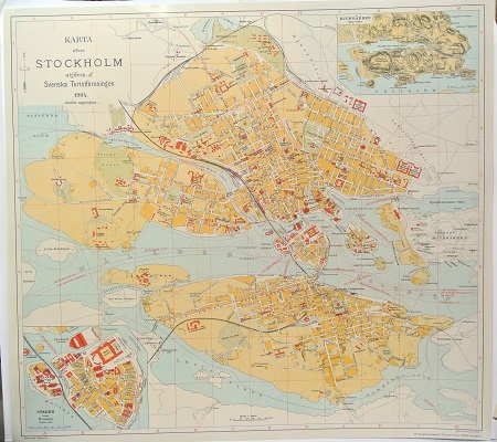
Karta öfver Stockholm. - 1904.
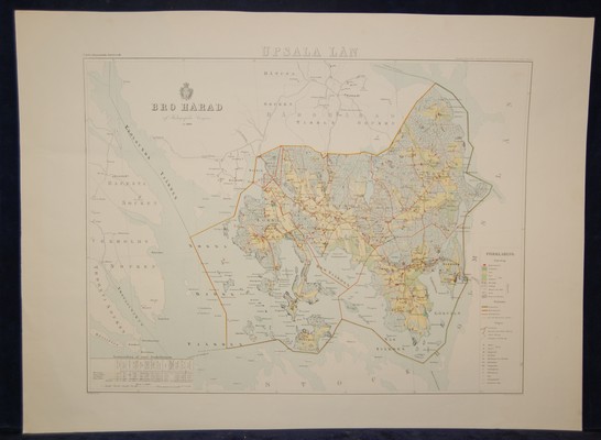
Bro härad. (1860-talets början).
Keere, Pieter van den [Kaerius, Petrus]
Biografiska uppgifter:1571-c. 1646.
Pieter van den Keere was one of a number of refugees who fled from religious persecution in the Low Countries between the years 1570 and 1 590. He moved to London in 1584 with his sister who married Jodocus Hondius, also a refugee there, and through Hondius he undoubtedly learned his skills as an engraver and cartographer. In the course of a long working life he engraved a large number of individual maps for prominent cartographers of the day but he also produced an Atlas of the Netherlands (1617-22) and county maps of the British Isles which have become known as Miniature Speeds, a misnomer which calls for some explanation.
In about 1599 he engraved plates for 44 maps of the English and Welsh counties, the regions of Scotland and the Irish provinces. The English maps were based on Saxton, the Scottish on Ortelius and the Irish on the famous map by Boazio. These maps were not published at once in book form but there is evidence which suggests a date of issue (in Amsterdam) between 1605 and 1610 although at least one authority believes they existed only in proof form until 1617 when Willem Blaeu issued them with a Latin edition of Camden's Britannia. At this stage two maps were added, one of the British Isles and the other of Yorkshire, the latter derived from Saxton. To confuse things further the title page of this edition is signed 'Guilielmus noster Janssonius', which is the Latinized form of Blaeu's name commonly used up to 1619.
At some time after this the plates came into the possession of Speed's publishers, George Humble, who in 1627, the year in which he published a major edition of Speed's Atlas, also issued the Keere maps as a pocket edition. For these he used the descriptive texts of the larger Speed maps and thereafter they were known as Miniature Speeds. In fact, of the 63 maps in the Atlas, 40 were from the original van den Keere plates, reworked, 16 were reduced from Speed and 7 were additional. The publication was very popular and there were further re-issues up to 1676.
