1720-1804. Född och död i Gran.
Norsk ämbetsman och naturhistoriker. Började 1738 att studera och läste olika ämnen under ett antal år. 1750 blev han anställd av den stora bok- och kartsamlaren greve Joh. L. Holstein för att måla grevskapet Ledreborg vid Roskilde. 1752 utnämnd till generalkonduktör vid Akershus stift. Han hade titeln kansliråd, senare justitieråd. Medlem av 'Det kgl. Videnskabers Selskab' i Trondheim och 'Det kgl. danske Landhusholdningsselskab'. - Av hans författarskap, som framförallt omfattar naturhistoriska avhandlingar, kan nämnas 'Indbydelse til de Norske Karter', en uppfodring att sända honom kartor och dokument som stöd för ett påtänkt norskt kartverk (1766), samt 'Subscriptions Plan Till En Norsk Atlas eller Land-Beskrivelse over Kongeriget Norge' (1773). Detta verk blev emellertid aldrig utgivet. Sina samlingar, däribland en betydande kartsamling, och en stor del av sin förmögenhet testamenterade han till 'Videnskabsselskabet' i Trondheim.
Bland arbeten.
Subscriptions Plan Till En Norsk Atlas eller Land-Beskrivelse over Kongeriget Norge.
Indbydelse til de Norske Karter.
Ehrencron.
1514-1589.
Fransk-nederländsk boktryckare, tryckte i Antwerpen från 1550 bl.a. liturgiska verk och en 'Biblia polyglotta' (8 bd, 1569). P. hade bl.a. en filialofficin i Leiden, som 1586 övertogs av svärsonen F. Raphelengh. P:s efterträdare i ANtwerpen blev hans svärson Jan Moerentorf (Moretus), under vars son, Balthasar Moretus (1574-1641), P. P. Rubens knöts till företaget. - P.-trycken (o. 1600 torde finnas) utmärka sig för vacker utstyrsel och praktiskt format samt stor noggrannhet i tekniken. Tryckeriet ägde bestånd i Antwerpen till 1876, då det inköptes av staden och blev Musée Plantin-Moretus.
Christophe Plantin ombesörjde efter 1579 utgivningen av Ortelius atlas 'Theatrum Orbis Terrarum'.
Bland arbeten.
Biblia polyglotta.
Svensk uppslagsbok.
1603-56
JUSTUS DANKERTS (son) 1635-1701
The Dankerts family, of whom the above were the most important, was very large and ramifying having had a lot of members who were active in engraving on an artistic level. In this short view, however, we are dealing mainly with those who took part in the atlas production.
The family’s roots can be traced back to Cornelis Danckerts (1536-1595), a carpenter in Amsterdam. From his marriage with Lijsbet Cornelisdr two sons are known: Cornelis Danckerts de Rij (1561-1634) and Danckert Cornelisz (ca. 1580-1625). Cornelis and his descendants called themselves Danckerts de Rij. Danckerts Cornelisz who is at the root of the line we are now interested in was first a skipper then a stone merchant. He married Lijstbeth Jansdr, shortly after the turn of the century. Several members of his branch were well-known engravers-etchers, mapmakers and printsellers (Keuning, 1955). Danckert Cornelisz had two sons: Cornelis Danckerts (1603-1656) and Dancker Danckerts (1614-?).
Cornelis the elder brother established himself as...
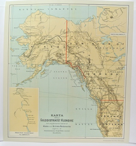
Gulddistriktet Klondike - ca 1897.
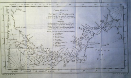
'Carte Reduite du Détroit de Magellan' - Bellin 1753.


