HURTER [HURTERO], JOHANN CHRISTOPH.
Alemannia siva Sueaviae superioris Choro. 1625, used by Blaeu 1634 & c.
Bland arbeten.
Alemannia siva Sueaviae superioris Choro.
Tooley.
Ca. 1780.
Engelsk kartförläggare. Inga övriga upplysningar hittade.
Född i Kalmar 25 mars 1792, död 3 maj 1878 i Stockholm.
Bror till Johan August Anckarswärd.
Artist, grefve efter den föregåendes död, f. 25 mars 1792 i Kalmar, utexaminerades 1808 som fänrik från krigsakademien och tjänstgjorde 1809 i arméns
värmländska fördelning såväl vid norska gränsen som i Stockholm. Med Svea lifgarde gjorde han som löjtnant tyska och norska fälttågen 1813 och 1814, blef kapten 1817, s. å. ordonnansofficer och 1829 adjutant hos Karl Johan samt tio år senare öfverstelöjtnant i armén. Därjämte egnade han sig åt konststudier, hufvudsakligen åt landskapsmålningen, och gjorde 1819–22 studieresor i utlandet. 1828 blef han ledamot och 1843 hedersledamot af konstakademien, och han var en af dem, som stiftade konstföreningen, 1832. Under åren 1844–58 var han öfverintendent och preses i konstakademien, hvilken därunder fick förnyade statuter och ny anordning af sitt läroverk och sin förvaltning. Inom vår planschverkslitteratur intog A. på 1820- och 30-talen ett framstående rum genom sina af honom själf litografierade arbeten Sveriges märkvärdiga...
Bland arbeten.
Fordna och närvarande Sverige
Nordisk Familjebok, Uggleupplagan
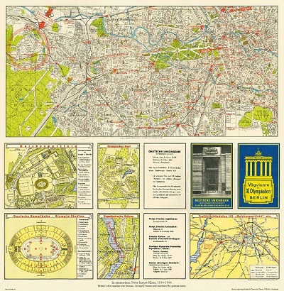
Vägvisare för XI Olympiaden i Berlin - 1936
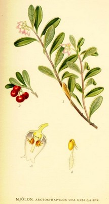
Mjölon, Arctostaphylos uva ursi - Lindman, C. A. M, Bilder ur Nordens Flora 1917-26.


