
Född 1/6 1833 i Ulricehamn, död 1873 14/5 i Göteborg.
Trägravör. Utbildat sig på egen hand. Känd för sina arbeten i kork och trä. Vid sin död hade hon för världsutställningen i Wien (1873) färdig en efterbildning i kork av Karl XV:s sista oljefärgstavla.
Göteborgs historiska museum äger en litografisk avbildning av en bordsskiva i kork, näver och svamp (Daedalea quersina) 'Minnen av Sverige' där i 13 större eller mindre bildfält återges Stockholms slott, Gripsholm, Skokloster, inloppet till Karlskrona, Mora kyrka med flera sevärdheter.
Enligt annons i Göteborgs adresskalender för 1871 utförde hon träsnitt 'till vetenskapliga arbeten, läroböcker, kataloger, vignetter för alla yrken m.m.' samt stöd till tjänst med arbeten i kork: 'uti taflor, läspulpeter, portefeuiller, lampskärmar m.m. efter eleganta teckningar och bekommas färdigmonterade'.
På industriutställningen i Malmö 1865 belönades hon med medalj.
Född d. 18 maj 1717. Död i Stockholm d. 19 mars 1793.
Arkitekt, gravör, konstälskare. Född d. 18 maj 1717. Son af Erik Bure och Rebecka Rehn (af den gamla stockholmska borgarsläkten), upptog R. moderns släktnamn.Gift med Anna Kristina Rungren.
Efter idkade militärstudier, därunder han lade sig särdeles vinn om teckning, ingick han vid fortifikationen och befordrades till löjtnant-dessinatör vid nämnda kår.
För att blifva i tillfälle att lära etsningskonsten eller, såsom det då hette, »skedvattensgravyren», reste han 1740 med offentligt understöd till Paris och utförde där under Le Bas' skickliga ledning åtskilliga lyckade arbeten i antydda väg, däribland planscherna öfver Ulrika Eleonoras bisättning och begrafning efter Hårlemans teckningar. Nämnda konstnär uppgjorde med honom 1745 ett kontrakt, enligt hvilket han mot årlig lön skulle gå de svenska sidenfabrikerna tillhanda »med mönster- och patronritning samt fasoners projekterande». Han hade vid denna tid återkommit till fäderneslandet, där han blef en eftersökt teckningslärare.
I sällskap med J. P...
(Svenskt biografiskt handlexikon)
1733-1806. Born in Norrköping.
Dansk geograf, gav 1769 ut en geografisk karta över Medelpad.
Land Survey Apprentice 1749, commission surveyor for the Västernorrland region in 1757. Staff surveyor 1784 for Vasa county. Retired 1802.
Bland arbeten.
Karta över Medelpad.
Sveriges sjökartor – A. Hedin.
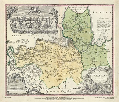
Ingermanlandiae – Homanns Erben 1734
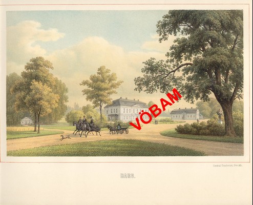
Harg - Nay 1881.
