VÖBAM - Din källa till den äldre bild- och kartvärlden. - Tel: 08-102121 - Epost: info@vobam.se

Biografier.
Namnet nämns pĺ bl.a. en globkarta utgiven i Augsburg 1786. 'Iean George Probst Fils'.
Norsk amatörtecknare som inte kunnat identifieras.
Se Dahlstierna.
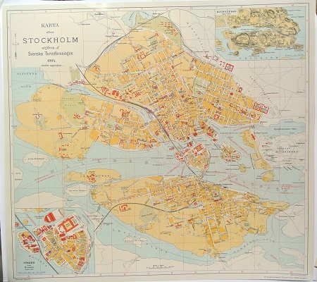
Karta öfver Stockholm. - 1904.
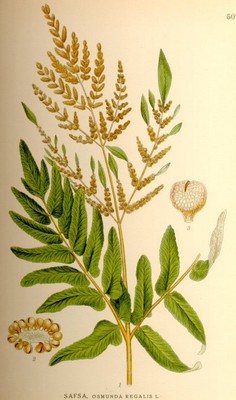
Safsa, Osmunda regalis - Lindman, C. A. M, Bilder ur Nordens Flora 1917-26.
VÖBAM - Din källa till den äldre bild- och kartvärlden. - Tel: 08-102121 - Epost: info@vobam.se
