
Son till MORTIER, PIETER. 1721 ingick han kompanjonskap med Johannes Covens (se denne), och förde sin fars verksamhet vidare under firmanamnet Cóvens et Mortier. Deras kartproduktion, nämnt under Cóvens, var förvisso den viktigaste delen av verksamheten, men bokproduktionen verkar ocksĺ ha varit ganska omfattande. Under viss tid samarbetade de med brodern Pierre Mortier (död 1754) som hade sin egen verksamhet, bl.a. om utgivningen av ett stort illustrerat bibelverk.
Kleerkooper.
1704-1754.
Bokhandlare och utgivare i Leiden.
Samarbetade tidvis med brodern Cornelius Mortiers firma Cóvens et Mortier.
LANGREN [LANGEREN], MICHAEL FLORIS van [MICHAELIS FLORENT˙, FLORENTIO].
1612-1675.
Mathematician and astronomer to King of Spain. Lived in Brussels.
Gjorde även kartor till Blaeu redan 1631.
Bland arbeten.
Maps for Blaeu 1635: Brabant, Louvain, Antwerp, Mechlin.
Tooley.
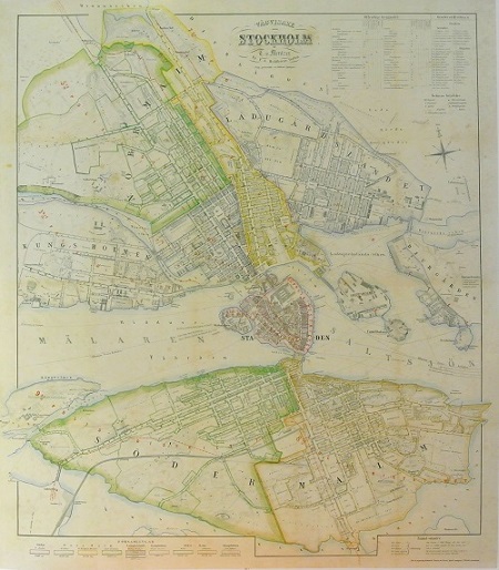
Stockholm - Mentzer ca 1860.
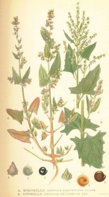
Spjutmĺlla, Altriplex hastifolium - Lindman, C. A. M, Bilder ur Nordens Flora 1917-26.
