
LUBBIN [LÜBBIN, LUBINUS], EILHARD [EILHARDUS, EILERT].
Cartographer and Professor of Mathematics of Rostock.
Bland arbeten.
Rügen Mercator 1609, Blaeu 1631,
Pomerania 12 sh. 1618 used by Hondius, Blaeu &c.
Tooley.
Fransk geograf i slutet av 1700-talet. Det finns en rad enkla kartor av honom frĺn ĺren 1753-91 men ingen hel atlas. Titeln geograf anger han själv pĺ kartorna. Inga ytterligare upplysningar om honom har funnits, om han inte är identisk med Jean Francois Augustin Janvier de Flainville (1717-91), som var advokat till 1759, inspektör vid krigsakademin vid revolutionen 1789 och senare borgmästare i Chartres och dessutom känd arkeolog.
Nouv. biogr. gen. - Phillips. - Tooley.
Kopparstickare som 1704 pĺ uppdrag av tsar Peter utförde ett kopparstick av en karta över Kexholms län - Ingermanland som renritats av lantmätaren A. Andersin.
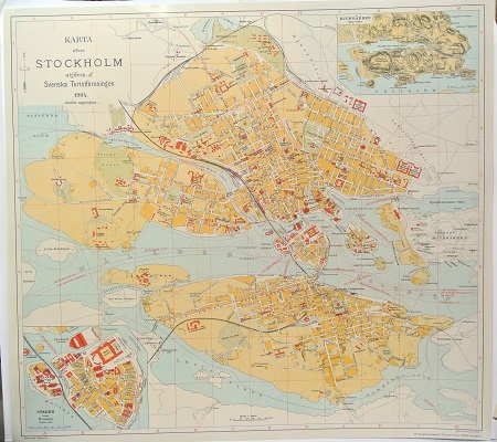
Karta öfver Stockholm. - 1904.
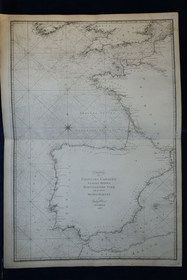
Charta öfver Engelska Canalen, Franska Bugten, Portugisiska Sjön och en del af Medel Hafvet. - G. af Klint 1798.
