
1785-1869. Född i Hurum, död i Drammen.
Norsk ämbetsman. Tog juridisk examen 1807, blev sockenskrivare i Nordre Jarlsberg 1810, byfogde och byskrivare i Drammen 1826, länsman i Buskerud 1831-57. Stortingsman under en rad ĺr och medlem av flera offentliga kommissioner, däribland 'Hovedmatrikuleringskommisjonen' 1823-38. Han författade en rad ekonomiska och statistiska skrifter. Av dessa kan nämnas 'Das Königreich Norwegen statistisch beschrieben' frĺn 1843. Medlem av Vetenskapssällskapet i Trondheim.
Bland arbeten.
Das Königreich Norwegen statistisch beschrieben.
K. St. O.O. Halvorsen.
Ca 1632-91.
A bookseller and publisher in Rotterdam, whose charts and maps were largely based on those of his father-in-law, Jacob Aertsz. Colom. His Nieuwe Zee-Atlas of 1660 was an important assembly of sea charts including many of South East Asia and Australia.
VISSCHER, CLAES (eller NICOLAS ) JANZON.
1586-1652. Född och död i Amsterdam.
Holländsk kartograf. Gick i lära som kopparstickare och kartritare hos Jodocus Hondius och grundlade därefter sitt eget konstförlag. Visscher var en duktig kopparstickare, som förutom kartor även utförde landskaps- och historiska bilder. Hans firma övertogs av sonen Nicolas (1618-79) och senare sonsonen Nicolas Visscher (se denne). Deras firma gav ca. 1660 ut en 'Atlas Contracuts' och ca. 1680 en 'Atlas minor' som bĺde kom i en rad utgĺvor. Deras kartplaner användes ocksĺ i stor utsträckning av andra kartutgivare, bĺde i Holland och andra länder. Kartor av den äldre Visscher räknas som ganska sällsynta. Han uppträder vanligtvis under sitt latinska namn Nicolaus Joh. Piscator.
Claes Jansz. ging rond 1608 in het huis 'Op de Kolck inde Visscher' wonen. In het begin lag de nadruk op het versieren van de kaarten van Blaeu en Hondius. Later begon hij zijn eigen drukkerij en startte ook met de productie van kaarten. In 1611 kocht hij een huis in de gerespecteerde Kalverstraat, waar ook belangrijke concurrent...
Bland arbeten.
Atlas Contracuts.
Atlas minor.
Nederl. biogr., VII. - Tooley.
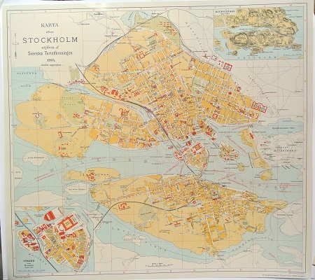
Karta öfver Stockholm. - 1904.
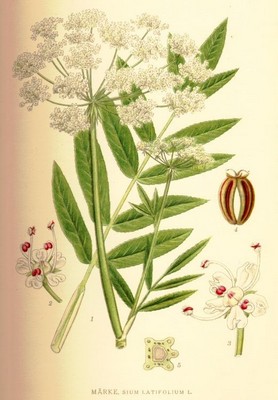
Märke, Sium latifolium - Lindman, C. A. M, Bilder ur Nordens Flora 1917-26.
