
REILLY, FRANZ JOHANN JOSEPH von.
Österrikisk kartograf under senare delen av 1700-talet. 1789-91 gav han ut en atlas 'Grosser deutscher Atlas' som omfattade hela världen, och 1799 'Atlas univers' som endast omfattade Europa.
Bland arbeten.
Grosser deutscher Atlas.
Atlas univers.
Phillips.
1821-91.
Norsk officer. Född och död i Christiania (Oslo). Han utexaminerades från Krigsskolan 1838, blev 1857 ritmästare, 1869 major och 1881 chef för 'Trondhjemske kavalerikorps', från 1889 vid 'Akershusiske kavalerikorps'. Han var under många år anställd vid 'Norges Geografiske Opmaaling', där han främst arbetade med generalkartorna över Norge.
Halvorsen.
Utförde bl.a. 1689 en karta med titeln 'General Landkort och Geographisk Afritning öfwer Westergiöthland, Dahl, Hallan och Bahuus Lähn, med der uthi liggiande Lähn, Härader, slott, städer, kÿrckior, herregårdar, prestegårdar, siöer, floder och elfver, landsväger, landemärc och härads skillnader... siergårder med des öiger, holmer, skier, hampner, och seglationer med annat som notabelt kunde giöras. Hvilket alt finnis på chartan... specificerat och med sine nampn noterat'.
Bland arbeten.
General Landkort och Geographisk Afritning öfwer Westergiöthland, Dahl, Hallan och Bahuus Lähn, med der uthi liggiande Lähn, Härader, slott, städer, kÿrckior, herregårdar, prestegårdar, siöer, floder och elfver, landsväger, landemärc och härads skillnader... siergårder med des öiger, holmer, skier, hampner, och seglationer med annat som notabelt kunde giöras. Hvilket alt finnis på chartan... specificerat och med sine nampn noterat.

Vägvisare för XI Olympiaden i Berlin - 1936
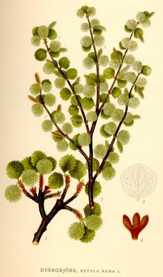
Dvärgbjörk, Betula nana - Lindman, C. A. M, Bilder ur Nordens Flora 1917-26.
Biografiska uppgifter:1725-1802. Född i Paris, död i Carrières de Charenton.
Fransk kopparstickare. Han lär ha skapat uppemot 1200 kartor, stadsplaner och liknande arbeten, bl a. för d'Anville (se denne) och Robert de Vaugondy.
(Thieme-Becker.)
