VÖBAM - Din källa till den äldre bild- och kartvärlden. - Tel: 08-102121 - Epost: info@vobam.se

Biografier.
fl. 1671.
Published a notable Atlas of America which was used by John Ogilby as the basis for his An Accurate Description and Complete History of America. The maps were extremely decorative and included a view of New Amsterdam as it appeared soon after its foundation.
Bland arbeten.
Encyclopédie ou dictionnaire universel raisonné des connaissances humaines.
Gravör. Arbetade ĺt Robert Sayer.
Bland arbeten.
Sayer & Bennett's General Atlas 1757-94.
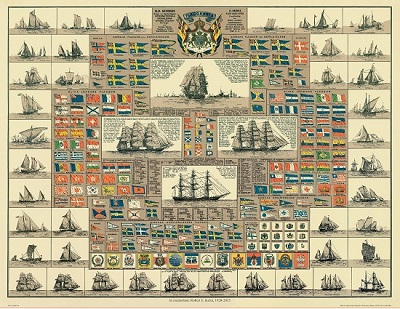
Amiral Häggs flaggkarta. - Stockholm 1888.
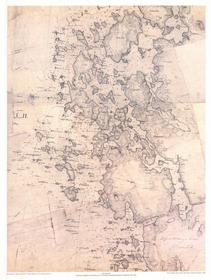
Havstenssund - J. S. Rosensvärd 1803-1805.
VÖBAM - Din källa till den äldre bild- och kartvärlden. - Tel: 08-102121 - Epost: info@vobam.se
