
Heraldischer Atlas, Tavla 27 - H. G. Ströhl 1899.
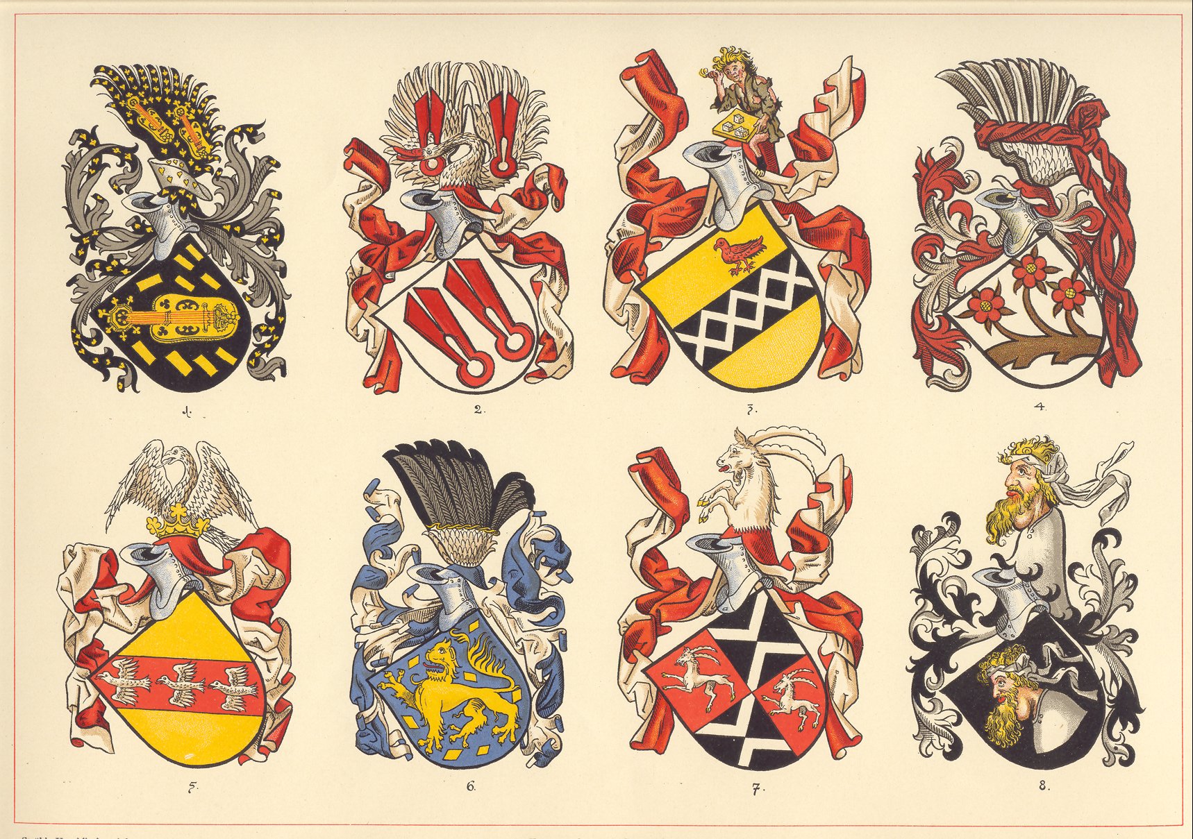
Heraldischer Atlas. Eine Sammlung von heraldischen Musterblättern für Künstler, Gewerbetreibende, sowie und Freunde der Wappenkunde, zusammengestellt und erläutert von H. G. Ströhl.
Stuttgart
Verlag von Julius Hoffmann
MDCCCXCIX.
Faksimiltryck av plansch ur Heraldischer Atlas, tryckt 1899 i Stutgart, uppförstorade pĺ 160 grams papper i format A3, med teckenförklaring.
Tavla 27.
Pris: 320 SEK - 40015 - Se bild.
76 Tafeln in Bunt- und Schwarzdruck nebst zahlreichen Text-Illustrationen.
Album Vilmorin 1853. - Elisa Champin.
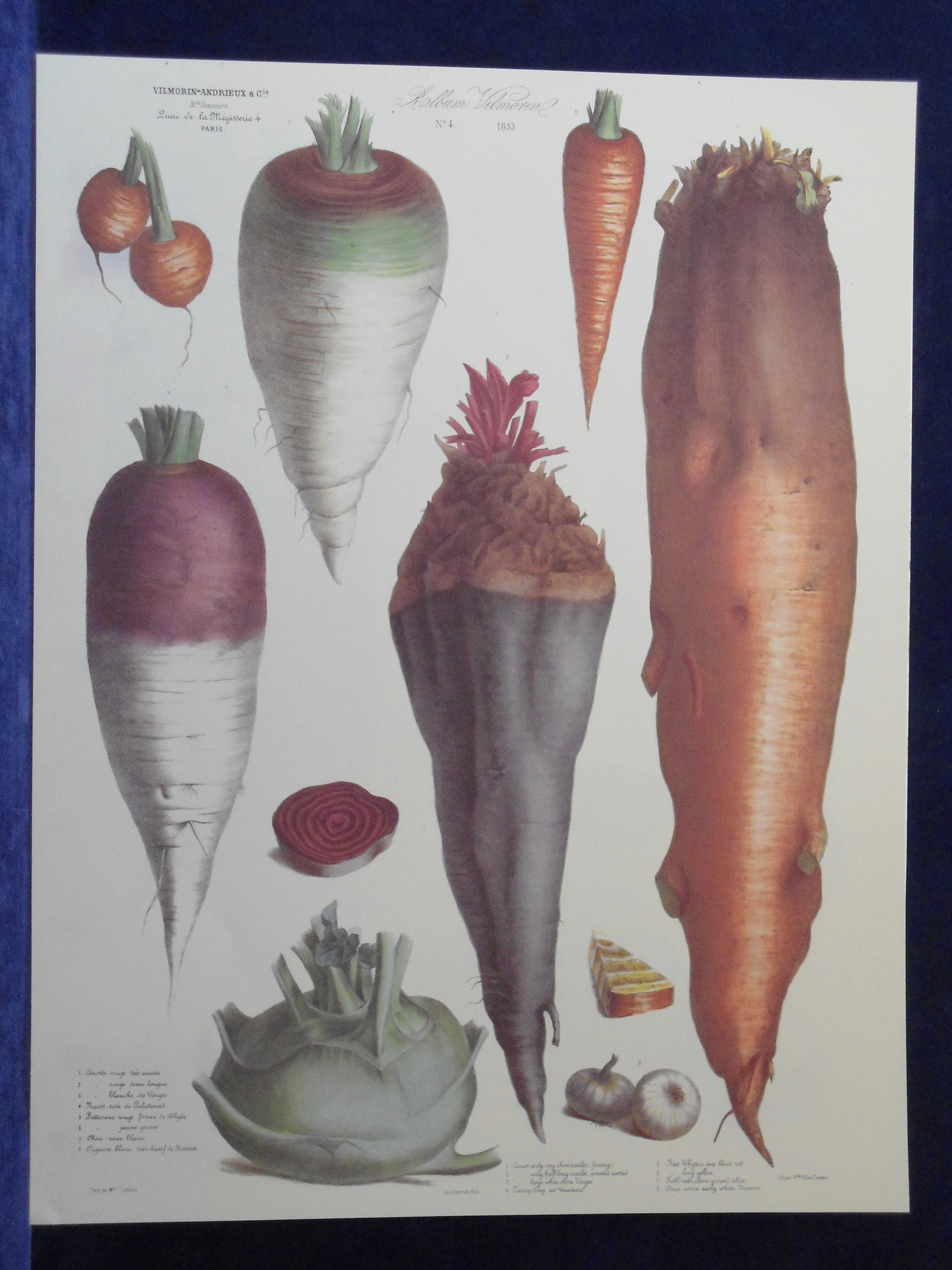
Album Vilmorin 1853. No 4.
Vilmorin-Andrieux & C.ie. M.ds Grainiers. Quai de la Mégisserie 4. Paris.
Peint par M.lle Coutance.
Elisa Champin.
Imp. Lemercier, r. de Seine 57. Paris.
Faksimil. Färgtryckt plansch, ur Album Vilmorin, Le Jardin Potager - The Vegetable Garden.
Originalet ritat och mĺlat av Coutance.
Litograferat av Elisa Champin
Storlek: 49x63 cm, planschytans bredd x höjd.
Morot, majrova, beta, kĺlrabbi och lök.
Pris: 400 SEK - 39923 - Se bild.
Vid köp av fyra, betala endast för tre.
Sjönöt, Trapa natans - Lindman, C. A. M, Bilder ur Nordens Flora 1917-26.
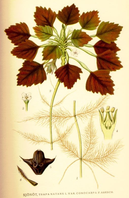
Sjönöt, Trapa natans
Bilder ur Nordens Flora.
Tredje upplagan 1917-1926.
VÖBAM har samtliga 663 planscher ur C. A. M. Lindmans 'Bilder ur Nordens Flora', 1917-1926.
Planschstorlek ca 15 x 20 cm.
Pris: 100 SEK - 40788 - Se bild.
'The Geological Structure of the Globe according to Ami Boue.' - A. Johnston.
The Geological Structure of the Globe according to Ami Boue.
The Geological Structure of the Globe according to Ami Boue. From the Large Chart Presented to the Reunion at Grätz 22:d Sep, 1846. With Dr Boues Corrections & additions to Sep. 1846.
Koppargraverad och handkolorerad karta ur 'A Series of Maps & Illustrations of the Geographical Distribution of Natural Phenomena embracing.' tryckt i London 1850.
Storlek: 57x47 cm. Kartytans bredd x höjd.
Textavsnitt medföljer.
Pris: 2500 SEK - 26259
Vacker färgsättning.
50. Julin, Johan Fredrik, landskapsmĺlare. - 1912.
50. Julin, Johan Fredrik, landskapsmĺlare.
Miniatyrporträtt utfört i Berlin ĺr 1912 i vackert akvarelltryck.
Oval. 8,5 x 10,3
Mĺttet anger bredden x höjden i cm = bildytan.
Pris: 400 SEK - 38317
Tok, Potentilla Fruticosa L. - Lindman, C. A. M, Bilder ur Nordens Flora 1917-26.
Tok, Potentilla Fruticosa L.
Bilder ur Nordens Flora.
Tredje upplagan 1917-1926.
VÖBAM har samtliga 663 planscher ur C. A. M. Lindmans 'Bilder ur Nordens Flora', 1917-1926.
Planschstorlek ca 15 x 20 cm.
Pris: 100 SEK - 41066
Stor skogslilja, Cephalanthera alba - Lindman, C. A. M, Bilder ur Nordens Flora 1917-26.
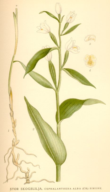
Stor skogslilja, Cephalanthera alba
Bilder ur Nordens Flora.
Tredje upplagan 1917-1926.
VÖBAM har samtliga 663 planscher ur C. A. M. Lindmans 'Bilder ur Nordens Flora', 1917-1926.
Planschstorlek ca 15 x 20 cm.
Pris: 100 SEK - 40865 - Se bild.
Hultbräken, Dryopteris phegopteris - Lindman, C. A. M, Bilder ur Nordens Flora 1917-26.
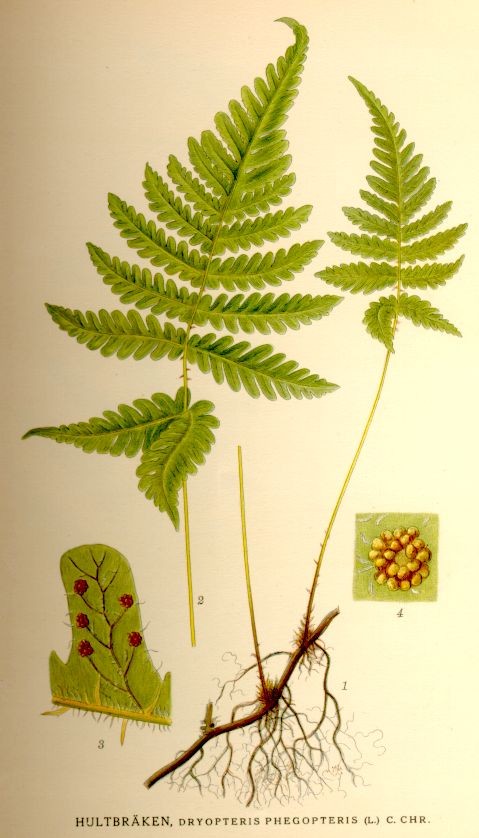
Hultbräken, Dryopteris phegopteris
Bilder ur Nordens Flora.
Tredje upplagan 1917-1926.
VÖBAM har samtliga 663 planscher ur C. A. M. Lindmans 'Bilder ur Nordens Flora', 1917-1926.
Planschstorlek ca 15 x 20 cm.
Pris: 100 SEK - 40951 - Se bild.
Vĺrsmörblomma, Ranunculus Auricomus L. - Lindman, C. A. M, Bilder ur Nordens Flora 1917-26.
Vĺrsmörblomma, Ranunculus Auricomus L.
Bilder ur Nordens Flora.
Tredje upplagan 1917-1926.
VÖBAM har samtliga 663 planscher ur C. A. M. Lindmans 'Bilder ur Nordens Flora', 1917-1926.
Planschstorlek ca 15 x 20 cm.
Pris: 100 SEK - 41042
Heraldischer Atlas, Tavla 26 - H. G. Ströhl 1899.
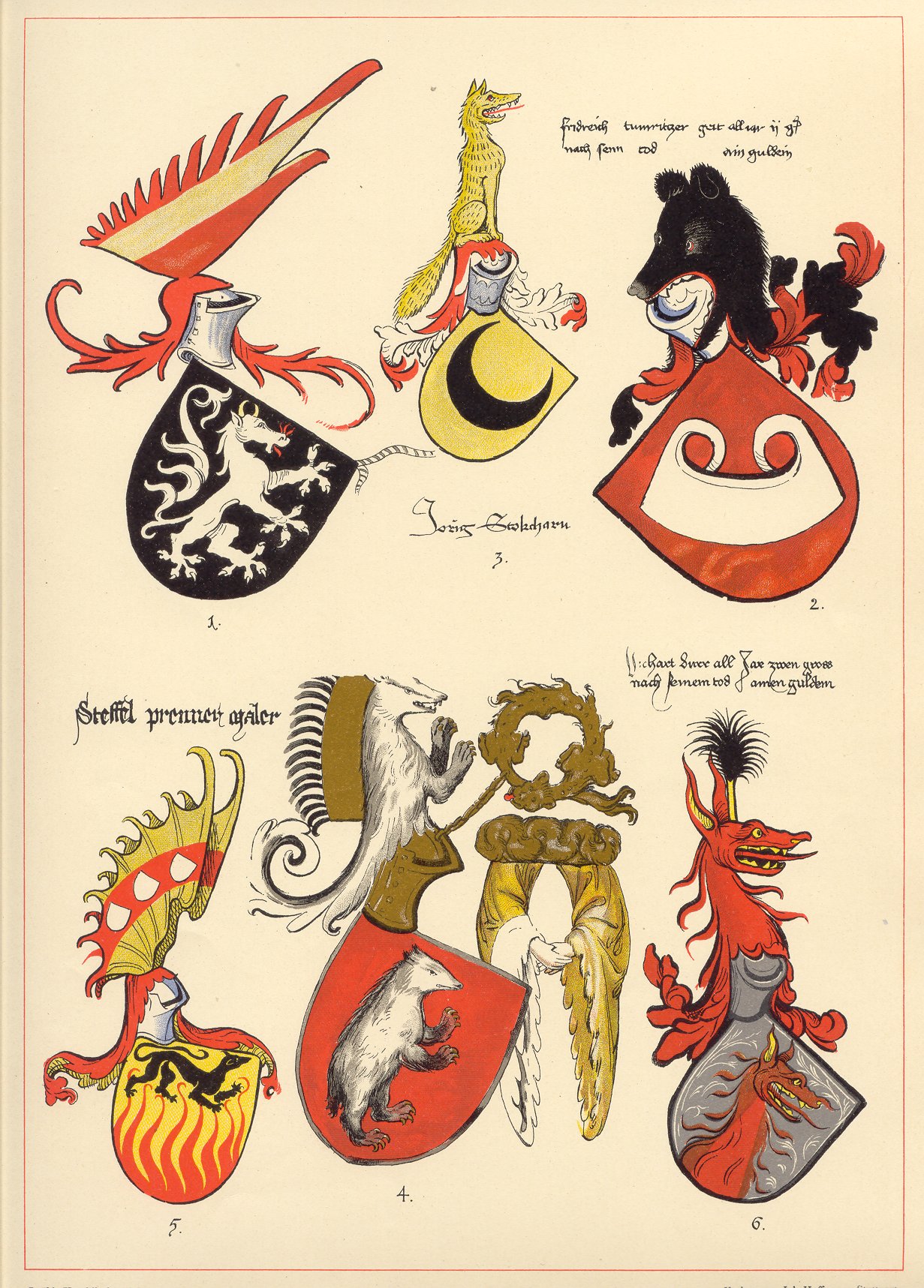
Heraldischer Atlas. Eine Sammlung von heraldischen Musterblättern für Künstler, Gewerbetreibende, sowie und Freunde der Wappenkunde, zusammengestellt und erläutert von H. G. Ströhl.
Stuttgart
Verlag von Julius Hoffmann
MDCCCXCIX.
Faksimiltryck av plansch ur Heraldischer Atlas, tryckt 1899 i Stutgart, uppförstorade pĺ 160 grams papper i format A3, med teckenförklaring.
Tavla 26.
Pris: 320 SEK - 40014 - Se bild.
76 Tafeln in Bunt- und Schwarzdruck nebst zahlreichen Text-Illustrationen.

Vägvisare för XI Olympiaden i Berlin - 1936
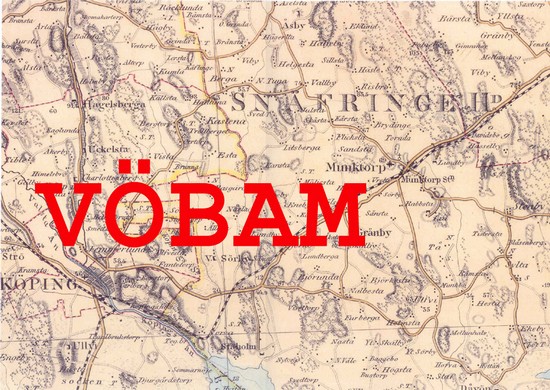
Köping - Munktorp - 1840/59.
Toppklocka, Campanula Glomerata L. - Lindman, C. A. M, Bilder ur Nordens Flora 1917-26.

Toppklocka, Campanula Glomerata L.
Bilder ur Nordens Flora.
Tredje upplagan 1917-1926.
VÖBAM har samtliga 663 planscher ur C. A. M. Lindmans 'Bilder ur Nordens Flora', 1917-1926.
Planschstorlek ca 15 x 20 cm.
Pris: 100 SEK - 41014 - Se bild.
Europa - Nordeuropa - -
