
Brudbröd, Flipendula hexapetala - Lindman, C. A. M, Bilder ur Nordens Flora 1917-26.
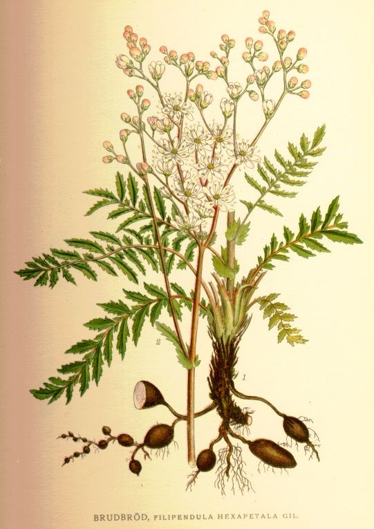
Brudbröd, Flipendula hexapetala
Bilder ur Nordens Flora.
Tredje upplagan 1917-1926.
VÖBAM har samtliga 663 planscher ur C. A. M. Lindmans 'Bilder ur Nordens Flora', 1917-1926.
Planschstorlek ca 15 x 20 cm.
Pris: 100 SEK - 40740 - Se bild.
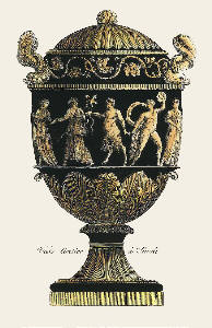
Black & Gold Vases, Pl. VII
Gravyr tryckt frĺn originalplĺten och handkolorerad.
Storlek: 15x25 cm, plĺtytans bredd x höjd.
Pris pĺ förfrĺgan. - 40409 - Se bild.
85. Wisniowiecki, Michael T. K. - 1912.
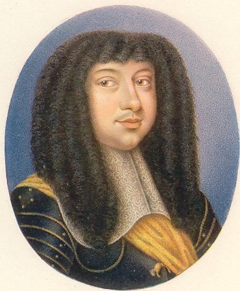
85. Wisniowiecki, Michael T. K.
Miniatyrporträtt utfört i Berlin ĺr 1912 i vackert akvarelltryck.
Oval. 5,6 x 6,8
Mĺttet anger bredden x höjden i cm = bildytan.
Pris: 400 SEK - 38352 - Se bild.
Backsöta, Astragalus glycyphyllus - Lindman, C. A. M, Bilder ur Nordens Flora 1917-26.

Backsöta, Astragalus glycyphyllus
Bilder ur Nordens Flora.
Tredje upplagan 1917-1926.
VÖBAM har samtliga 663 planscher ur C. A. M. Lindmans 'Bilder ur Nordens Flora', 1917-1926.
Planschstorlek ca 15 x 20 cm.
Pris: 100 SEK - 40772 - Se bild.
Apel, Pyrus malus - Lindman, C. A. M, Bilder ur Nordens Flora 1917-26.
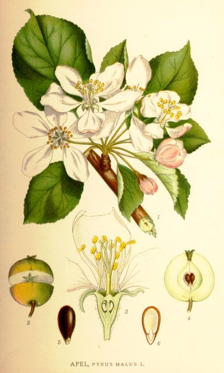
Apel, Pyrus malus
Bilder ur Nordens Flora.
Tredje upplagan 1917-1926.
VÖBAM har samtliga 663 planscher ur C. A. M. Lindmans 'Bilder ur Nordens Flora', 1917-1926.
Planschstorlek ca 15 x 20 cm.
Pris: 100 SEK - 40734 - Se bild.
Tuvnarv, Sagina Caespitosa (J. Vahl) Lge - Lindman, C. A. M, Bilder ur Nordens Flora 1917-26.
Tuvnarv, Sagina Caespitosa (J. Vahl) Lge
Bilder ur Nordens Flora.
Tredje upplagan 1917-1926.
VÖBAM har samtliga 663 planscher ur C. A. M. Lindmans 'Bilder ur Nordens Flora', 1917-1926.
Planschstorlek ca 15 x 20 cm.
Pris: 100 SEK - 41220
Revormstörel, Euphorbia helioscopia - Lindman, C. A. M, Bilder ur Nordens Flora 1917-26.
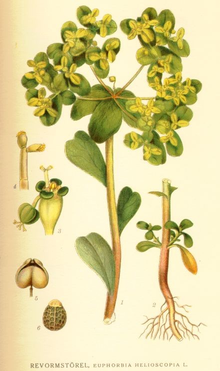
Revormstörel, Euphorbia helioscopia
Bilder ur Nordens Flora.
Tredje upplagan 1917-1926.
VÖBAM har samtliga 663 planscher ur C. A. M. Lindmans 'Bilder ur Nordens Flora', 1917-1926.
Planschstorlek ca 15 x 20 cm.
Pris: 100 SEK - 40695 - Se bild.
Lungört, Pulmonaria officinalis - Lindman, C. A. M, Bilder ur Nordens Flora 1917-26.
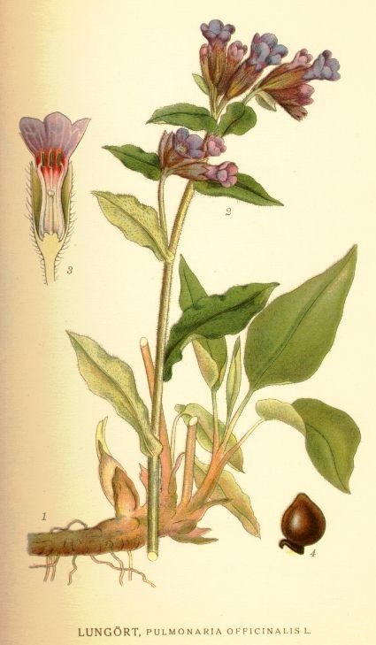
Lungört, Pulmonaria officinalis
Bilder ur Nordens Flora.
Tredje upplagan 1917-1926.
VÖBAM har samtliga 663 planscher ur C. A. M. Lindmans 'Bilder ur Nordens Flora', 1917-1926.
Planschstorlek ca 15 x 20 cm.
Pris: 100 SEK - 40536 - Se bild.
95. Man – Denner, Balthasar. 1912.
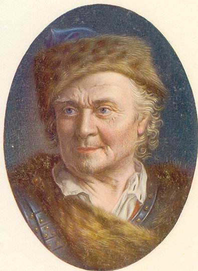
Man
Miniatyrporträtt utfört i Berlin ĺr 1912 i vackert akvarelltryck.
Oval. 6,6 x 9
Mĺttet anger bredden x höjden i cm = bildytan.
Pris: 300 SEK - 38362 - Se bild.
Album Vilmorin 1880. - F. Godard.
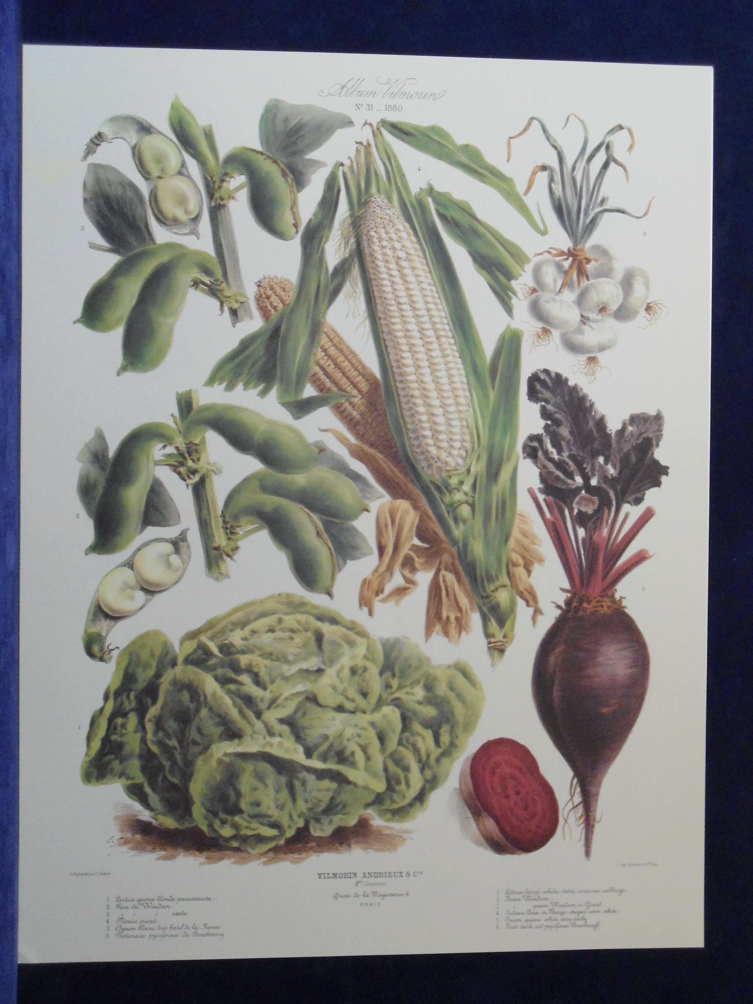
Album Vilmorin 1880. No 31.
Vilmorin-Andrieux & C.ie. M.ds Grainiers. Quai de la Mégisserie 4. Paris.
Lithographie par F. Godard.
Imp. Lemercier, r. de Seine 57. Paris.
Faksimil. Färgtryckt plansch, ur Album Vilmorin, Le Jardin Potager - The Vegetable Garden.
Litograferat av F. Godard.
Storlek: 49x63 cm, planschytans bredd x höjd.
Sallad, beta, majs, lök och böna.
Pris: 400 SEK - 39950 - Se bild.
Vid köp av fyra, betala endast för tre.
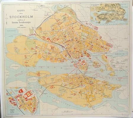
Karta öfver Stockholm. - 1904.
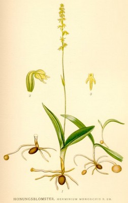
Honungsblomster, Herminium inonorchis - Lindman, C. A. M, Bilder ur Nordens Flora 1917-26.
Loppstarr, Carex pulicaris - Lindman, C. A. M, Bilder ur Nordens Flora 1917-26.
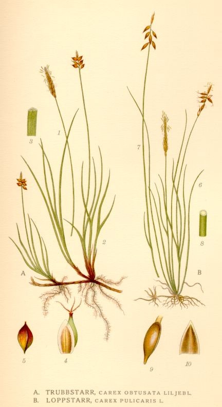
Loppstarr, Carex pulicaris
Bilder ur Nordens Flora.
Tredje upplagan 1917-1926.
VÖBAM har samtliga 663 planscher ur C. A. M. Lindmans 'Bilder ur Nordens Flora', 1917-1926.
Planschstorlek ca 15 x 20 cm.
Pris: 100 SEK - 40882 - Se bild.
Europa - Nordeuropa - -
