
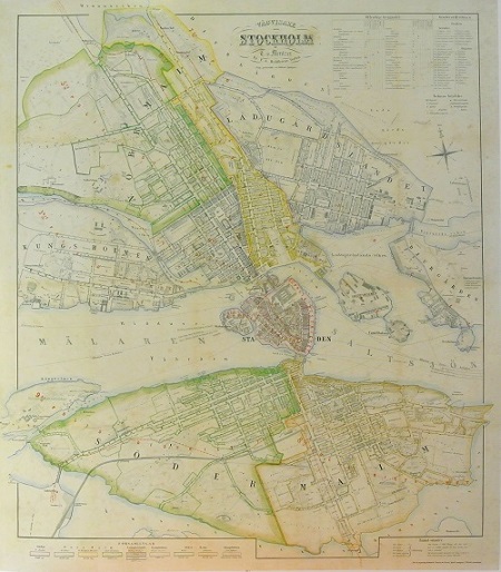
Stockholm - Mentzer ca 1860.
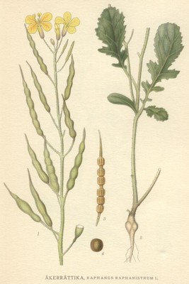
Åkerrättika, Raphanus raphanistrum - Lindman, C. A. M, Bilder ur Nordens Flora 1917-26.
'A Draught of the Cattegute...' - John Norris 1728.
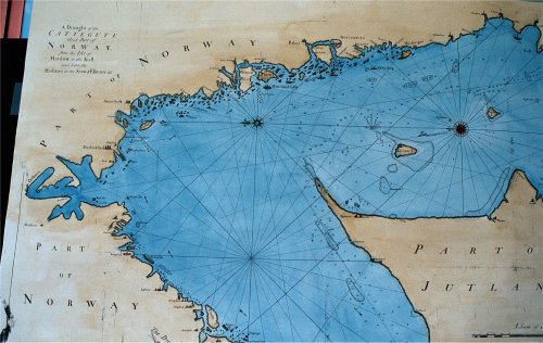
A Draught of the Cattegute and Part of Norway from the Isle of Mardow to the Koll and from the Holmes to the Scaw & Elsinore & c....
VÖBAM's faksimil utförs på akvarellpapper och handkoloreras.
Originalet från John Norris sjöatlas A Compleat Set of New Charts, Containing the North-Sea, Cattegatt and Baltic, tryckt och utgiven hos Thomas Page, William and Fisher Mount 1728.
Sjökortet rekognoscerat år 1721.
Originalkartan är ej kolorerad.
Sjökortet är orienterat med öster uppåt.
Storlek: 100 X 62 cm. Kartytans bredd x höjd.
Det sträcker sig från Oslo i norr (vänster) till Ven i söder (höger) och i öst-västlig riktning från Holmes i väst till Göteborg och Laholm i öst.
Pris: 1600 SEK - 25930 - Se bild.
Atlanten, Europa - Nordatlanten, Nordeuropa - Nordsjön, Sverige, Danmark, Norge - Kattegatt, Bohuslän
