
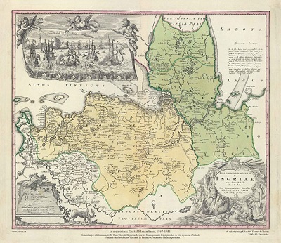
Ingermanlandiae Homanns Erben 1734
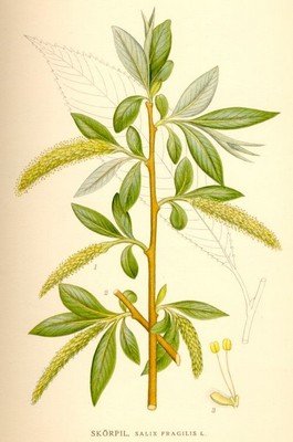
Skörpil, Salix fragilis - Lindman, C. A. M, Bilder ur Nordens Flora 1917-26.
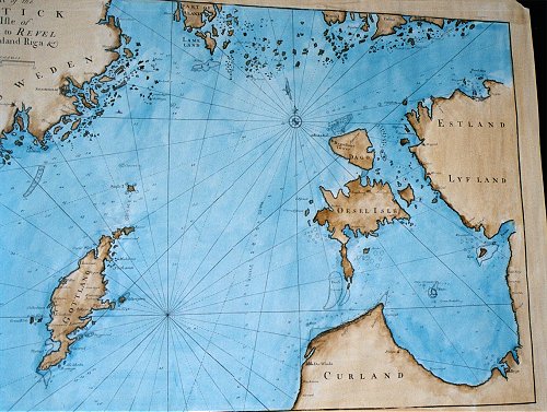
A Draught of the Baltic from the Isle of Oeland to Reval including Gothland, Riga.
VÖBAM's faksimil utförs på akvarellpapper och handkoloreras.
Originalet från John Norris sjöatlas A Compleat Set of New Charts, Containing the North-Sea, Cattegatt and Baltic, tryckt och utgiven hos Thomas Page, William and Fisher Mount 1728.
Sjökortet rekognoscerat år 1721.
Originalkartan är ej kolorerad.
Storlek: 76 X 52 cm. Kartytans bredd x höjd.
Från Stockholm - Gotland - Öland till Baltiska kusten med Tallinn - Riga - Dagö - Ösel - Runö.
Pris: 1500 SEK - 25917 - Se bild.
Atlanten, Europa - Nordatlanten, Nordeuropa - Östersjön, Sverige, Estlant, Lettland - Egentliga Östersjön, Rigabukten, Öland, Gotland
