
Kyle Rhea and the north part of Sleat Sound. - London 1903.
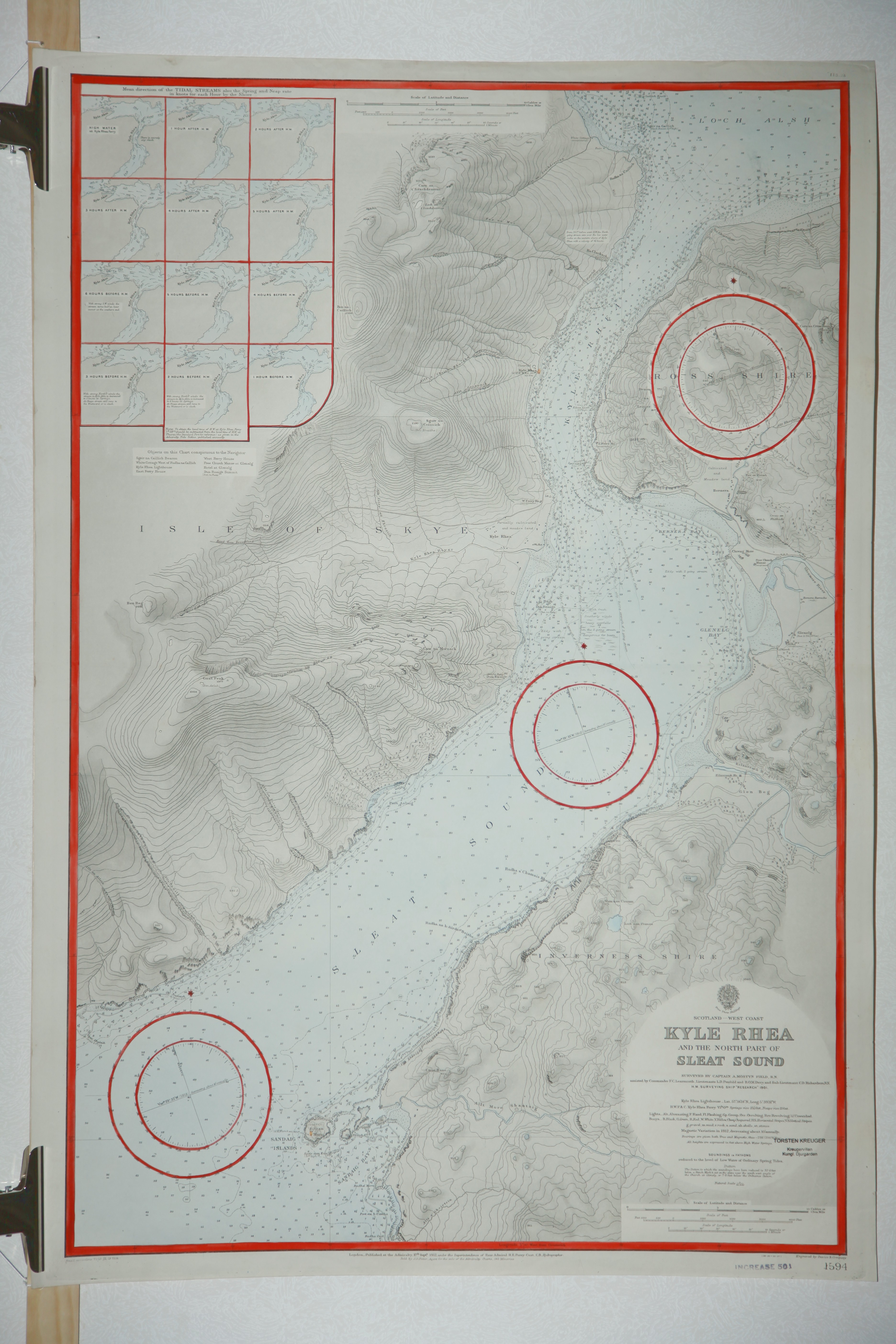
Kyle Rhea and the north part of Sleat Sound.
Nr. 1594
Admiralty.
Koppargraverat handkolorerat sj—kort.
Infðllda kartor: 'Mean direction of the tidal streams'
Rðttat till 1914.
ágarstðmpel.
Storlek: 70x102 cm. Totalytan bredd x h—jd.
Vikning.
Pris pÍ f—rfrÍgan. - 40263 - Se bild.
Scotland - North Coast. Pentland Firth. - London 1858.
Scotland - North Coast. Pentland Firth.
Surveyed by Commanders Slater, Otter and Thomas R.N. 1850. Approaches to Hoxa Sound surveyed by Captain W. Pudsey-Dawson R.N. and the Officers of H.M. Surveying Ship Triton 1906-9 With additional Tidal information by Staff Comm.r T.H. Tizard R.N. 1885.
Nr. 2162.
Hydrographic Office at the Admiralty.
Handkolorerat sj—kort.
Rðttat till 1922.
Storlek: 64x49 cm. Kartytans bredd x h—jd.
Stðmpel.
Pris: 1000 SEK - 25161
Sound of Islay. - London 1856.
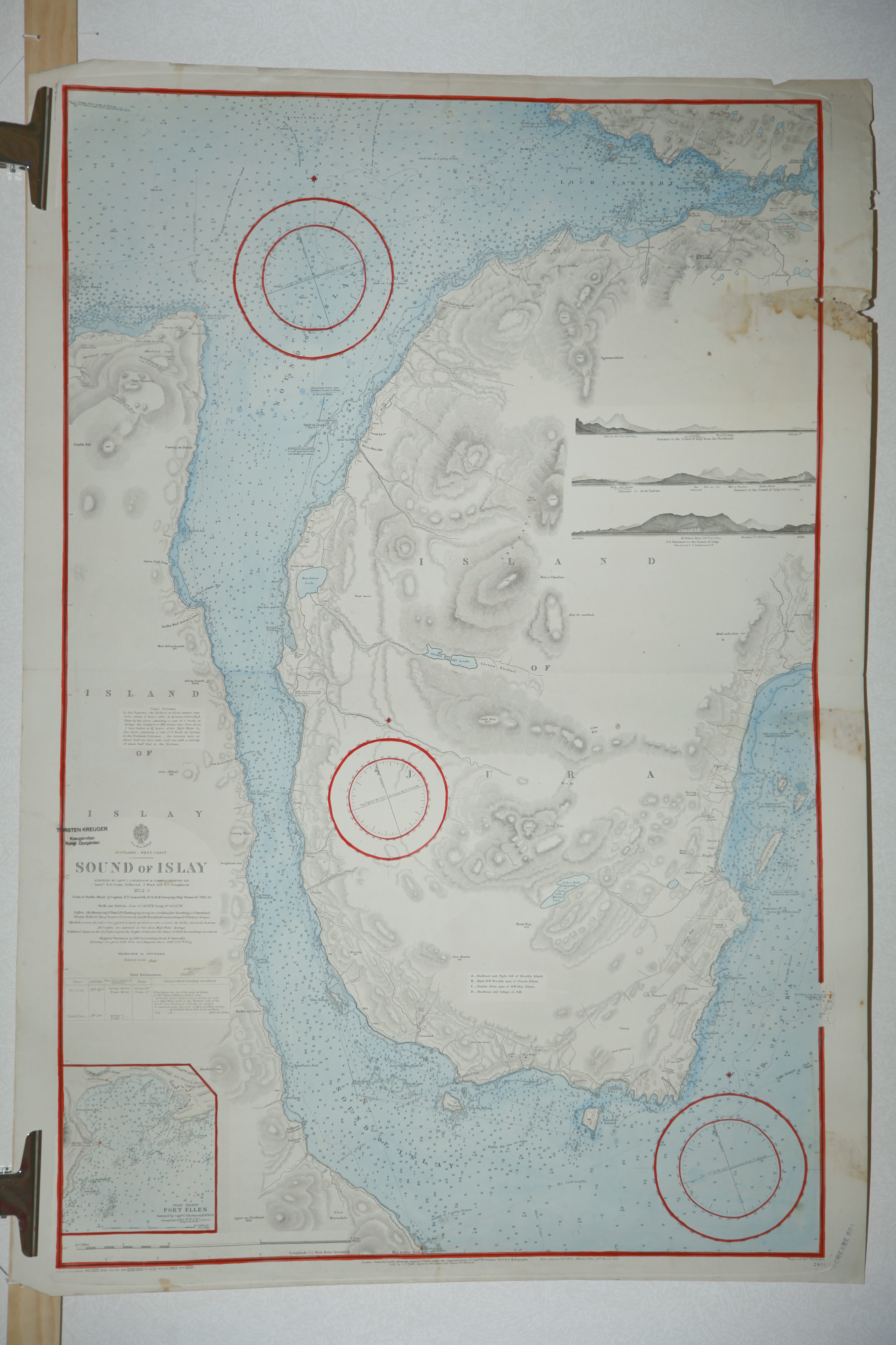
Sound of Islay.
Nr. 2481
Admiralty.
Koppargraverat handkolorerat sj—kort.
Infðllda kartor: 'Islay Island. Port Ellen.'
Rðttat till 1923.
ágarstðmpel.
Storlek: 70x102 cm. Totalytan bredd x h—jd.
Vikning.
Pris pÍ f—rfrÍgan. - 40265 - Se bild.
Orkney Islands. Northern Portion. - Washington 1915.
Orkney Islands. Northern Portion. From the latest British surveys.
Nr. 4464.
Hydrographic Office. Secretary of the Navy.
Litograferat handkolorerat sj—kort.
Rðttat till 1917.
Storlek: 92x63 cm. Kartytans bredd x h—jd.
Vikning. ágarstðmpel.
Pris: 2000 SEK - 25160
Det ðr lite intressant att USA lðt ge ut ett sj—kort pÍ Orkney—arna vilka utg—r Storbritanniens norra —rlogshamn.
Loch Alsh and Kyle Rhea. - London 1903.

Loch Alsh and Kyle Rhea.
Nr. 3292
Admiralty.
Litograferat handkolorerat sj—kort.
Infðllda kartor: 'Mean direction of the tidal streams'
Rðttat till 1922.
ágarstðmpel.
Storlek: 110x70 cm. Totalytan bredd x h—jd.
Vikning.
Pris pÍ f—rfrÍgan. - 40261 - Se bild.
Cape Wrath to the Flannan Isles... North Minch and Lewis. - London 1912.
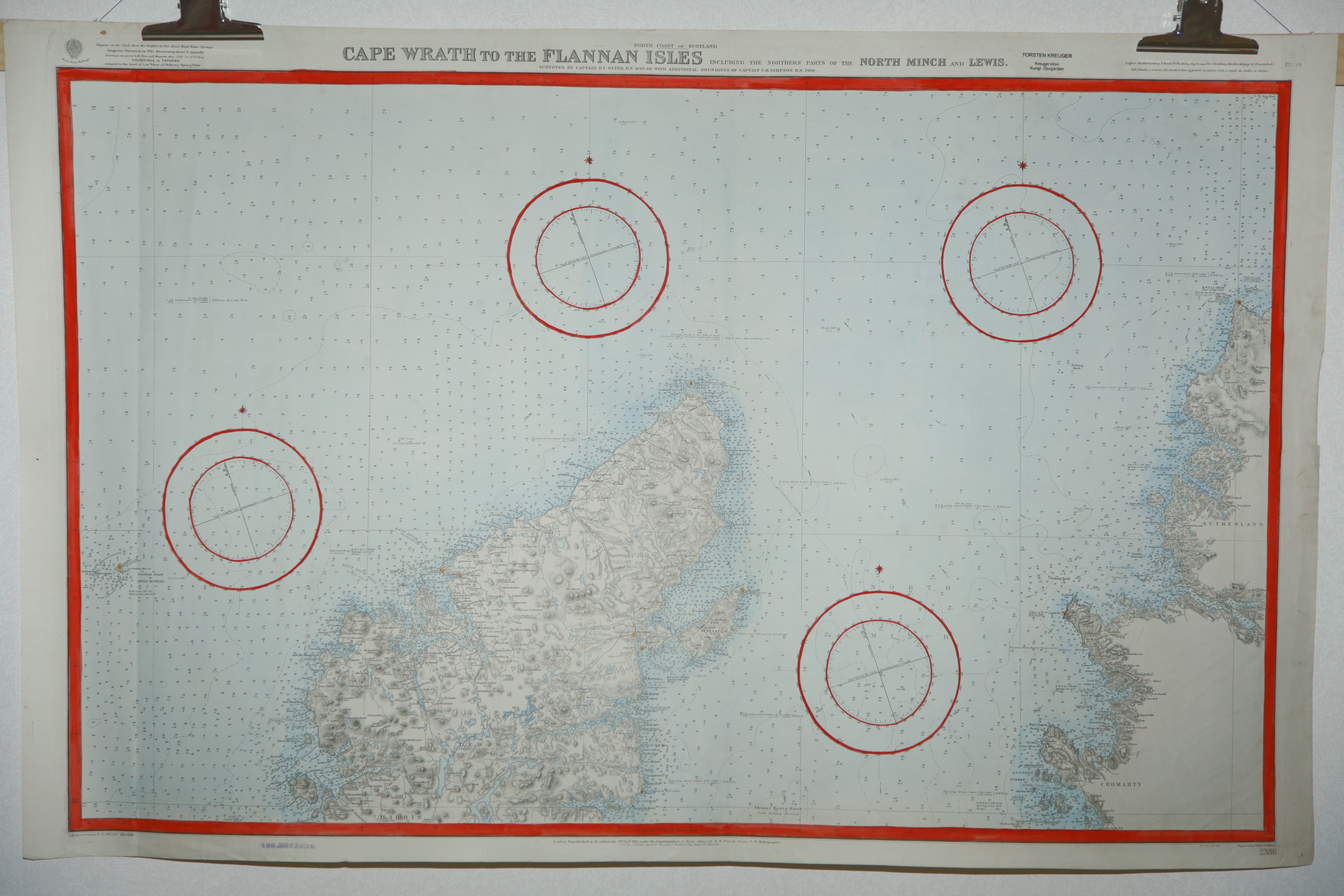
Cape Wrath to the Flannan Isles including the northern parts of the North Minch and Lewis.
Nr. 1594
Admiralty.
Koppargraverat handkolorerat sj—kort.
Rðttat till 1920.
ágarstðmpel.
Storlek: 110x70 cm. Totalytan bredd x h—jd.
Vikning.
Pris pÍ f—rfrÍgan. - 40264 - Se bild.
Sound of Mull. Western portion. - London 1909.
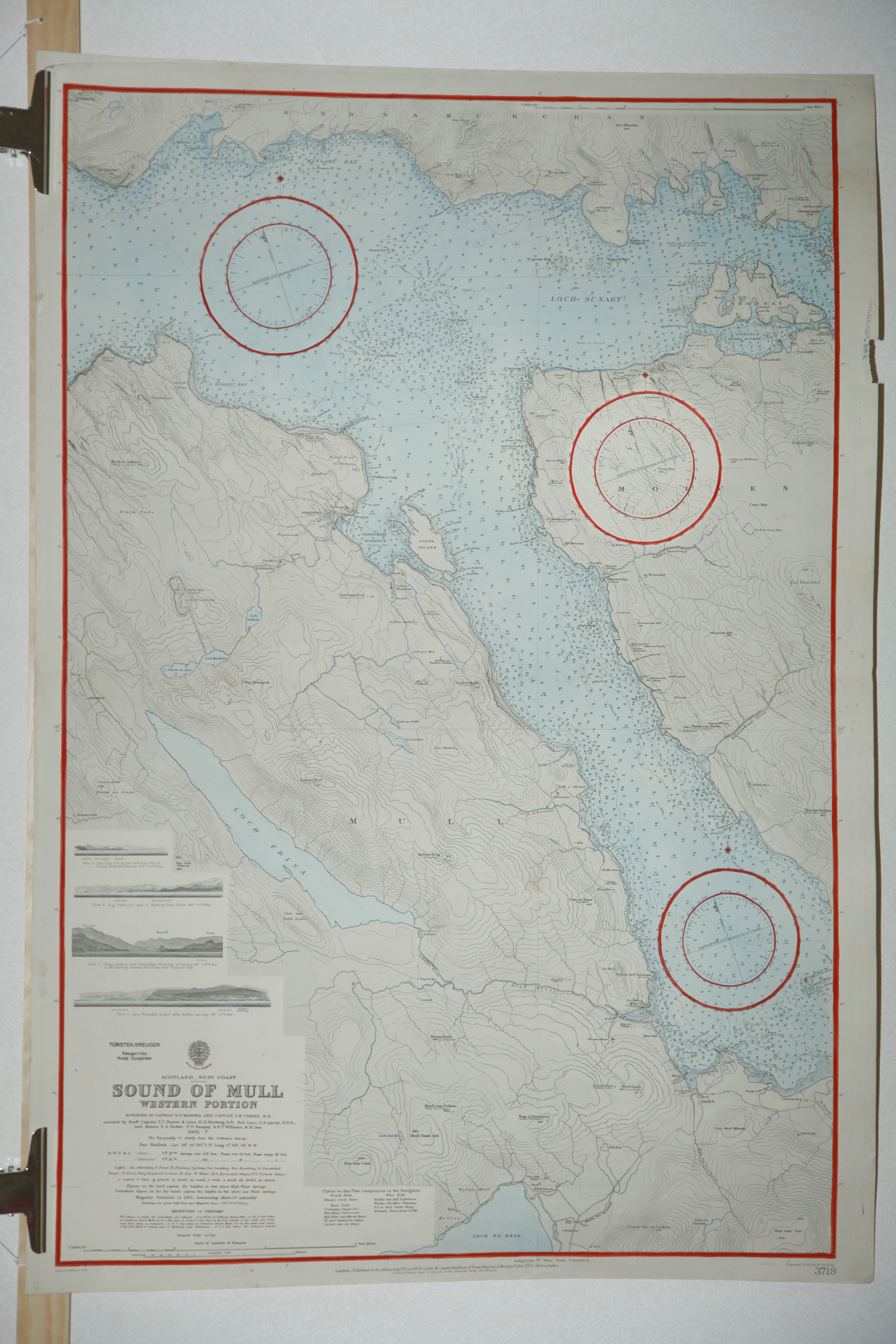
Sound of Mull. Western portion.
Nr. 3718
Admiralty.
Koppargraverat handkolorerat sj—kort.
Rðttat till 1916.
ágarstðmpel.
Storlek: 70x102 cm. Totalytan bredd x h—jd.
Vikning.
Pris pÍ f—rfrÍgan. - 40266 - Se bild.
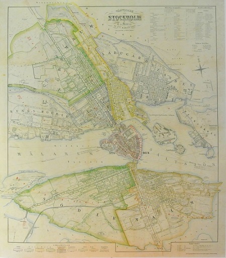
Stockholm - Mentzer ca 1860.
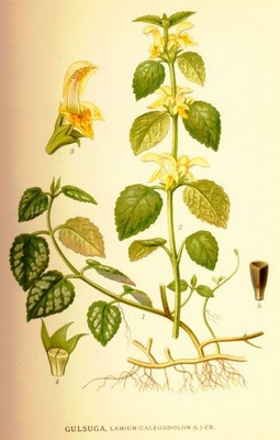
Gulsuga, Lamium galeobdolon - Lindman, C. A. M, Bilder ur Nordens Flora 1917-26.
Sound of Mull. Eastern portion. - London 1907.
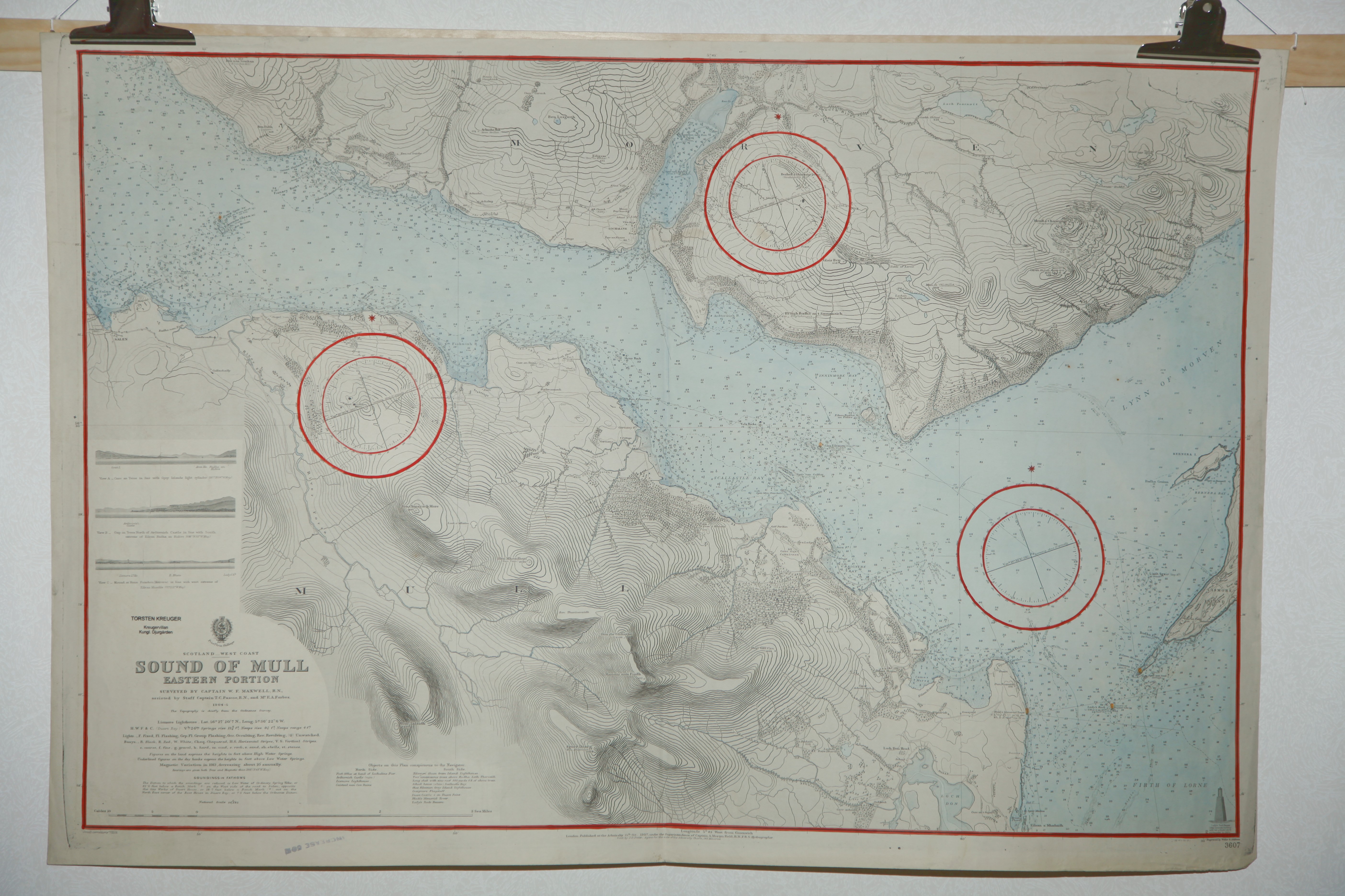
Sound of Mull. Eastern portion.
Nr. 3607
Admiralty.
Koppargraverat handkolorerat sj—kort.
Rðttat till 1912.
ágarstðmpel.
Storlek: 112x70 cm. Totalytan bredd x h—jd.
Vikning.
Pris pÍ f—rfrÍgan. - 40262 - Se bild.
Atlanten, Europa - Nordatlanten, Vðsteuropa - , Storbritannien - , Skottland
