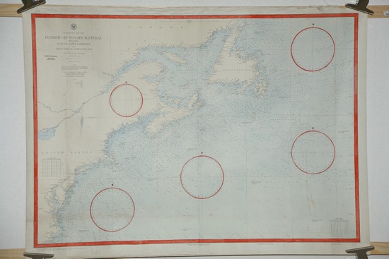
Flemish Cap to Cape Hatteras. - Washington D.C. 1896.
East Coast. Flemish Cap to Cape Hatteras including Gulf of Saint Lawrence and Great Bank of Newfoundland.
No. 1412.
Skala: ca 1:2.500.000
Litograferat handkolorerat sjökort.
Rättat till 1929.
Ägarstämpel.
Storlek: 118x87 cm. Totalytans bredd x höjd.
Vikning.
Med hela Nordamerikas kust från Bellislesundet mellan Labrador och Newfoundland ända ner till söder om Richmond. Förutom de stora öarna Newfoundland och Nova Scotia med Saint Lawrencebukten är även hela Saint Lawrencefloden och del av Lake Ontario med. Bland städer kan vi nämna Quebec och Montreal i Kanada och i USA Boston, New York, Philadelphia, Baltimore, Washington, Richmond m.fl. För inbitet sjöfolk kan nämnas att de legendariska stora fiskebankarna utanför Nordamerikas kust är nogsamt utmärkta, såsom Great Banks of Newfoundland och det smått mytiska Flemish Cap långt ute i Nordatlanten.
Pris: 3500 SEK - 40305 - Se bild.
Newfoundland. Placentia to Burin Harbour. - London 1876.
North America - South Coast of Newfoundland. Placentia to Burin Harbour.
From the Surveys of Captain Orlebar, R.N. 1860-3, and of Nav.g Lieut.t W.F. Maxwell R.N. 1874-8.
Engraved by Edw.d Weller.
No. 290.
Admiralty. F.J. Evans.
Rättat till 1928.
Infällt kort: 'Little Southern & La Manche Harbours.'
Vacker liten profil på en fyr, Cape St Mary lighthouse.
Koppargraverat och handkolorerat sjökort.
Storlek: 65x98 cm. Kartytans bredd x höjd.
Svag vikning. Ägarstämpel. Blyertsnoteringar i marginalerna. Smutsrand i bladets nedre del.
Pris: 2500 SEK - 25208
Newfoundland - South Coast. Richards Harbor to Ramea Islands. - Washington 1907.
North America. Newfoundland - South Coast. Richards Harbor to Ramea Islands.
From British surveys between 1872 and 1885.
Hydrographic Office. Secretary of the Navy.
Rättat till 1929.
Infällda kort: 'Continuation of White Bear Bay on same scale', 'Head of Hare Bay', 'Head of Recontre Bay'
Litograferat handkolorerat sjökort.
Storlek: 116x67 cm. Kartytans bredd x höjd.
Svag vikning. Ägarstämpel.
Pris: 2000 SEK - 25209
Gulf of Saint Lawrence entrance. S.t Johns (Newfoundland) to Halifax (Nova Scotia). - London 1878.
North America. Gulf of Saint Lawrence entrance. S.t Johns (Newfoundland) to Halifax (Nova Scotia) with the Outer Banks.
From the latest admiralty surveys. The Outer Banks include the French Surveys of 1836-59.
No. 2666.
Admiralty. F.J. Evans.
Rättat till 1927.
Infällt kort: 'Great Bank of Newfoundland. The Virgin Rocks and Eastern Shoals. By Staff Commander W.F. Maxwell R.N. 1879.'
Handkolorerat sjökort.
Storlek: 99x67 cm. Kartytans bredd x höjd.
Vikning. Ägarstämpel.
Pris: 2500 SEK - 25199
Newfoundland. Bay Bulls to Placentia. - London 1864.
North America. South East Coast of Newfoundland. Bay Bulls to Placentia.
Surveyed by Capt.n Orlebar, R.N. assisted by Com.r Hancock, Mess.rs Carey, Clifton, Des Brisay, & Hyndman, R.N. 1860-3.
No. 2915.
Admiralty. G.H. Richards.
Rättat till 1928.
Med fem vackra kustprofiler.
Handkolorerat sjökort.
Storlek: 95x64 cm. Kartytans bredd x höjd.
Vikning. Ägarstämpel. Lätt smutsat. Blyertsanteckningar.
Pris: 2500 SEK - 25206
Newfoundland. S.t John's Harbour. - London 1914.
North America - East Coast. Newfoundland. S.t John's Harbour.
Surveyed by Captain J.W.F. Combe, R.N., assisted by Lieutenant L.G. Garbett, R.N., and Lieutenant J.A. Rupert-Jones and F.C. Shankland, R.N.R., 1912.
No. 298.
Admiralty. H.E. Purey-Cust.
Rättat till 1927.
Mycket topografisk information samt staden St. Johns stadsplan.
Handkolorerat sjökort.
Storlek: 99x66 cm. Kartytans bredd x höjd.
Stämpel i marginalen.
Ägarstämpel.
Pris: 3500 SEK - 25205
St John var den första kolonin britterna grundade i Nordamerika. Namnet kommer från att John Cabot 1497 landsteg på Johannes Döparens dag, var han landsteg på Newfoundland är dock omtvistat.
Newfoundland - South Coast. Miquelon Islands. - London 1875.
Newfoundland - South Coast. Miquelon Islands.
Surveyed by M.J. de la Roche-Poncié, Ingenieur Hydrographe of the Royal French Navy, 1841.
Engraved by Davies & Company.
No. 303.
Admiralty. F.J. Evans.
Rättat till 1928.
Med flertalet vackra kustprofiler och fyrar.
Ytterligare två detaljkort på samma blad: 'Miquelon road', 'S.t Pierre Harbour'
Koppargraverat och handkolorerat sjökort.
Storlek: 76x65 cm. Kartytans bredd x höjd.
Svag vikning. Stämpel i marginalen. Ägarstämpel.
Ögruppen Miquelon - St Pierre är det enda som idag återstår av Frankrikes kolonier i Nordamerika.
Pris: 3500 SEK - 25207
Nova Scotia - South East Coast. Lunenburg to Mars head. - London 1866.
North America - East Coast. Nova Scotia - South East Coast. Lunenburg to Mars head.
Surveyed by Captain P.F. Shortland, R.N. assisted by Com.r P.A. Scott, Staff Com.r T.W. Pike, W. Scarnell & E. Mourilyan, Masters & W.E. Archdeacon, 2.nd Master, R.N. 1864
No. 343.
Admiralty. G.H. Richards.
Rättat till 1920.
Fem profiler på kusten.
Handkolorerat sjökort uppfodrat på väv.
Storlek: 98x72 cm. Kartytans bredd x höjd.
Vikningar. Ägarstämpel.
Pris: 2500 SEK - 25204
South Coast of Newfoundland. From the Burgeo Islands to Cape St. Mary. - Washington 1888.
North America. South Coast of Newfoundland. From the Burgeo Islands to Cape St. Mary.
No. 1103.
Hydrographic Office. Secretary of the Navy.
Rättat till 1929.
Handkolorerat sjökort.
Storlek: 102x66 cm. Kartytans bredd x höjd.
Svag vikning. Stämpel. Lätt smutsat.
Pris: 2500 SEK - 25210
Nova Scotia - S.E. Coast. Sambro I. to C. Canso. - London 1867.
British N. America. Nova Scotia - S.E. Coast. Sambro I. to C. Canso.
Compiled from the Surveys of Captain Bayfield & Com.r Orlebar, R.N. 1867
No. 729.
Admiralty. G.H. Richards.
Rättat till 1929.
Två profiler på fyrar.
Handkolorerat sjökort.
Storlek: 99x66 cm. Kartytans bredd x höjd.
Vikning. Ägarstämpel.
Pris: 2000 SEK - 25203
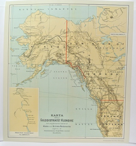
Gulddistriktet Klondike - ca 1897.
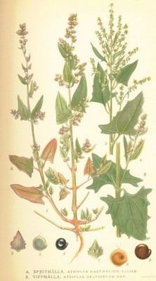
Spjutmålla, Altriplex hastifolium - Lindman, C. A. M, Bilder ur Nordens Flora 1917-26.
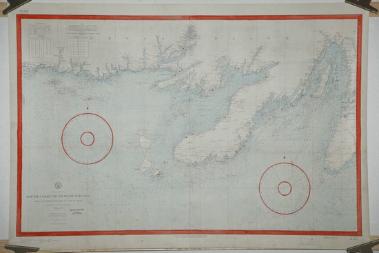
South Coast of Newfoundland. From the Burgeo Islands to Cape St. Mary. - Washington D.C. 1888.
South Coast of Newfoundland. From the Burgeo Islands to Cape St. Mary.
No. 1103.
Hydrographic Office.
Litograferat handkolorerat sjökort.
Rättat till 1929.
Ägarstämpel.
Storlek: 106x73 cm. Totalytans bredd x höjd.
Svag vikning.
Pris på förfrågan. - 40306 - Se bild.
Atlanten, Amerika - Nordatlanten, Nordamerika - , Kanada - ,


