
'New Map of Boston...' - 1883.
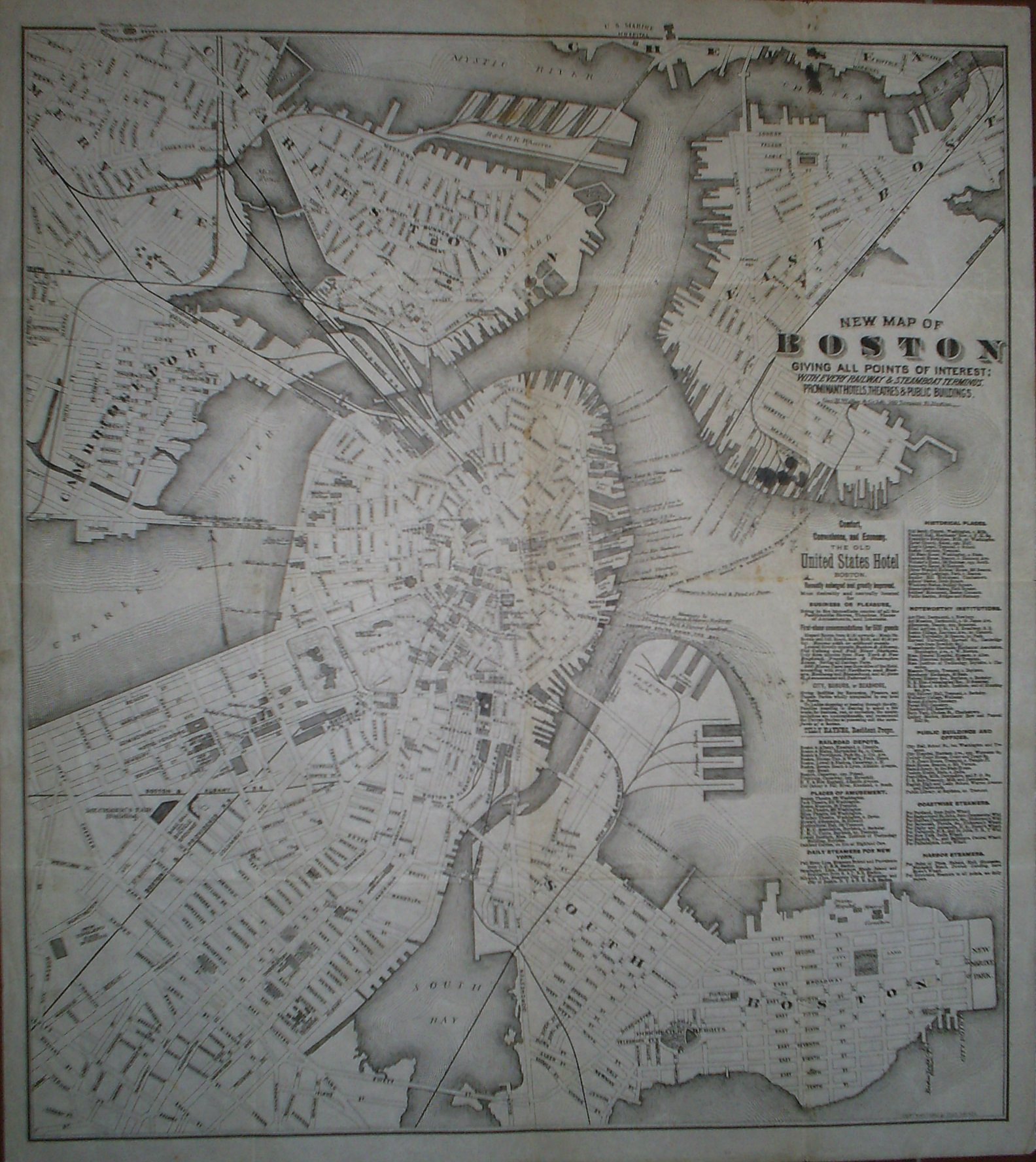
New Map of Boston giving all points of interest: with every railway & steamboat terminus, prominant hotels, theatres & public buildings.
Geo. H. Walker & Co Lith. 160 Tremont St. Boston.
Copyright 1883 by Tilly Haynes.
Litograferad karta.
Storlek: 44x49 cm. Kartytans bredd x höjd.
Kartan har varit vikt. Med smĺhĺl i vikningen. Fyra smärre bläckfläckar under titeln samt tre stycken i kartans övre kant. Svag bruntoning i mittvecket.
Karta över Boston.
Pris: 2000 SEK - 26650 - Se bild.
Med reklam för 'The Old United States Hotel Boston' samt lista över kommunikationer, sevärdheter, historiska platser med mera.
'Geologic Atlas of the United States. Livingstone Folio. Montana.' - Washington D.C. 1894.
Department of the Interior. United States Geological Survey. J. W. Powell, Director.
Washington D. C. Engraved and Printed by the U. S. Geological Survey. Bailey Willis, Editor of Geological maps. S. J. Kübel, Chief Engraver.
Flerfärgslitografi.
Mapp med text pĺ insidan samt ytterligare fyra sidor text.
Fyra kartor, 'Topography', 'Areal Geology', 'Economic Geology', 'Structure Sections'.
Storlek: 48x55 cm. Mappens bredd x höjd.
Pris: 600 SEK - 26665
Department of the Interior. United States Geological Survey. J. W. Powell, Director.
Washington D. C. Engraved and Printed by the U. S. Geological Survey. Bailey Willis, Editor of Geological maps. S. J. Kübel, Chief Engraver.
Flerfärgslitografi.
Mapp med text pĺ insidan samt ytterligare fyra sidor text.
Fyra kartor, 'Topography', 'Areal Geology', 'Economic Geology', 'Structure Sections'.
Storlek: 48x55 cm. Mappens bredd x höjd.
Pris: 600 SEK - 26664
Nya Sverige. - P. Lindström, T. Campanius Holm 1655.
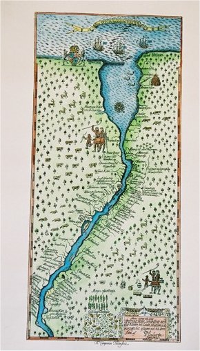
Nova Svecia hodie dicta Pennsylvania.
Anno 1654 och 1655 är denna Nove Svecie charta med dess Riviers och Landz situation ock beskaffenhet aftagen och till Carts förd af P. Lindström ingin. fortif..
Originalet frĺn Thomas Campanius Holms bok, 1702.
Faksimil pĺ akvarellpapper och helt handkolorerad.
Uppförstorad: 25x55 cm. Pris: 1.200:-
Originalstorlek: 17x36,5 cm. Pris: 900:-
Pris: 900 SEK - 26645 - Se bild.
Department of the Interior. United States Geological Survey. J. W. Powell, Director.
Washington D. C. Engraved and Printed by the U. S. Geological Survey. Bailey Willis, Editor of Geological maps. S. J. Kübel, Chief Engraver.
Flerfärgslitografi.
Mapp med text pĺ insidan samt ytterligare fyra sidor text.
Fyra kartor, 'Topography', 'Areal Geology', 'Economic Geology', 'Structure Sections'.
Storlek: 48x55 cm. Mappens bredd x höjd.
Pris: 600 SEK - 26666
'Geologic Atlas of the United States. Ringgold Folio. Georgia - Tennessee.' - Washington D.C. 1894.
Department of the Interior. United States Geological Survey. J. W. Powell, Director.
Washington D. C. Engraved and Printed by the U. S. Geological Survey. Bailey Willis, Editor of Geological maps. S. J. Kübel, Chief Engraver.
Mapp med text pĺ insidan samt ytterligare fyra sidor text.
Fyra kartor, 'Topography', 'Areal Geology', 'Economic Geology', 'Structure Sections'.
En tabell, 'Columnar Sections'.
Storlek: 48x55 cm. Mappens bredd x höjd.
Pris: 600 SEK - 26659
'Geologic Atlas of the United States. Jackson Folio. California.' - Washington D.C. 1894.
Department of the Interior. United States Geological Survey. J. W. Powell, Director.
Washington D. C. Engraved and Printed by the U. S. Geological Survey. Bailey Willis, Editor of Geological maps. S. J. Kübel, Chief Engraver.
Flerfärgslitografi.
Mapp med text pĺ insidan samt ytterligare sex sidor text.
Fyra kartor, 'Topography', 'Areal Geology', 'Economic Geology', 'Structure Sections'.
Storlek: 48x55 cm. Mappens bredd x höjd.
Pris: 600 SEK - 26661
'Plan of the City of Washington.' - Ellicott 1792.
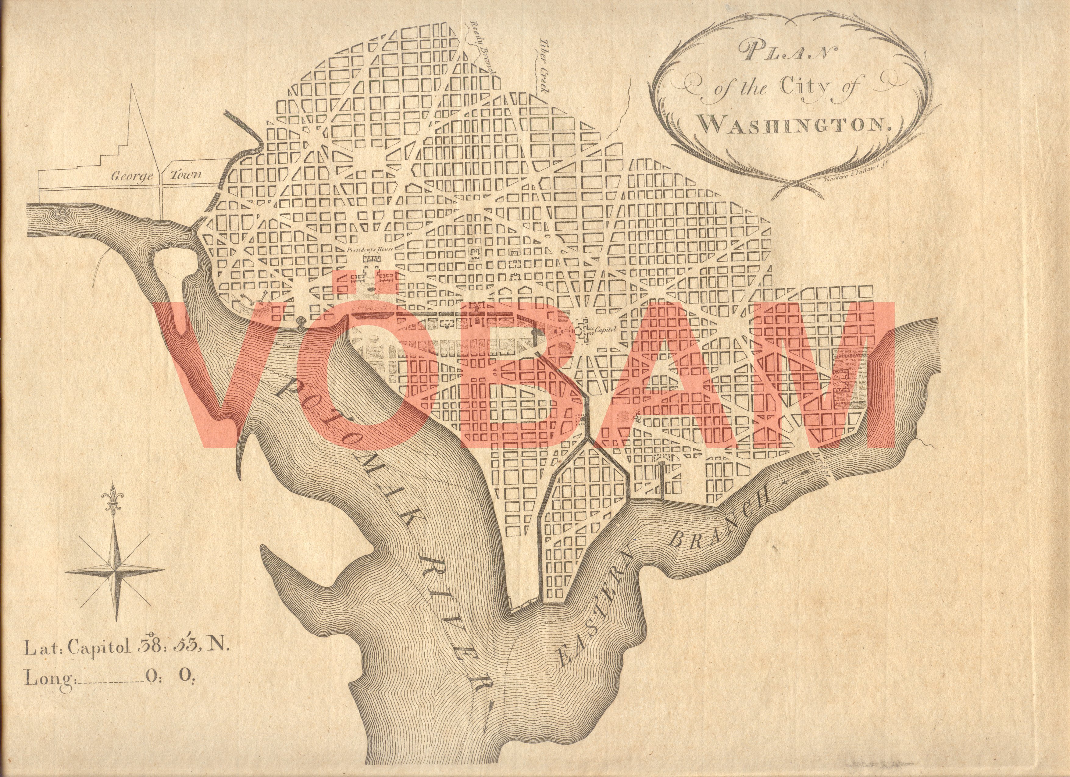
Plan of the City of Washington.
Tryckt i Philadelphia mars 1792 av Thackara och Vallance.
Storlek: 30x22 cm. Kartplĺtens bredd x höjd. Breda marginaler.
Utomordentligt rar. / Very rare.
Karta över Washington.
Pris: 110000 SEK - 26649 - Se bild.
Denna karta lät man trycka i första hand för att kunna visa var kvarter, markomrĺden o.s.v. i den nya huvudstaden lĺg för de presumtiva köpare man sĺlde tomter till.
This map was printed primarily to show future buyers of building lots in the new capital where these lots actually was located in the city. It would take another couple of months until the first official city plan was published in november 1792 by Thackara and Vallance.
'Habits et Maisons des Floridiens.' - 1700-talets mitt.
Habits et Maisons des Floridiens.
Koppargraverad bild.
Storlek: 7x12 cm. Bildytans bredd x höjd.
Bild pĺ människor, hus och palmer i Florida.
Pris: 500 SEK - 26652
'Geologic Atlas of the United States. Kingston Folio. Tennessee.' - Washington D.C. 1894.
Department of the Interior. United States Geological Survey. J. W. Powell, Director.
Washington D. C. Engraved and Printed by the U. S. Geological Survey. Bailey Willis, Editor of Geological maps. S. J. Kübel, Chief Engraver.
Flerfärgslitografi.
Mapp med text pĺ insidan samt ytterligare fyra sidor text.
Fyra kartor, 'Topography', 'Areal Geology', 'Economic Geology', 'Structure Sections'.
En tabell, 'Columnar Sections'.
Storlek: 48x55 cm. Mappens bredd x höjd.
Pris: 600 SEK - 26657
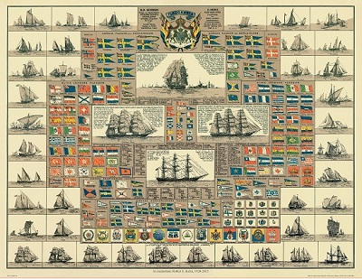
Amiral Häggs flaggkarta. - Stockholm 1888.
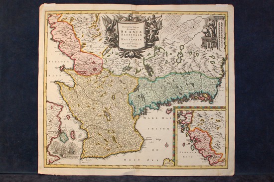
'Scaniae, Blekingiae et Hallandiae.' - Matthaeus Seutter ca 1710-1740.
'Cataracte de Niagara.' - 1700-tal.
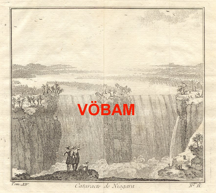
Cataracte de Niagara.
Koppargraverad vy.
Storlek: 14x13 cm. Bildytans bredd x höjd.
Bilden har varit vikt.
Vy över Niagarafallen.
Pris: 800 SEK - 26651 - Se bild.
Amerika - Nordamerika - USA -
