
New York - John William Hill, ca 1850.
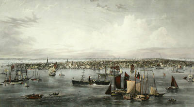
New York
Gravyr tryckt frÍn originalplÍten och handkolorerad.
Storlek: 142x89 cm. Bildytans bredd x h—jd.
En mycket dekorativ panoramavy —ver Manhattan med East River i f—rgrunden och Hudsonfloden i bakgrunden.
Pris: 8000 SEK - 26653 - Se bild.
Pris med bred spansk vacker mahognyinspirerad ram: 15.000:-
'Geologic Atlas of the United States. Sewanee Folio. Tennessee.' - Washington D.C. 1894.
Department of the Interior. United States Geological Survey. J. W. Powell, Director.
Washington D. C. Engraved and Printed by the U. S. Geological Survey. Bailey Willis, Editor of Geological maps. S. J. K■bel, Chief Engraver.
Flerfðrgslitografi.
Mapp med text pÍ insidan samt ytterligare fyra sidor text.
Fyra kartor, 'Topography', 'Areal Geology', 'Economic Geology', 'Structure Sections'.
En tabell, 'Columnar Sections'.
Storlek: 48x55 cm. Mappens bredd x h—jd.
Pris: 600 SEK - 26656
'New Map of Boston...' - 1883.
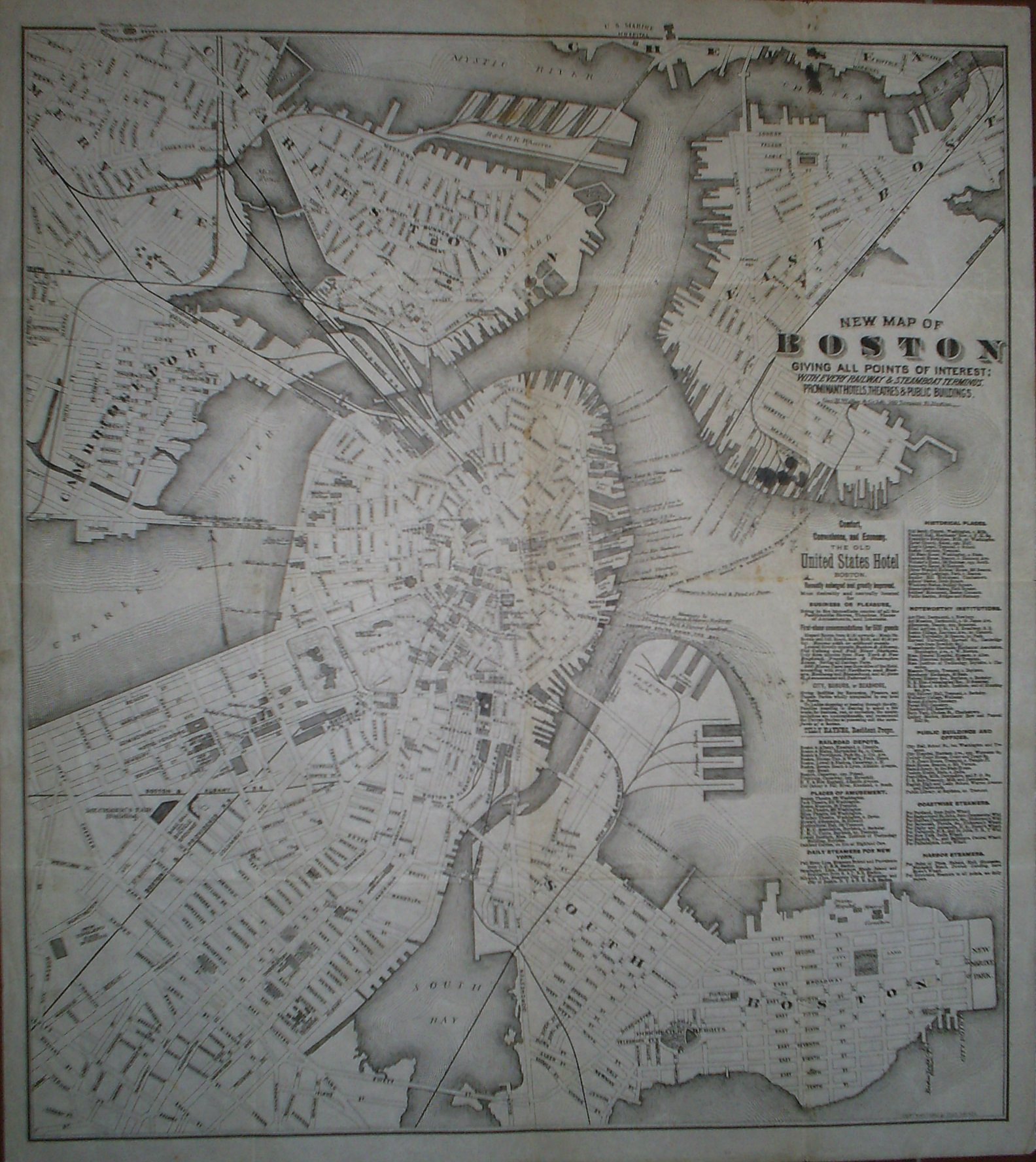
New Map of Boston giving all points of interest: with every railway & steamboat terminus, prominant hotels, theatres & public buildings.
Geo. H. Walker & Co Lith. 160 Tremont St. Boston.
Copyright 1883 by Tilly Haynes.
Litograferad karta.
Storlek: 44x49 cm. Kartytans bredd x h—jd.
Kartan har varit vikt. Med smÍhÍl i vikningen. Fyra smðrre blðckflðckar under titeln samt tre stycken i kartans —vre kant. Svag bruntoning i mittvecket.
Karta —ver Boston.
Pris: 2000 SEK - 26650 - Se bild.
Med reklam f—r 'The Old United States Hotel Boston' samt lista —ver kommunikationer, sevðrdheter, historiska platser med mera.
'Geologic Atlas of the United States. Placerville Folio. California.' - Washington D.C. 1894.
Department of the Interior. United States Geological Survey. J. W. Powell, Director.
Washington D. C. Engraved and Printed by the U. S. Geological Survey. Bailey Willis, Editor of Geological maps. S. J. K■bel, Chief Engraver.
Flerfðrgslitografi.
Mapp med text pÍ insidan samt ytterligare fyra sidor text.
Fyra kartor, 'Topography', 'Areal Geology', 'Economic Geology', 'Structure Sections'.
Storlek: 48x55 cm. Mappens bredd x h—jd.
Pris: 600 SEK - 26663
'Geologic Atlas of the United States. Jackson Folio. California.' - Washington D.C. 1894.
Department of the Interior. United States Geological Survey. J. W. Powell, Director.
Washington D. C. Engraved and Printed by the U. S. Geological Survey. Bailey Willis, Editor of Geological maps. S. J. K■bel, Chief Engraver.
Flerfðrgslitografi.
Mapp med text pÍ insidan samt ytterligare sex sidor text.
Fyra kartor, 'Topography', 'Areal Geology', 'Economic Geology', 'Structure Sections'.
Storlek: 48x55 cm. Mappens bredd x h—jd.
Pris: 600 SEK - 26661
Carte de la Nouvelle Angleterre,...' - Bellin 1757.
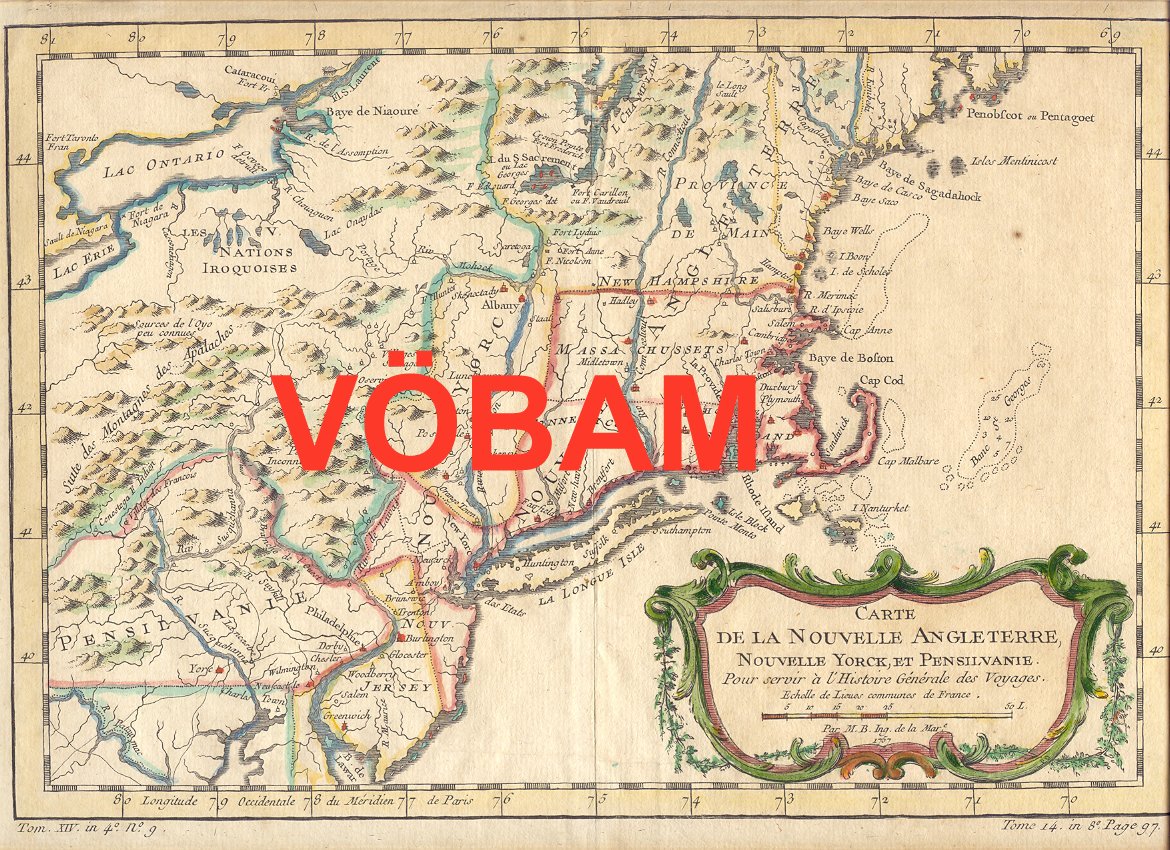
Carte de la Nouvelle Angleterre, Nouvelle Yorck, et Pensilvanie. Pour servir Á l'Histoire GÕnÕrale des Voyages.
Par M. B. Ing. de la Mare. 1757.
Koppargraverad karta med vacker handkolorering frÍn tiden.
Kartan har varit vikt, lite bruntonad i marginalerna.
Storlek: 29x20 cm. Kartytan bredden x h—jden.
Pris: 2000 SEK - 26647 - Se bild.
'Habits et Maisons des Floridiens.' - 1700-talets mitt.
Habits et Maisons des Floridiens.
Koppargraverad bild.
Storlek: 7x12 cm. Bildytans bredd x h—jd.
Bild pÍ mðnniskor, hus och palmer i Florida.
Pris: 500 SEK - 26652
Department of the Interior. United States Geological Survey. J. W. Powell, Director.
Washington D. C. Engraved and Printed by the U. S. Geological Survey. Bailey Willis, Editor of Geological maps. S. J. K■bel, Chief Engraver.
Flerfðrgslitografi.
Mapp med text pÍ insidan samt ytterligare fyra sidor text.
Fyra kartor, 'Topography', 'Areal Geology', 'Economic Geology', 'Structure Sections'.
Storlek: 48x55 cm. Mappens bredd x h—jd.
Pris: 600 SEK - 26666
'Cataracte de Niagara.' - 1700-tal.
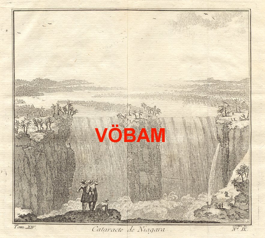
Cataracte de Niagara.
Koppargraverad vy.
Storlek: 14x13 cm. Bildytans bredd x h—jd.
Bilden har varit vikt.
Vy —ver Niagarafallen.
Pris: 800 SEK - 26651 - Se bild.
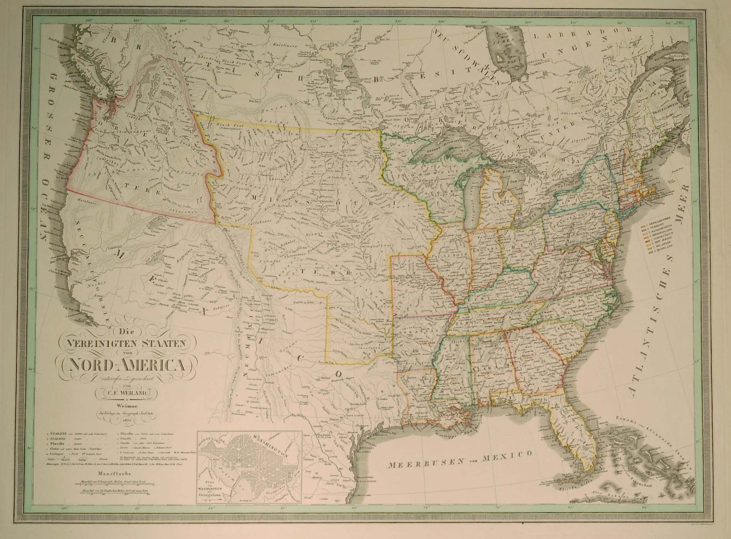
Die VEREINIGTEN STAATEN von NORD-AMERICA
Eentworfen und gezeichnet von C. F. Wieland.
Infðlld karta: 'Plan von Washington mit Georgetown.'
Weimar 1834. Verlage des Geograph. Instituts.
Storlek: 62x46 cm.
Kraftfull grðnskolorering.
Pris: 4000 SEK - 26075 - Se bild.
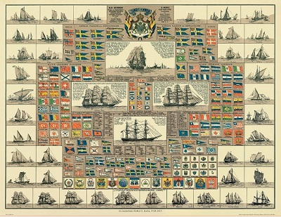
Amiral Hðggs flaggkarta. - Stockholm 1888.
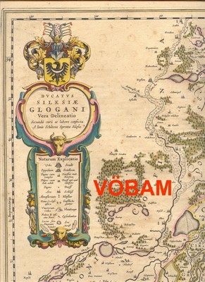
'Dvcatvs Silesiae Glogani...' - Blaeu ca 1640.
'Carte de la Louisiane...' - Bellin 1757.
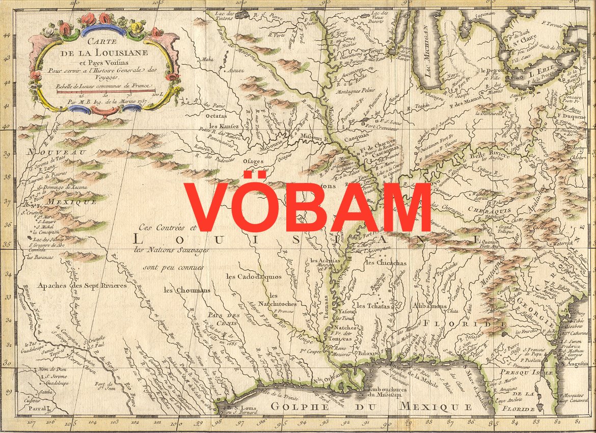
Carte de la Louisiane et Pays Voisins Pour servir a l'Histoire Generale des Voyages. ...
Par M. B. Ing. de la Marine 1757.
Koppargraverad karta med vacker handkolorering frÍn tiden.
Kartan har varit vikt, liten brunflðck i nedre marginalen.
Storlek: 30x22 cm. Kartytan bredden x h—jden.
Pris: 2000 SEK - 26646 - Se bild.
Amerika - Nordamerika - USA -
