'Geologic Atlas of the United States. Jackson Folio. California.' - Washington D.C. 1894.
Department of the Interior. United States Geological Survey. J. W. Powell, Director.
Washington D. C. Engraved and Printed by the U. S. Geological Survey. Bailey Willis, Editor of Geological maps. S. J. Kübel, Chief Engraver.
Flerfärgslitografi.
Mapp med text på insidan samt ytterligare sex sidor text.
Fyra kartor, 'Topography', 'Areal Geology', 'Economic Geology', 'Structure Sections'.
Storlek: 48x55 cm. Mappens bredd x höjd.
Pris: 600 SEK - 26661
'Geologic Atlas of the United States. Sacramento Folio. California.' - Washington D.C. 1894.
Department of the Interior. United States Geological Survey. J. W. Powell, Director.
Washington D. C. Engraved and Printed by the U. S. Geological Survey. Bailey Willis, Editor of Geological maps. S. J. Kübel, Chief Engraver.
Flerfärgslitografi.
Mapp med text på insidan samt ytterligare fyra sidor text.
Fyra kartor, 'Topography', 'Areal Geology', 'Economic Geology', 'Structure Sections'.
Storlek: 48x55 cm. Mappens bredd x höjd.
Pris: 600 SEK - 26662
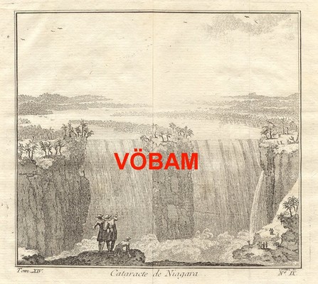
'Cataracte de Niagara.' - 1700-tal.
Cataracte de Niagara.
Koppargraverad vy.
Storlek: 14x13 cm. Bildytans bredd x höjd.
Bilden har varit vikt.
Vy över Niagarafallen.
Pris: 800 SEK - 26651 - Se bild.
Department of the Interior. United States Geological Survey. J. W. Powell, Director.
Washington D. C. Engraved and Printed by the U. S. Geological Survey. Bailey Willis, Editor of Geological maps. S. J. Kübel, Chief Engraver.
Flerfärgslitografi.
Mapp med text på insidan samt ytterligare fyra sidor text.
Fyra kartor, 'Topography', 'Areal Geology', 'Economic Geology', 'Structure Sections'.
Storlek: 48x55 cm. Mappens bredd x höjd.
Pris: 600 SEK - 26666
'Habits et Maisons des Floridiens.' - 1700-talets mitt.
Habits et Maisons des Floridiens.
Koppargraverad bild.
Storlek: 7x12 cm. Bildytans bredd x höjd.
Bild på människor, hus och palmer i Florida.
Pris: 500 SEK - 26652
'Geologic Atlas of the United States. Ringgold Folio. Georgia - Tennessee.' - Washington D.C. 1894.
Department of the Interior. United States Geological Survey. J. W. Powell, Director.
Washington D. C. Engraved and Printed by the U. S. Geological Survey. Bailey Willis, Editor of Geological maps. S. J. Kübel, Chief Engraver.
Mapp med text på insidan samt ytterligare fyra sidor text.
Fyra kartor, 'Topography', 'Areal Geology', 'Economic Geology', 'Structure Sections'.
En tabell, 'Columnar Sections'.
Storlek: 48x55 cm. Mappens bredd x höjd.
Pris: 600 SEK - 26659
'Geologic Atlas of the United States. Placerville Folio. California.' - Washington D.C. 1894.
Department of the Interior. United States Geological Survey. J. W. Powell, Director.
Washington D. C. Engraved and Printed by the U. S. Geological Survey. Bailey Willis, Editor of Geological maps. S. J. Kübel, Chief Engraver.
Flerfärgslitografi.
Mapp med text på insidan samt ytterligare fyra sidor text.
Fyra kartor, 'Topography', 'Areal Geology', 'Economic Geology', 'Structure Sections'.
Storlek: 48x55 cm. Mappens bredd x höjd.
Pris: 600 SEK - 26663
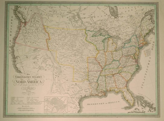
Die VEREINIGTEN STAATEN von NORD-AMERICA
Eentworfen und gezeichnet von C. F. Wieland.
Infälld karta: 'Plan von Washington mit Georgetown.'
Weimar 1834. Verlage des Geograph. Instituts.
Storlek: 62x46 cm.
Kraftfull gränskolorering.
Pris: 4000 SEK - 26075 - Se bild.
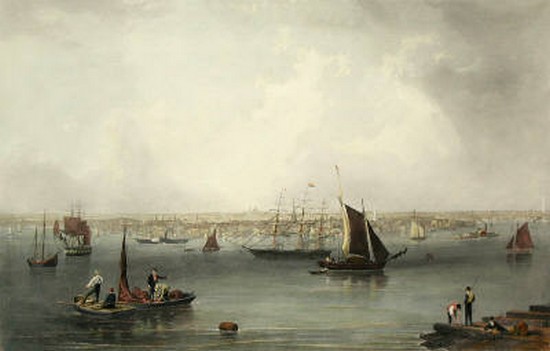
Boston - John William Hill, ca 1850.
Boston
Gravyr tryckt från originalplåten och handkolorerad.
Storlek: 102x71 cm. Bildytans bredd x höjd.
En mycket dekorativ panoramavy över Boston och dess hamn från tiden före inbördeskriget.
Pris: 6000 SEK - 26654 - Se bild.
Pris med bred spansk vacker mahognyinspirerad ram: 9.000:-
'Geologic Atlas of the United States. Kingston Folio. Tennessee.' - Washington D.C. 1894.
Department of the Interior. United States Geological Survey. J. W. Powell, Director.
Washington D. C. Engraved and Printed by the U. S. Geological Survey. Bailey Willis, Editor of Geological maps. S. J. Kübel, Chief Engraver.
Flerfärgslitografi.
Mapp med text på insidan samt ytterligare fyra sidor text.
Fyra kartor, 'Topography', 'Areal Geology', 'Economic Geology', 'Structure Sections'.
En tabell, 'Columnar Sections'.
Storlek: 48x55 cm. Mappens bredd x höjd.
Pris: 600 SEK - 26657
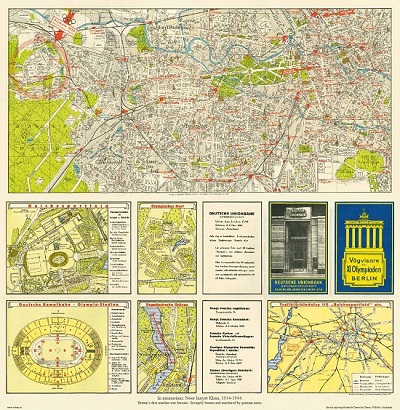
Vägvisare för XI Olympiaden i Berlin - 1936
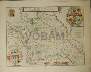
Lille. - Blaeu 1643/44.
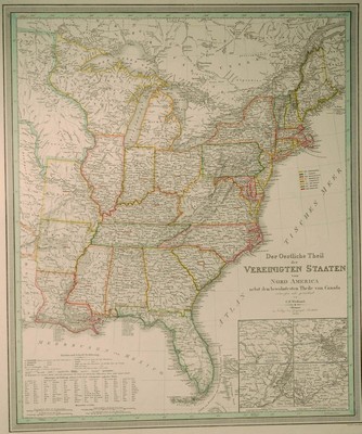
Der Oestliche Theil der VEREINIGTEN STAATEN von NORD AMERICA nebst dem bewohntesten Theile von Canada.
Entworfen und gezeichnet von C. F. Weiland.
Skala: 1:5.140.000
Infällda kartor: 'Umgebungen von Baltimore und Washington.', 'Umgebungen von Boston.', 'Umgebungen von New-York.', 'Umgebungen von Philadelphia und Trenton.'
Weimar 1835. Verlage des Geograph. Instituts.
Storlek: 50x59 cm.
Kraftfull gränskolorering.
Pris: 4500 SEK - 26076 - Se bild.
Amerika - Nordamerika - USA -

