
Port Sagua la Grande. - Washington D.C. 1892.
Port Sagua la Grande.
Nr. 1311.
Hydrographic Office.
Litograferat handkolorerat sjökort.
Rättat till 1916.
Storlek: 80x73 cm. Kartytans bredd x höjd.
Vikning.
Ägarstämpel.
Pris på förfrågan. - 40289
Ports and Anchorages at the Eastern end of Cuba. - Washington D.C. 1915.
Ports and Anchorages at the Eastern end of Cuba.
No. 377A.
Hydrographic Office. Secretary of the Navy.
Litograferat handkolorerat sjökort.
Infällda kort: 'Port Baracoa and Miel Bay', 'Port Maravi', 'Port Sigua', 'Port Aguacate', 'Port Mata', 'Port Taco', 'Port Cayaguaneque', 'Port Bay', 'Port Boma', 'Port Cueva', 'Port Navas', 'Naguarage', 'Yumuri Bay'
Rättat till 1916.
Storlek: 66x43 cm. Kartytans bredd x höjd.
Vikning.
Ägarstämpel.
Pris på förfrågan. - 40290
North Coast of Cuba. Livisa and Cabonico Bays. - Washington 1901.
West Indies. North Coast of Cuba. Livisa and Cabonico Bays.
No. 1991. Original survey by U.S.S. Yankton in 1901.
Hydrographic Office. Secretary of the Navy.
Handkolorerat sjökort.
Rättat till 1917.
Storlek: 102x71 cm. Kartytans bredd x höjd.
Vikning. Stämpel.
Pris: 1200 SEK - 25191
Banes Bay.
Nr 1862,
Hydrographic Office.
Litograferat handkolorerat sjökort.
Rättat till 1916.
Storlek: 90x61 cm. Kartytans bredd x höjd.
VIkning.
Ägarstämpel.
Pris på förfrågan. - 40288
South Coast of Cuba. Pilon Harbor. - Washington 1903.
West Indies. South Coast of Cuba. Pilon Harbor.
Nr. 2138.
Hydrographic Office.
Koppargraverat och handkolorerat sjökort.
Rättat till 1916.
Storlek: 93x75 cm. Kartytans bredd x höjd.
Vikning.
Ägarstämpel.
Pris på förfrågan. - 40287

Vägvisare för XI Olympiaden i Berlin - 1936
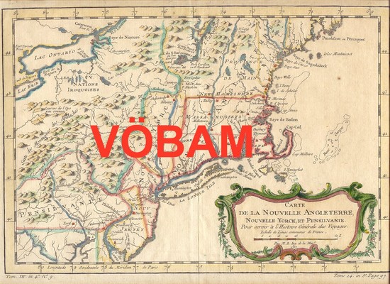
Carte de la Nouvelle Angleterre,...' - Bellin 1757.
Livisa and Cabonico Bays. - Washington D.C. 1901.

Livisa and Cabonico Bays.
No. 1991.
Hydrographic Office.
Koppargraverat handkolorerat sjökort.
Rättat till 1917.
Ägarstämpel, rättelsestämpel.
Storlek: 109x80 cm. Totalytans bredd x höjd.
Vikning.
Pris på förfrågan. - 40307 - Se bild.
Atlanten, Amerika - Nordatlanten, Nordamerika - Karibiska havet, Kuba - ,
