
Heraldischer Atlas, Tavla 23 - H. G. Str÷hl 1899.
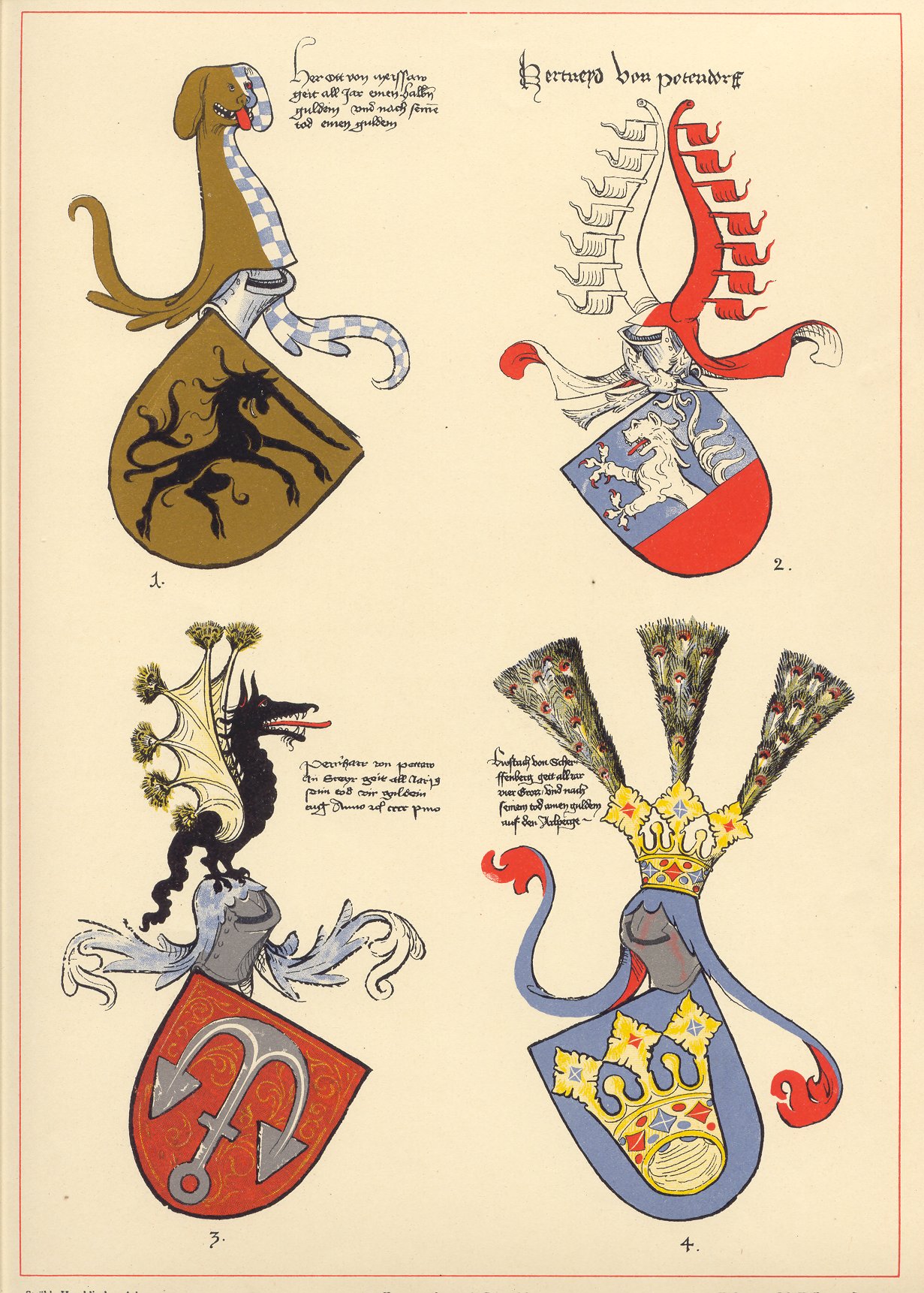
Heraldischer Atlas. Eine Sammlung von heraldischen Musterblõttern f³r K³nstler, Gewerbetreibende, sowie und Freunde der Wappenkunde, zusammengestellt und erlõutert von H. G. Str÷hl.
Stuttgart
Verlag von Julius Hoffmann
MDCCCXCIX.
Faksimiltryck av plansch ur Heraldischer Atlas, tryckt 1899 i Stutgart, uppf÷rstorade pÕ 160 grams papper i format A3, med teckenf÷rklaring.
Tavla 23.
Pris: 320 SEK - 40011 - Se bild.
76 Tafeln in Bunt- und Schwarzdruck nebst zahlreichen Text-Illustrationen.
'The River Systems of Asia & Europe.' - A. Johnston 1850.
The River Systems of Asia & Europe.
Showing the Boundaries and comparative extent of the River Basins and the Seas to which they contribute their Waters.
Koppargraverad och handkolorerad karta ur 'A Series of Maps & Illustrations of the Geographical Distribution of Natural Phenomena embracing.' tryckt i London 1850.
Storlek: 57x47 cm. Kartytans bredd x h÷jd.
Textavsnitt medf÷ljer.
Pris: 2000 SEK - 26276
Praktnejlika, Dianthus superbus - Lindman, C. A. M, Bilder ur Nordens Flora 1917-26.

Praktnejlika, Dianthus superbus
Bilder ur Nordens Flora.
Tredje upplagan 1917-1926.
VųBAM har samtliga 663 planscher ur C. A. M. Lindmans 'Bilder ur Nordens Flora', 1917-1926.
Planschstorlek ca 15 x 20 cm.
Pris: 100 SEK - 40795 - Se bild.
Spetshagtorn, Crataegus Calycina (Peterm.) Em Lindm
Bilder ur Nordens Flora.
Tredje upplagan 1917-1926.
VųBAM har samtliga 663 planscher ur C. A. M. Lindmans 'Bilder ur Nordens Flora', 1917-1926.
Planschstorlek ca 15 x 20 cm.
Pris: 100 SEK - 41216
Hundkõx, Anthriscus silvestris - Lindman, C. A. M, Bilder ur Nordens Flora 1917-26.
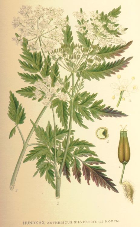
Hundkõx, Anthriscus silvestris
Bilder ur Nordens Flora.
Tredje upplagan 1917-1926.
VųBAM har samtliga 663 planscher ur C. A. M. Lindmans 'Bilder ur Nordens Flora', 1917-1926.
Planschstorlek ca 15 x 20 cm.
Pris: 100 SEK - 40714 - Se bild.
'Utriusque Terrae Hemisphaerii...' - L. Euler 1760.

Mappa Geographica Utriusque Terrae Hemisphaerii ad emendatiora exempla adhuc edita jussu Acad. Regiae Scietn. et Eleg. Litt. Borussicae descripta.
Koppargraverad och originalkolorerad globkarta, tvÕ stora glober och fyra mindre. De tvÕ stora globerna visar jordens võstra samt ÷stra halva. TvÕ av de mindre visar jorden rakt norrifrÕn och en rakt s÷derifrÕn samt tvÕ stycken varav ena i vinkel centrerat ÷ver Europa och den andra centrerat ÷ver Stilla havet ÷ster om Australien.
Kartan ur 'Geographischer Atlas' utgiven i Berlin 1760.
Mittveck, helt och rent exemplar av denna rara karta.
Stõmplad med den preussiska skatte-, privilegiestõmpeln i ÷vre võnstra h÷rnet.
Storlek: 37x33 cm, kartytans bredd x h÷jd.
Pris: 6500 SEK - 38448 - Se bild.
BandtÕng, Zostera marina - Lindman, C. A. M, Bilder ur Nordens Flora 1917-26.
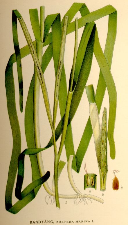
BandtÕng, Zostera marina
Bilder ur Nordens Flora.
Tredje upplagan 1917-1926.
VųBAM har samtliga 663 planscher ur C. A. M. Lindmans 'Bilder ur Nordens Flora', 1917-1926.
Planschstorlek ca 15 x 20 cm.
Pris: 100 SEK - 40942 - Se bild.
Luktnypon, Rosea rubiginosa - Lindman, C. A. M, Bilder ur Nordens Flora 1917-26.
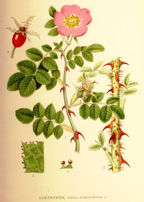
Luktnypon, Rosea rubiginosa
Bilder ur Nordens Flora.
Tredje upplagan 1917-1926.
VųBAM har samtliga 663 planscher ur C. A. M. Lindmans 'Bilder ur Nordens Flora', 1917-1926.
Planschstorlek ca 15 x 20 cm.
Pris: 100 SEK - 40743 - Se bild.
Hundrova, Bryonia alba - Lindman, C. A. M, Bilder ur Nordens Flora 1917-26.
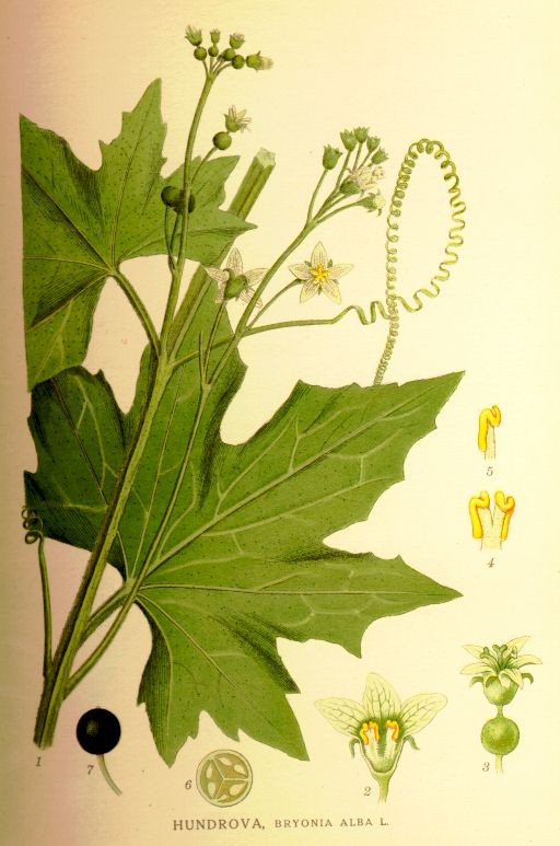
Hundrova, Bryonia alba
Bilder ur Nordens Flora.
Tredje upplagan 1917-1926.
VųBAM har samtliga 663 planscher ur C. A. M. Lindmans 'Bilder ur Nordens Flora', 1917-1926.
Planschstorlek ca 15 x 20 cm.
Pris: 100 SEK - 40510 - Se bild.
Knappag, Schoenus nigricans - Lindman, C. A. M, Bilder ur Nordens Flora 1917-26.

Knappag, Schoenus nigricans
Bilder ur Nordens Flora.
Tredje upplagan 1917-1926.
VųBAM har samtliga 663 planscher ur C. A. M. Lindmans 'Bilder ur Nordens Flora', 1917-1926.
Planschstorlek ca 15 x 20 cm.
Pris: 100 SEK - 41173 - Se bild.
Amiral Hõggs flaggkarta. - Stockholm 1888.
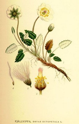
Fjõllvippa, Dryas octopetala - Lindman, C. A. M, Bilder ur Nordens Flora 1917-26.
Võstafrika, s÷dra delen. - Weiland 1840.

NIEDER-GUINEA und das Innere des WESTLICHEN MITTEL-AFRICA'S oder Westrand von Hoch-Afrika.
Entworfen u. gezeichnet von C. F. Weiland.
Gest. v. Karl Mõdel sen.
Skala: 1:5.480.000
Infõlld karta: 'Die Insel St. Helena.'
Weimar 1840. Verlage des Geograph. Instituts.
Storlek: 48x62 cm.
Kraftfull grõnskolorering.
Pris: 3000 SEK - 26072 - Se bild.
Afrika - Võstafrika - -
