
Född i Kalmar 25 mars 1792, död 3 maj 1878 i Stockholm.
Bror till Johan August Anckarswärd.
Artist, grefve efter den föregåendes död, f. 25 mars 1792 i Kalmar, utexaminerades 1808 som fänrik från krigsakademien och tjänstgjorde 1809 i arméns
värmländska fördelning såväl vid norska gränsen som i Stockholm. Med Svea lifgarde gjorde han som löjtnant tyska och norska fälttågen 1813 och 1814, blef kapten 1817, s. å. ordonnansofficer och 1829 adjutant hos Karl Johan samt tio år senare öfverstelöjtnant i armén. Därjämte egnade han sig åt konststudier, hufvudsakligen åt landskapsmålningen, och gjorde 1819–22 studieresor i utlandet. 1828 blef han ledamot och 1843 hedersledamot af konstakademien, och han var en af dem, som stiftade konstföreningen, 1832. Under åren 1844–58 var han öfverintendent och preses i konstakademien, hvilken därunder fick förnyade statuter och ny anordning af sitt läroverk och sin förvaltning. Inom vår planschverkslitteratur intog A. på 1820- och 30-talen ett framstående rum genom sina af honom själf litografierade arbeten Sveriges märkvärdiga...
Bland arbeten.
Fordna och närvarande Sverige
Nordisk Familjebok, Uggleupplagan
1787-1865.
Författade följande två skrifter 1818 respektive 1823.
Beskrifning öfwer Hardemo socken uti Nerike. En af Örebro läns kongl. hushållningssällskap med högsta priset år 1814 belönt skrift. Af Gustaf Bernhardt. Med en charta. Strengnäs, tryckt hos Carl Erik Ekmarck, 1818.
Beskrifning öfwer Björkwik socken i Södermanland. På begäran författad och utgifwen af G.B. Med en charta. Nyköping, tryckt hos P.E. Winge, 1823. På desz förlag.
På en karta utgiven över Färentuna härad 1853 står 'Skrift af I. Bernhardt', detta kan vara samme Bernhardt som ovanstående.
Bland arbeten.
Beskrifning öfwer Hardemo socken uti Nerike. En af Örebro läns kongl. hushållningssällskap med högsta priset år 1814 belönt skrift. Af Gustaf Bernhardt. Med en charta. Strengnäs, tryckt hos Carl Erik Ekmarck, 1818.
Beskrifning öfwer Björkwik socken i Södermanland. På begäran författad och utgifwen af G.B. Med en charta. Nyköping, tryckt hos P.E. Winge, 1823. På desz förlag.
KB.
ERATOSTHENES, (grek. Eratosthen'es),
Grekisk astronom (276-194 f.Kr.), född i Cyrene, av Ptolemaios III Euergetes kallad till bibliotekarie vid museet i Alexandria. E. utförde den första vetenskapliga bestämningen av jordens storlek. I Syene i Afrika kastade en gnomon vid sommarsolståndet icke någon skugga, då däremot vid samma tid solen i Alexandria var 7,2 grader (=360:50 grader) från zenit. Då avståndet mellan Syene och Alexandria enl. E. var 5.000 stadier, så följer, att jordens omkrets är = 50x5.000 = 250.000 stadier. Värdet på E:s stadie är ej säkert bekant, men följer man Plinius' uppgifter, är en stadie = 157,5 m, och i så afll blir alltså jordens omkrets = 39.375.000 m, nära överensstämmande med senare mätningar (40.000.000 m), en överensstämmelse, som dock kan betraktas som helt och hållet tillfällig.
Eratosthenes framställde även en världskarta.
Svensk uppslagsbok, 1948.
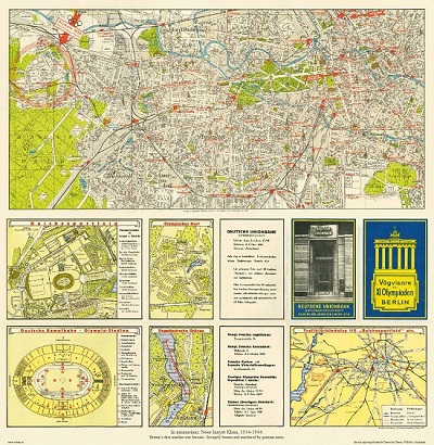
Vägvisare för XI Olympiaden i Berlin - 1936
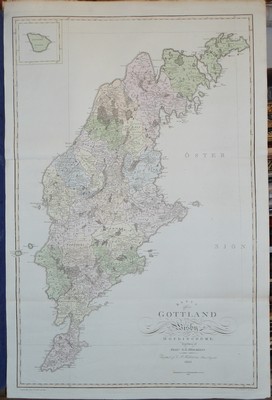
Karta öfver Gottland eller Wisby höfdingdöme. - Hermelin 1805.
PTOLEMAIOS, CLAUDIUS (Ptolemaeus / Ptolemy).
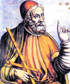
Biografiska uppgifter:Ca. 150 e. Kr.
Den äldre tidens mest berömda astronom, geograf och matematiker. Hans astronomiska teorier var ledande under 14 århundraden, och hans främsta verk, 'Syntaxis' eller 'Almagest', avlöstes inte förrän Newtons banbrytande forskning. Hans 'Geographia' dominerade hela den kristna och muhammedanska världen under 1500 år. Det var Ptolemaeus som införde begreppen längd- och breddgrader, det system som geografin sedan dess följt i alla tider. Efter uppfinningen av boktryckerikonsten kom hans främsta geografiska verk helt eller delvis ut i en rad utgåvor, som oftast kompletterades med senare forskningsresultat och nyare kartritningar. Till år 1700 hade 45 utgåvor på många olika språk utgivits. Sedan dess har ytterligare 7 utgåvor tillkommit, den senaste år 1883.
The 1482 edition of the Cosmographia, printed in Ulm, is one of the finest and most ambitious productions of the fifteenth century and the first printed atlas to include a corpus of “modern maps” as revised and supplemented by the important renaissance cartographer Dom Nicolaus Germanus. “The strictly classical world map goes no further than Thule, just to the north of Scotland, but the Ulm Ptolemy shows a rudimentary Scandinavia within an extension of the map’s top border…..No hint is given of the Portuguese exploration down the west coast of Africa nor of the existence of “modern” sea charts (portolani) showing the European and neighbouring coasts in great detail” (Shirley).
All fifteenth-century printed editions of Ptolemy were based on the work of Dom Nicolaus, a Benedictine monk from the diocese of Breslau, who prepared a series of magnificent vellum manuscript atlases in Florence in the 1460s and 1470s for various Italian dignitaries. The direct model for the Ulm edition was the manuscript atlas Dom Nicolaus made for presentation to Pope Paul II (d. 1471) which seems to have been carried from Rom to Ulm for that purpose and then never returned. It survives today at Schloss Wolfegg.
Bland arbeten:
World. Untitled map of the world. Ulm: Leinhart Holle, 1482 or later. Prepared by Donnus Nicolas Germanus and cut by Johannes “Schnitzer”.
This world map is from the first edition of Ptolemy to be printed north of the Alps, and the first to use woodcut maps. It is the earliest surviving printed map signed by its engraver, and the first in the Ptolemaic sequence to include Scandinavia and to allude to lands beyond the confines of Ptolemy’s world view.
(Salmonsen.- Tooley.) - Se bild.
