
Född 1683 i Stockholm, död 1767 i Alvhem, Älvsborgs län.
Johan Anton Matérn, adlad von Matérn, född 1683-10-22 i Stockholm. Konduktör vid fortifikationen 1704-11-06. Löjtnant vid fortifikationen 1708-03-26. Kaptens karaktär 1722-06-26. Kapten vid fortifikationsbrigaden i Göteborg 1731-12-04. Major vid fortifikationsbrigaden 1741-03-05. Generalkvartermästarelöjtnant vid finska brigaden 1742-07-23. Flyttad till Stockholmsbrigaden och fortifikationskontoret 1744-11-10. RSO 1748-09-26. Överste och kommendant i Landskrona 1748-10-27. Adlad 1751-11-21 (introducerad 1756 under nr 1963). Avsked 1760. Död 1767-12-20 i Alvhem i Skepplanda socken, Älvsborgs län och begraven 1768-01-05. 'Han blev 1708 kommenderad frĺn armén för att göra kartor över Polen, Samogitien och Litauen. Bevistade 1708-07-04 slaget vid Holofzin samt 1709 belägringen av Poltava, där han med egen hand uppsatte skanskorgarna längs efter linjen till betäckning av svenska armén. Blev fĺngen vid Perevolotjna 1709-07-01 och förd till Tobolsk i Sibirien, varest han sysselsatte sig med kartors förfärdigande öve...
Bland arbeten.
Nova descriptio geographica Tattarić magnć.
Pictorial maps - maps with vignette illustrations on top of the geographical content - go back practically to the known beginning of cartographic history: Petroglyph maps dating from the Neolithic sometimes are found combining geographic features with representations of animals, people or dwellings.
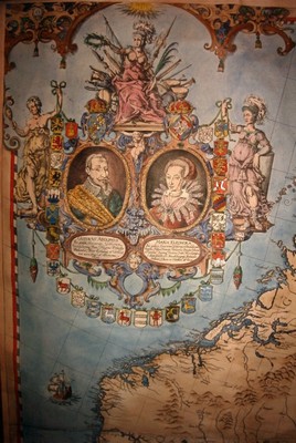
Vignette insets or overlays are also found throughout the period of printed maps. But maps richly overlaid with small pictures are more commonly found from the 19th century onwards. (A notable exception is the Carta Marina of Olaus Magnus, published in Venice in 1539, which presents a depiction of Scandinavia with more than 100 small woodcut illustrations of animals, real and imagined, and of people pursuing all kinds of activities, such as hunting, fishing, skiing, etc.)
Ernest Dudley Chase was an exceptional creator of pictorial maps. Though he worked primarily as a graphic artist and businessman in the greeting card industry, Chase also designed, drew, and self-published more than 50 pictorial map...
Bland arbeten.
A Pictorial Map of North America 1945.
A Pictorial Map of South America 1942.
1632-94. Född i Sachsen, död i Berlin.
Tysk-svensk historiker. Han studerade rättsvetenskap och filosofi i Leipzig och Jena, tog magistergraden 1656 och blev 1661 professor vid universitetet i Heidelberg. 1667 kallad att bli professor i natur- och folkrätt i Lund, och 1677 utnämnd till svensk rikshistoriograf. Han utgav en rad juridiska och historiska skrifter. Av störst intresse i detta sammanhang är det stora verk om Karl X Gustaf, 'De rebus a Carolo Gustavo, Sueciae regis, gestis commentariorum libri septem' som kom 1696. Verket är illustrerat med en mängd kartor och bilder i kopparstick.
Bland arbeten.
De rebus a Carolo Gustavo, Sueciae regis, gestis commentariorum libri septem.
Sv. män och kv.

Vägvisare för XI Olympiaden i Berlin - 1936
Bureus karta över Norden - 1626.
Frisius, Gemma. [Reinerszoon, Jemme.]
Biografiska uppgifter:9 december 1508 - 25 maj 1555.
Gemma Frisius was a physician, mathematician, cartographer, philosopher, and instrument maker. He created important globes, improved the mathematical instruments of his day and applied mathematics in new ways to surveying and navigation.
Frisius was born in Dokkum, Friesland (present-day Netherlands) of poor parents, who died when he was young. He moved to Groningen and studied at the University in Leuven beginning in 1525. He received the degree of MD in 1536 and remained on the faculty of medicine in Leuven for the rest of his life. His oldest son, Cornelius Gemma, edited a posthumous volume of his work and continued to work with Ptolemaic astrological models.
While still a student, Frisius set up a workshop to produce globes and mathematical instruments. He became noted for the quality and accuracy of his instruments, which were praised by Tycho Brahe, among others. In 1533, he described for the first time the method of triangulation still used today in surveying. Twenty years later, he was the first to describe how an accurate clock could be used to determine longitude. Jean-Baptiste Morin (1583–1656) did not believe that Frisius' method for calculating longitude would work, remarking, 'I do not know if the Devil will succeed in making a longitude timekeeper but it is folly for man to try.'
Frisius created or improved many instruments, including the cross-staff, the astrolabe and the astronomical rings. His students included Gerardus Mercator (who became his collaborator), Johannes Stadius, John Dee, Andreas Vesalius and Rembert Dodoens.
A lunar crater has been named after him.
Bland arbeten:
(Cosmographia (1529) von Petrus Apianus, annotated by Gemma Frisius)
De principiis astronomiae et cosmographiae (1530)
De usu globi (1530)
Libellus de locorum describendorum ratione (1533)
Arithmeticae practicae methodus facilis (1540)
De annuli astronomici usu (1540)
De radio astronomico et geometrico (1545)
De astrolabio catholico (1556)
